China’s Amphibious Drills Wind Down as Shipbuilding Push Continues
This update was made possible thanks to @MT_Anderson, who first shared the imagery and context via X. We’re always grateful for the strength of the open source intelligence community that uses SkyFi to monitor events unfolding across the globe. From military movements to maritime construction, we’re proud to support those using satellite data to stay informed and keep others informed.
Amphibious Activity Near Zhanjiang Might Be Wrapping Up
Satellite imagery from Sentinel 2, captured on March 27, 2025, shows what looks like the end of amphibious exercises off the coast of Zhanjiang, a major base used by the People’s Liberation Army Navy. That’s the naval branch of China’s military, also known as the PLA Navy. The image shows a few vessels offshore at 20.975 latitude and 110.534 longitude, but the beach activity appears to be calming down compared to earlier days.
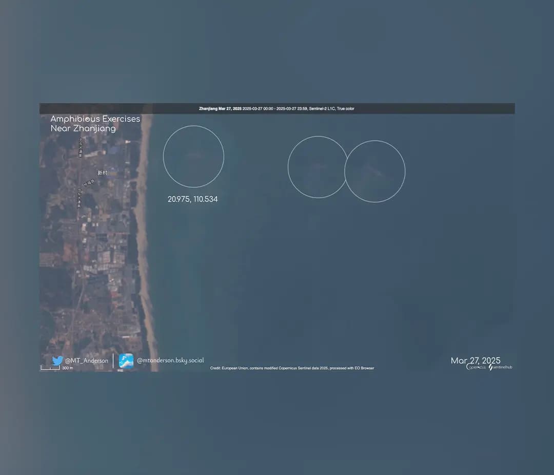
Zhanjiang is a key launch point for China’s naval drills. These exercises are routine but closely watched, especially given rising tensions in the South China Sea. The location is important not just for training but for signaling strength to other countries in the region.
This image comes from the Sentinel 2 mission, which is operated by the European Union as part of the Copernicus program. It provides free wide area satellite coverage and is available directly on the SkyFi platform. It is a good option for spotting patterns across large regions, but it does not show enough detail for object level analysis.
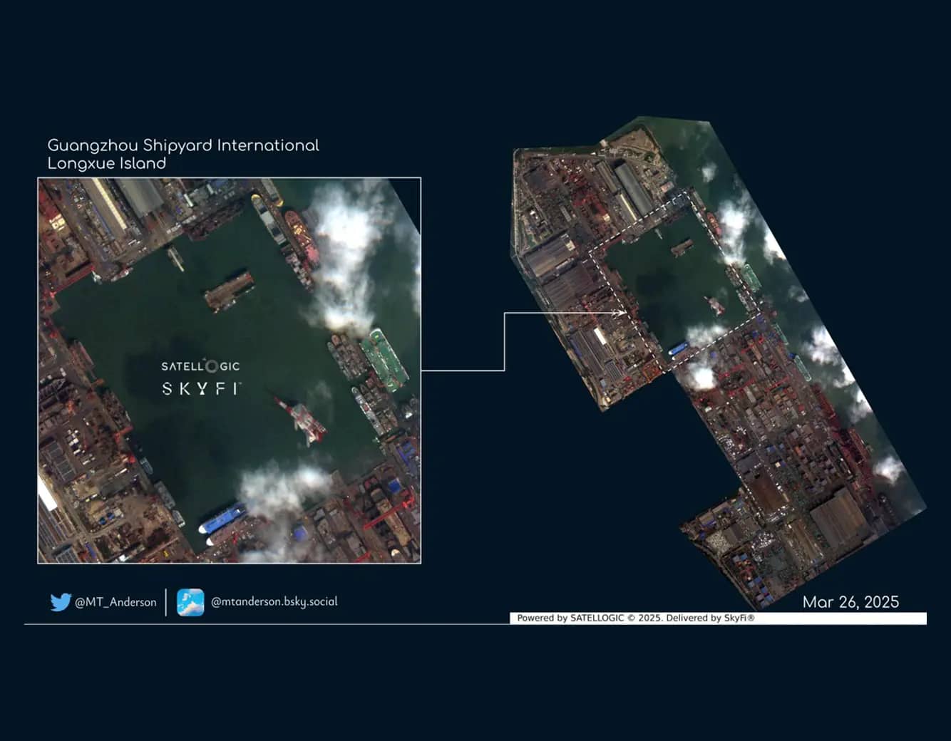
Shipbuilding Continues at Longxue
The day before that Sentinel 2 pass, on March 26, SkyFi users received a 99 centimeter image, captured by Satellogic, of Guangzhou Shipyard International, located on Longxue Island. A 99 centimeter image means that each pixel represents 99 centimeters of ground, which is detailed enough to identify individual ships, docks, and construction stages.

This image shows multiple vessels in different phases of construction or refit. Some of the visible hull shapes appear to match known military designs, suggesting that production of defense-related vessels is ongoing. This shipyard is part of the China State Shipbuilding Corporation, the main government owned group responsible for building both civilian and military ships.
High resolution imagery like this is useful for monitoring shipyards, comparing build timelines, and keeping track of what’s moving through key maritime infrastructure. SkyFi provides access to this type of commercial imagery without requiring subscriptions or long term contracts.
What These Images Show
The two images tell part of the same story. Near Zhanjiang, activity tied to amphibious operations looks like it is slowing down or relocating. Meanwhile, at Longxue, shipbuilding continues at a steady pace. Both locations sit along China’s southern coast, and both play a role in the country’s maritime strategy.
For people tracking regional developments or looking to understand what is happening on the ground, having both a wide angle and a sharp close up view is useful. With SkyFi, you can browse and order imagery from a growing list of providers, including free Sentinel-2 data and high resolution options like the one shown here from Satellogic.