Everything You Need to Know About Digital Elevation Models (DEMs)
Digital Elevation Models (DEMs) are essential for understanding the Earth's surface. Whether it's for flood risk assessment, urban planning, or environmental monitoring, DEMs provide precise information about terrain and elevation. This post will cover how DEMs are created, their key applications, and how to access DEM data through platforms like SkyFi, which simplifies DEM access across various industries.
What Are Digital Elevation Models (DEMs)?
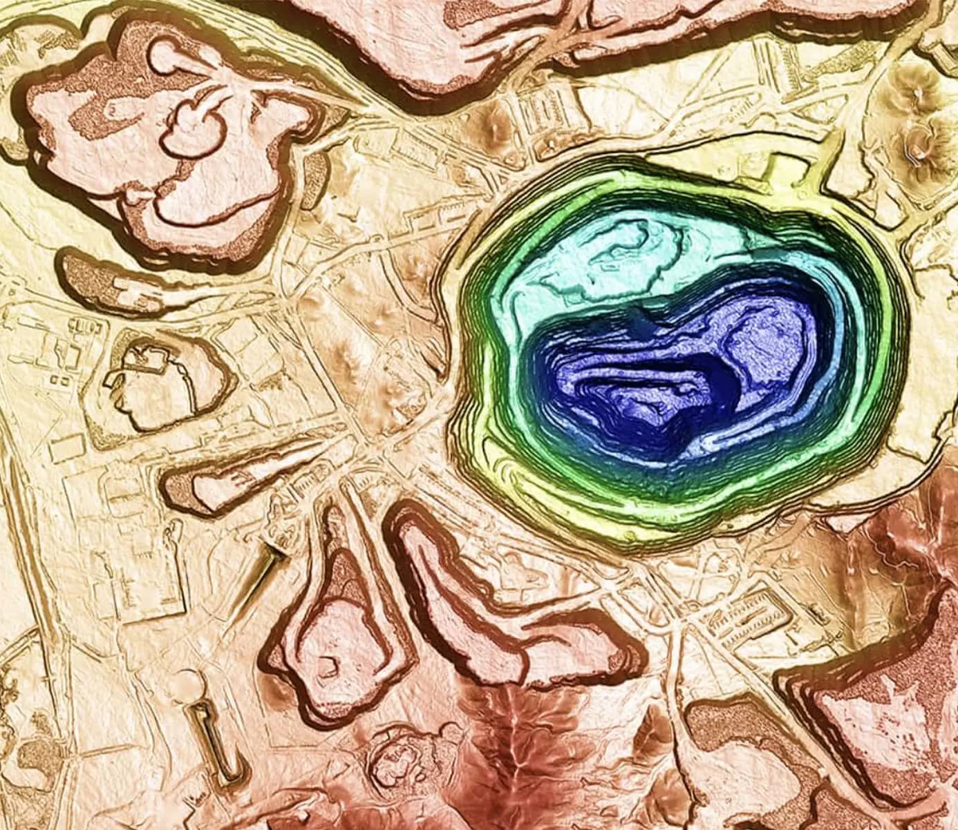
A Digital Elevation Model (DEM) is a 3D representation of the Earth’s bare ground surface, stripped of any trees, buildings, or other above-ground objects. Each point on the DEM grid has an elevation value, offering a detailed view of the landscape’s structure. This data is fundamental in many fields, as it helps model water flow, map flood risk zones, and support infrastructure development.
How Are Digital Elevation Models Created?
Creating a DEM involves capturing elevation data using remote sensing methods. Here are the primary techniques used:
1. Aerial Photogrammetry
Aerial photogrammetry involves taking overlapping images from an aerial platform, like a drone or plane, and processing these to calculate elevation. By capturing different angles, this method creates a 3D model of the terrain.
2. Synthetic Aperture Radar (SAR)
SAR uses radar waves to collect elevation data, capable of seeing through clouds and capturing data day or night. This makes SAR ideal for regions with frequent cloud cover, as well as for applications needing continuous monitoring.
3. Light Detection and Ranging (LiDAR)
LiDAR uses laser pulses emitted from airborne sensors, which reflect back from the ground to measure elevation. LiDAR provides high-resolution elevation data, which is especially useful for detailed terrain mapping.
Each of these methods has unique strengths depending on the terrain type and project needs. For example, LiDAR excels in capturing complex landscapes with dense vegetation, while SAR is useful in areas with frequent cloud cover.
Applications of Digital Elevation Models
DEMs have widespread applications across various fields. Here are some of the most common:
Flood Risk Mapping
DEMs allow precise modeling of water flow, making them invaluable for assessing flood risk. By understanding how water will move across a landscape, planners can design better flood defenses and map out evacuation routes.
Urban and Infrastructure Planning
City planners and engineers rely on DEMs to evaluate potential building sites, design roads, and plan utilities. DEMs help visualize how new structures will interact with existing terrain and infrastructure.
Agriculture and Environmental Monitoring
Farmers use DEMs to optimize irrigation, reduce soil erosion, and manage water resources more efficiently. Environmental scientists also rely on DEMs to monitor changes in topography, such as landslides or deforestation, to better manage natural resources.
Mining and Resource Management
In mining, DEMs help in planning site layouts, monitoring stockpiles, and assessing environmental impacts. The detailed terrain information from DEMs assists in minimizing ecological damage and optimizing resource extraction.
Factors Affecting DEM Accuracy
The quality of a DEM can vary depending on several factors, from the data collection method to environmental conditions. Here’s a brief overview of the primary factors influencing DEM accuracy:
Spatial Resolution
Spatial resolution refers to the distance between data points in a DEM. Higher resolution (closer points) captures finer details, which is essential for applications needing precise information, like urban planning.
Vertical Accuracy
Vertical accuracy measures how close the DEM’s elevation values are to real-world elevations. Methods like LiDAR offer higher vertical accuracy, making them suitable for projects that require detailed topography.
Temporal Resolution
Temporal resolution refers to how frequently the DEM data is updated. For applications like disaster response or environmental monitoring, recent data is crucial for accurate analysis.
Common Errors in DEMs
Errors in DEMs can occur due to shadowing, data misalignment, or other collection issues. These errors often appear as unnatural “sinks” (low points) or “peaks” (high points), which can interfere with accurate analysis.
Sinks and Peaks
Sinks are artificial depressions in a DEM that may cause errors in hydrological modeling, as they can falsely indicate drainage basins.
Peaks are high points that may skew elevation readings, impacting applications like flood modeling or terrain analysis.
These errors are often corrected through interpolation, a technique that smooths out the DEM data to provide a more accurate representation of the landscape.
Where to Find DEM Data
DEMs are widely available from multiple sources, including government data portals and private providers. Platforms like SkyFi offer access to high-resolution DEMs for users in industries ranging from urban planning to agriculture. SkyFi’s platform allows for easy browsing, ordering, and downloading of DEM data, making it accessible and convenient for those who need reliable elevation models for their projects.
FAQs About Digital Elevation Models
What’s the difference between DEM, DSM, and DTM?
A DEM is a general term for elevation data, while DSM (Digital Surface Model) includes surface objects, and DTM (Digital Terrain Model) shows only the bare-earth terrain.
How accurate are DEMs?
The accuracy of a DEM depends on its resolution and the method used to capture it. LiDAR-based DEMs are highly accurate, while satellite-derived DEMs may offer broader coverage with slightly less precision.
Can DEMs be used for flood prediction?
Yes, DEMs are essential for flood risk mapping, as they model water flow across the terrain, helping to predict flood-prone areas.
What software is needed to view DEMs?
DEMs can be viewed and analyzed using GIS software like QGIS or ArcGIS, which allow users to visualize and work with elevation data.
Incorporating DEMs into planning and environmental projects has become essential for gaining insight into terrain, water flow, and potential hazards. By providing easy access to DEM data, platforms like SkyFi support users across industries, helping them make informed, data-driven decisions.