Industries
Our platform delivers accurate satellite imagery and analytical tools, enabling enterprises to gain a competitive edge, understand risks before starting a project, or monitor changes over the past 5 years. SkyFi is your partner in harnessing the power of Earth observation for industry success.
Explore Swipe to see more
25.00 km
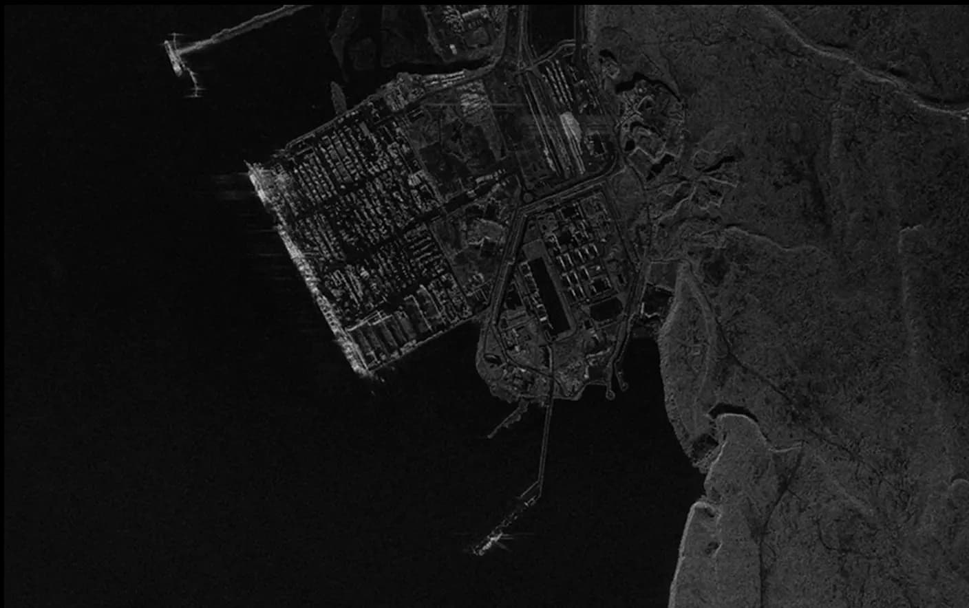
Military & Defense
Defense and security teams use SkyFi to turn satellite imagery and multi-domain sensor data into trusted operational intelligence. Access 150+ satellite sources, apply AI-enabled analytics, and deliver high-fidelity insights directly into COP systems and ATAK for faster, mission-ready decision-making.
Learn MoreHow It Works
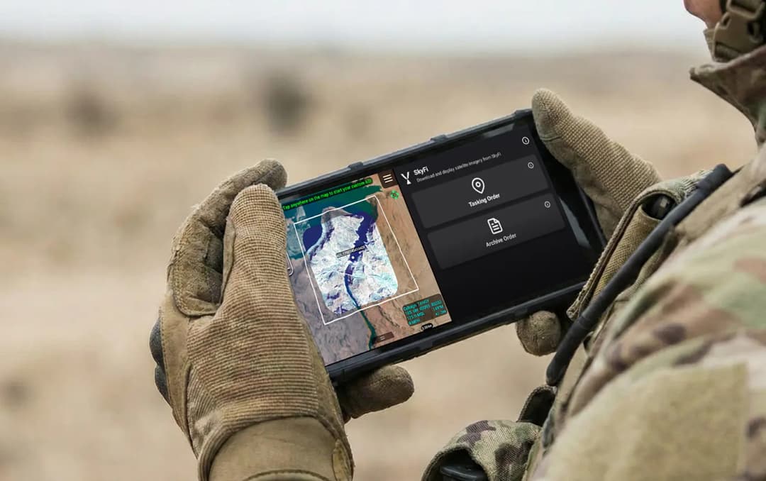
Get Access to Near Real-Time Satellite Imagery
SkyFi simplifies access to high-resolution Earth observation data and analytics, providing an intuitive satellite imagery platform that transforms complex imagery data and analysis into quick answers with just a few clicks. SkyFi uses up-to-date technology so that you can view and buy high-resolution imagery up to 7.5 cm resolution, featuring near real-time updates (satellite images captured within the last 24 hours).
01


Signing Up for SkyFi Satellite Imagery
Start exploring without the need for a signup or subscription. SkyFi’s quick and straightforward process opens the door to the world of advanced Earth observation data. With access to optical, Synthetic Aperture Radar (SAR), multispectral, and aerial data, users can monitor the world from multiple sources and across all weather conditions. This multi-sensor approach provides reliable, high-quality intelligence for persistent monitoring, analysis, and decision-making.
02

Exploring and Ordering Precise Imagery
With virtual constellations of satellites and applied analytics, you’ll see why SkyFi is the world’s geospatial data hub. Browse the SkyFi satellite imagery marketplace, task a satellite, or apply geospatial analytics to an image. SkyFi’s updated image archive and ability to task a satellite for a new image allows for a focus on geometrically accurate images that reflect day-to-day operations of businesses and agencies all over the world.
03

Checking Out of SkyFi’s Imagery Marketplace
Simply add satellite images and analytics to your cart and check out. You’ll receive your order via email and within your SkyFi account.
Only Pay for What You Need with Lowest-in-Market, Transparent Pricing
| Single Archive Image | Single Tasking Image |
Starting at $ 15 *High-resolution optical image | Starting at $ 200 *High-resolution optical image |
Comprehensive Coverage
Commercial and open data options available
High Precision & Resolution
Ideal for detailed analysis and strategic planning
Cost-Effective Accessibility
Meets any budget with low minimum order sizes
Diverse Data Types
From optical to SAR, and multispectral to stereo, find the right tools for your job
All-in-one Platform
Get the data and analytics you need in one place.

Explore More of SkyFi
SkyFi's platform makes geospatial data and analytics accessible worldwide for sectors such as mining, energy, maritime, and disaster management. We are believers that all industries will benefit from Earth observation data. Find a product that's right for yours.
