Military and Defense Satellite Imagery & Geospatial Intelligence
BLUF: SkyFi builds secure, sovereign software that turns satellite imagery into actionable intelligence. By providing a single gateway to 150+ satellite sources, the platform leverages Modular AI Analytics to identify threats and push high-fidelity data directly to U.S. and allied Common Operating Pictures (COP) and to operators at the tactical edge.
SkyFi’s sovereign intelligence platforms ingest multi-domain sensor data and apply automated, AI-enabled analytics to deliver trusted, shareable operational pictures for government, defense, and security missions. CAGE: 9HVN6 UEI: D1U2DPA3JQK4
Trusted by leaders in defense and intelligence


40.7128º N
74.0060º W
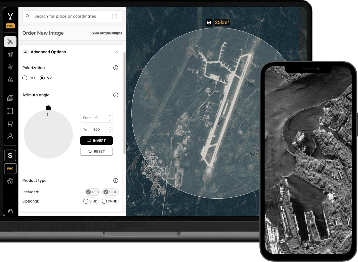
Access: A single, secure platform to task or archive-search 150+ multi-sensor satellites, providing seamlessly shareable Earth intelligence and analysis to ensure a unified operating picture for all allies.
Agency: Put high-fidelity imagery and AI-enabled analytics directly to operators and analysts. Designed to for sovereign and secure operations, with configurable data controls, access management, and deployment options.
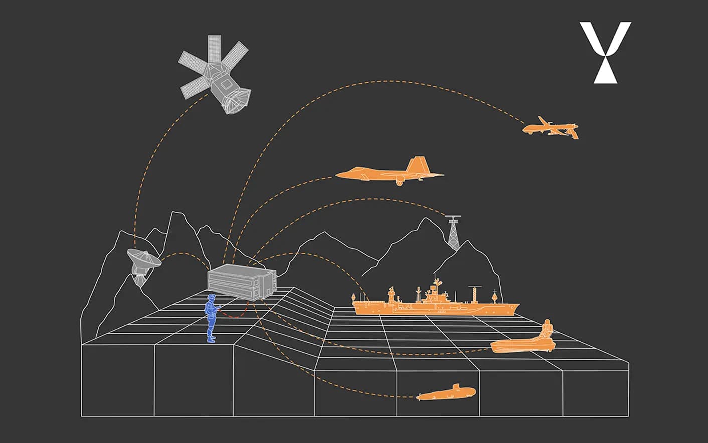
Integration: Define the operational area from seabed to space. SkyFi serves as the single source of integration, pushing synchronized data to the COP and to the edge via the SkyFi ATAK plugin.
Sovereign Intelligence Platforms & Geospatial Analytics for Operations
The Mission: Multi-Domain Awareness
SkyFi bridges the gap between orbital constellations and tactical operators. Our Sovereign Intelligence Platforms (SIPs) ensure total intelligence custody, layering multi-sensor imagery with modular AI to eliminate vendor burdens and identify what matters.
Battle Damage Assessment:
Rapidly quantify effects on target.
Border Security: Automated persistent surveillance for unauthorized activity in contested areas.
Operational Planning:
High-fidelity geospatial analysis and mission context for any area of interest (AOI).
Situational Awareness:
A sharable, unified, unclassified operating picture for real-time visibility and shared context.
Disaster Response:
Instant ground truth to map hazards, assess damage, and identify safe routes.
Contested Logistics:
Sustain operations and supply chains across disconnected, intermittent, and low-bandwidth (DDIL) environments.
The Foundation: Sovereign Intelligence Platform (SIP)
The need for near real-time earth observation data and intelligence is critical. SkyFi enables allied partner nations to build and operate sovereign platforms designed to equip militaries, intelligence agencies, and first responders with actionable answers.
Virtual Constellation Access:
Tap into a unified gateway of 150+ commercial satellites or integrate data from sovereign space programs.
Data Sovereignty:
Ensure custody of the intelligence chain. Deploy in-country to keep mission-critical imagery and search areas secure and independent of external providers.
Trusted by NATO: SkyFi was selected to participate in the North Atlantic Treaty Organization’s (NATO) Defence Innovation Accelerator for the North Atlantic (DIANA) 2026 Challenge Programme.

The Edge: Command and Control (C2) Integration
SkyFi’s C2-agnostic architecture brings Earth intelligence to the tactical edge. While currently delivering mission-ready intelligence via the SkyFi ATAK Plugin, our API-first design is ready for integration into the Army’s NGC2 ecosystem like Palantir’s Maven Smart System and Anduril’s Lattice.
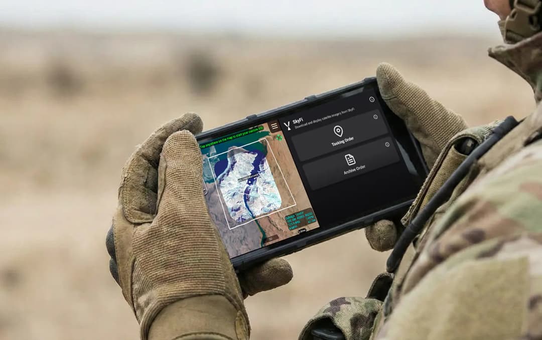
SkyFi ATAK Plugin:
Provides high-resolution, CAC-free satellite imagery and analytics to support planning, overwatch, and disaster response in any environment.
Offline Resilience:
Cached high-resolution overlays ensure mission continuity in comms-denied or GPS-contested environments.
Unified Ground Truth:
Synchronize validated data across the entire mesh network, from the individual operator to the COP.
The Engine: Modular Intelligence
One-size-fits-all software is a tactical liability. The SkyFi platform utilizes a Modular AI Analytics framework, enabling operators to deploy high-fidelity modules tailored to the specific requirements of any Area of Operations (AO).
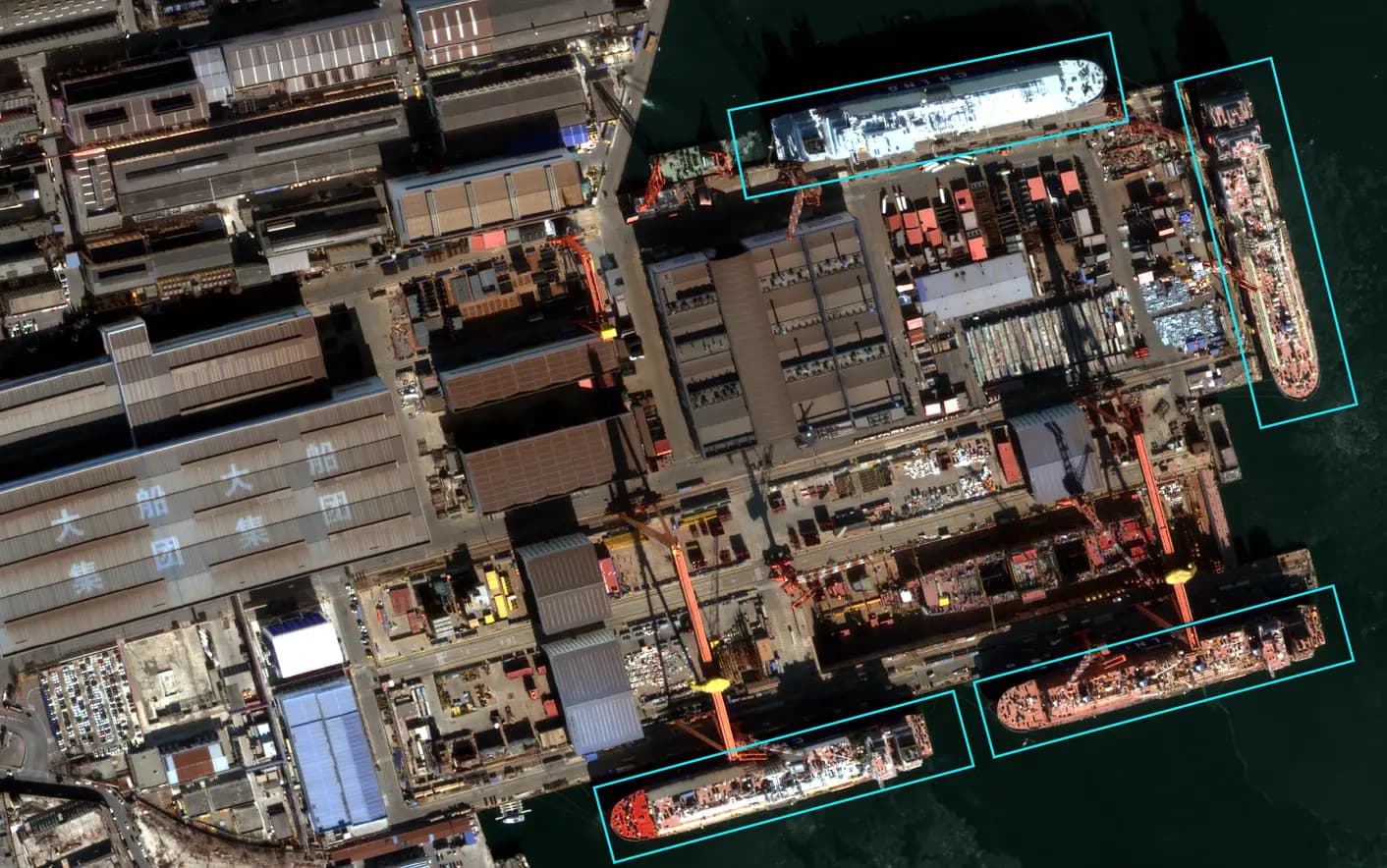
Object Detection & Classification:
Automatically identifies and categorizes high-value assets across vast geographies, filtering noise to highlight critical threats.
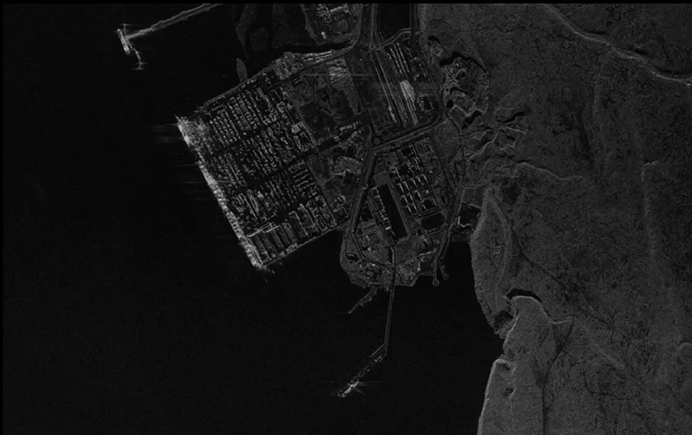
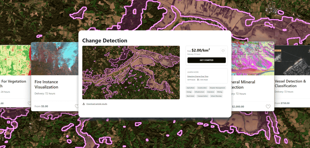
Automated Change Detection:
Scans temporal imagery to flag soil disturbances, new construction, or environmental shifts for real-time BDA and pattern-of-life analysis.
Infrastructure & Road Intelligence:
Evaluates trafficability in contested or disaster zones by identifying bridge collapses and debris to secure supply lines.
The Proof: Case Studies
Problem
THE ANALYST
Analysts are sidelined by a fragmented process that prioritizes data logistics over insight. Instead of identifying threats, they waste critical mission windows navigating disparate portals and reconciling incompatible formats. When analysts must act as data coordinators rather than investigators, the intelligence cycle fails to meet the operational tempo.
Solution
SIPs consolidate virtual constellations into one interface, replacing manual imagery tasking with streamlined workflows. By integrating Modular AI Analytics, the platform automates data searching so analysts can focus on high-level interpretation. This ensures all earth intelligence is mission-ready and immediately compatible with tactical tools.
Problem
THE WARFIGHTER
For decades, the warfighter has been at the mercy of a "top-down" intelligence hierarchy. Critical Earth intelligence and geospatial data are often bogged down in bureaucratic pipelines, leaving units at the tactical edge with an incomplete or outdated picture of their Area of Responsibility (AOR). When the operation demands rapid response, relying on a sluggish, centralized intelligence pipeline creates a gap that puts the warfighter at risk."
Solution
SIPs bridge the gap between orbital assets and the tactical operator. By integrating directly into tactical C2 systems, including ATAK, SkyFi puts Earth intelligence and situational awareness directly into the hands of the warfighter. Our process enables decentralized decision-making, allowing the user to task, receive, and analyze high-resolution imagery in a single platform, ensuring those at the edge have the autonomy to define their own intelligence requirements.
Problem
THE COMMANDER
Slow decision cycles due to reliance on imagery from external agencies or large commercial vendors often leave commanders with aged data, creating a gap between intent and available intelligence. Without organic control over tasking, leadership loses the ability to validate environments in real time, creating friction that slows the overall speed of command.
Solution
SIPs grant Commanders the autonomy to align Earth intelligence collection with mission priorities. By integrating with tools like ATAK, the platform enables real-time tasking and high-resolution image delivery within relevant windows. This decentralizes data access, moving the organization from a reactive posture to proactive maneuver.
SkyFi is your solution for any and all satellite imagery needs.


Satellite Imagery, Data, and Analytics. All in One Platform
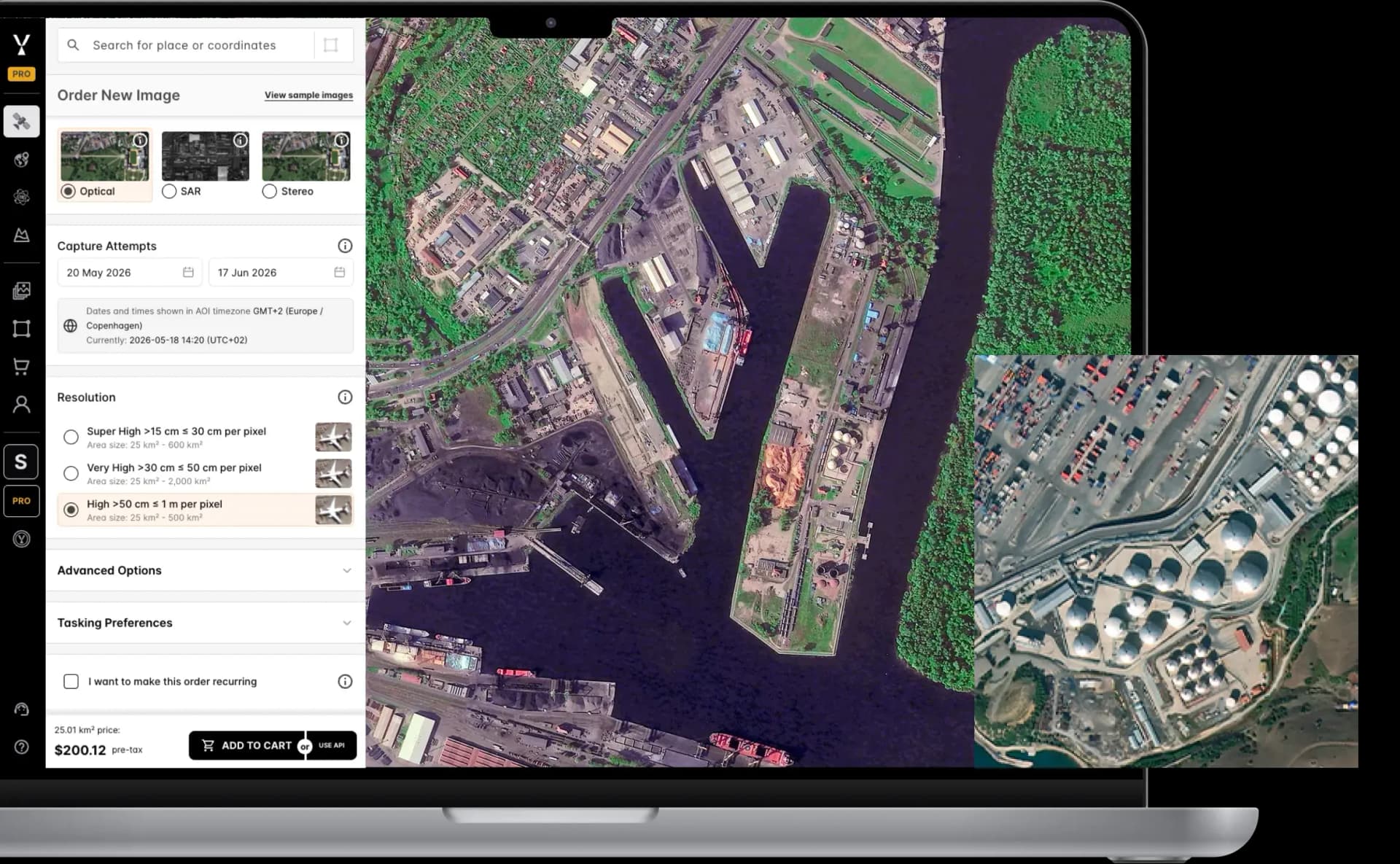
Get new imagery IN UNDER 24 HOURS
| Single Archive Image | Single Tasking Image |
Starting at $ 15 *High-resolution optical image | Starting at $ 200 *High-resolution optical image |
Or Connect Directly To Our API and Integrate SkyFi’s Powerful Solutions Into Your Daily Workflow.
SEE PRICINGStart Exploring Now!
CREATE YOUR FREE ACCOUNTCreate your FREE account today.
Get immediate access to our user-friendly interface and start exploring anywhere on the planet with transparent pricing options upfront.
Order new images for a specific date and location, or access our extensive library of existing images.
About SkyFi
SkyFi is a self-service Earth Intelligence Platform that allows users to run built-in geospatial analytics, task satellites, and access archived imagery. The dual-use platform supports both civilian and defense use cases, with flexible ordering options, transparent pricing, and API access for large-scale workflows.
Customers can use SkyFi's web platform, mobile app, or developer APIs to manage Earth observation projects without needing contracts or in-house GIS teams.
More SkyFi Products
Analytics

Commercial Imagery

Open Data

Vantor

Vantor Connect

Maritime AIS Data

SkyFi Plugin for ATAK

ICEYE US Direct

Planet Select