Vantor Connect Product Image
High-resolution, high-frequency data when and where you need it
Vantor Connect Logo

Vantor Connect

High-resolution satellite imagery and 3D data, delivered on demand

Vantor Connect provides access to high-resolution optical satellite imagery, historical imagery archives, and satellite-derived 3D data through a single, self-serve platform developed by SkyFi in partnership with Vantor.

Get Started
ACCESS
On-Demand Satellite Imagery
Instantly access high-resolution satellite imagery without subscriptions or minimum spend. Search historical satellite imagery or task new collections through a self-serve platform.
benefit_icon
PRECISION
High-Resolution Data You Can Rely On
Analyze locations with 30–50 cm resolution satellite imagery, accurate area-of-interest targeting, and flexible capture windows for real-world use cases.
benefit_icon
PLATFORM
One Platform for Vantor Data
Access Vantor’s satellite imagery archives, new satellite tasking, and 3D data through a single platform.

Pay only for the imagery and data products you use.

benefit_icon

Powered by SkyFi

Premium satellite imagery and 3D data, simplified.

Vantor Connect is a platform developed by SkyFi for Vantor, combining the highest quality view of their world with a modern, self-serve ordering and delivery experience. The result is fast, transparent access to high-resolution satellite imagery and data products without complexity.

Explore Vantor Connect
How it Works

Get Started with Ease

01
Log In or Sign Up image
Log In or Sign Up
Access the Vantor Connect platform to explore global coverage. Define your Area of Interest (AOI) using the map or upload GeoJSON/KML files. Instantly view available satellite imagery and 3D data options.
02
Order Imagery or 3D data image
Order Imagery or 3D data
Search, preview, and select high-resolution satellite imagery and satellite-derived 3D data products. Access historical imagery archives, request new tasking collections, and review transparent pay-as-you-go pricing before checkout.
03
Checkout and Download image
Checkout and Download
Complete your order securely and receive updates as it’s processed. Archive data delivers instantly and tasked imagery is available within your selected window.
One Platform for Vantor Satellite Imagery and 3D Data
Vantor Connect brings archive imagery, new tasking, and satellite-derived 3D data together in a single interface developed by SkyFi for Vantor. Orders are placed, tracked, and delivered through one unified workflow.
01
request new satellite imagery

Request New Satellite Imagery

Task new satellite imagery collections with precise area-of-interest targeting and flexible capture windows. Vantor’s constellation is designed for agility and scale.
Available resolutions:
  • 30 cm high-resolution optical imagery
  • 50 cm high-resolution optical imagery
Key capabilities include:
  • Greatest collection capacity
  • Intraday revisit capability
  • Rapid retargeting for time-sensitive collections
  • High geolocational accuracy
TASK VANTOR NOW
02
search the high-resolution imagery archive

Search the High-Resolution Imagery Archive

Browse a continually updated archive of high-resolution optical satellite imagery. Filter by location, date, and coverage to quickly identify relevant imagery.
Common uses include:
  • Historical baselining and validation
  • Change analysis
  • Ongoing site and area monitoring
ACCESS VANTOR ARCHIVE
03
order satellite-derived 3d data

Order Satellite-Derived 3D Data

Get 3D terrain, structure, and surface data built from high-resolution optical satellite imagery. These products support planning, modeling, simulation, visualization, and environmental review.
Choose from elevation models, structure data, vegetation layers, or complete 3D bundles. All products are delivered with clear pricing and in standard GIS- and 3D-compatible formats.
Available 3D products include:
  • DSM / DTM / DHM: Digital surface, terrain, and height models
  • 3D Point Clouds: Colorized surface data
  • Buildings: 3D building footprints and height information
  • Vegetation: Tree and canopy structure models
  • 3D Bundles: Combined datasets for full-area coverage
EXPLORE 3D PRODUCTS

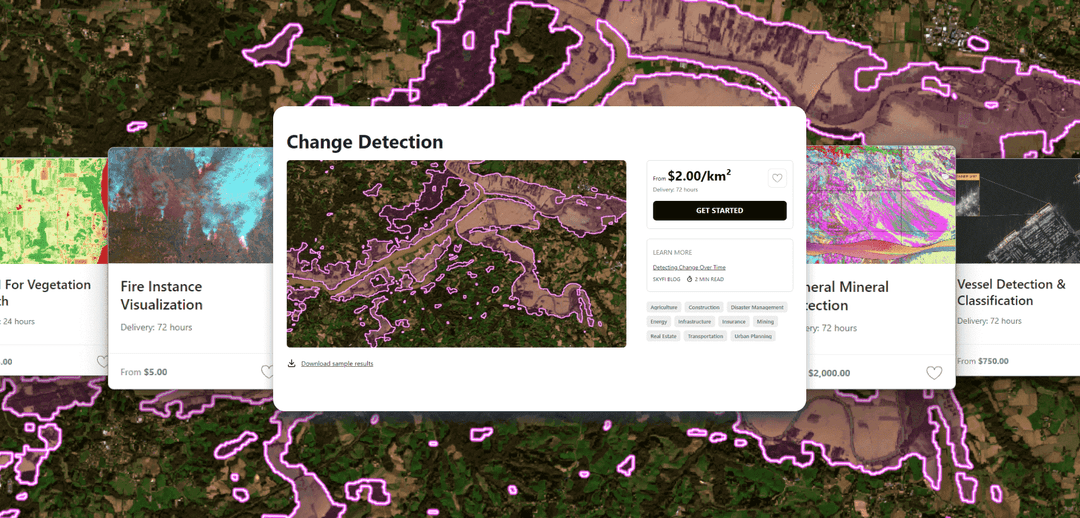
Vantor Connect: Satellite Imagery and 3D Models Use Cases

reliable satellite tasking at scale
Reliable Satellite Tasking at Scale
Predictable, high-resolution satellite collections for recurring monitoring, large AOIs, and operational continuity.
low-latency imagery for time-critical decisions
Low-Latency Imagery for Time-Critical Decisions
Access fresh satellite imagery fast enough to support real-time response, disruption monitoring, and operational awareness.
infrastructure planning with 3d terrain models
Infrastructure Planning with 3D Terrain Models
Use satellite-derived DTMs and DSMs to evaluate elevation, slope, and surface context for large-scale infrastructure projects.
flood risk & environmental modeling with elevation data
Flood Risk & Environmental Modeling with Elevation Data
Model flood exposure and environmental risk using high-accuracy, satellite-derived terrain products.
site assessment with satellite  imagery and 3d context
Site Assessment with Satellite Imagery and 3D Context
Combine high-resolution satellite imagery and 3D terrain to assess access, feasibility, and development constraints before ground deployment.
Start Using Vantor Connect today
Join hundreds of organizations already using on-demand satellite imagery
Connect with us
About Vantor
Vantor is forging the new frontier of spatial intelligence to unlock a more autonomous, interoperable world. We give decision makers and operators the power to build a unified intelligence picture, delivering the clarity they need to navigate what’s happening now and shape what’s coming next. We fuse data from the world’s most capable imaging satellites with real-time sensor feeds from space, air, and ground to create an AI-ready digital replica of Earth. Our spatial intelligence platform automates every part of the cycle—from tasking to collection to production—to update and analyze this foundation at the pace of change. Our products drive deeper mission-critical insights and connect the next generation of autonomous systems across the defense, intelligence, and commercial landscape.
To learn more, visit www.vantor.com
vantor_image

Vantor Connect

Vantor Connect brings satellite imagery archives, new satellite tasking, and satellite-derived 3D data together in one interface. The platform enables users to place orders, track status, and receive data through a unified workflow.

Users pay only for what they order and download only the data they need, making it easy to scale usage without long-term commitments.

Order Now

Frequently Asked Questions

More SkyFi Products

product Analytics
Starting at $5

Analytics

Transform raw images and datasets into real answers with SkyFi Analytics. Our platform delivers pivotal insights across industries with advanced tools like object detection, hyperspectral signature analysis, and commodity stockpile measurement, empowering you to optimize operations and strategic planning.
product Commercial Imagery
Starting at $25

Commercial Imagery

Task a satellite to capture an image in the future of your area of interest in just a few clicks, set up recurring orders, and purchase existing images from our vast archive of data.
product Open Data
Available for FREE

Open Data

SkyFi's open data program provides comprehensive, free satellite data to broaden analytics use cases and provide crucial data for agriculture, urban planning, and disaster management.
product Vantor

Vantor

On-demand access to Vantor’s WorldView constellation, global basemaps, and 3D terrain models directly on SkyFi. Task new imagery and explore the world in unmatched detail.
product Vantor Connect

Vantor Connect

On-demand access to Vantor’s full constellation and 3D models through Vantor Connect, powered by SkyFi. Schedule new Vantor tasking at 30 cm or 50 cm resolution, browse decades of Vantor archive imagery, or order Vantor 3D models to measure and visualize change with unmatched clarity. Designed for mission-critical workflows that demand precision and speed.
product Maritime AIS Data

Maritime AIS Data

Track global vessel activity with SkyFi’s unified Maritime AIS data. The platform merges satellite, terrestrial, and shipborne AIS feeds to deliver worldwide visibility, anomaly detection, and dark-ship tracking for security, logistics, and compliance missions.
product SkyFi Plugin for ATAK

SkyFi Plugin for ATAK

Access satellite imagery with SkyFi's ATAK Plugin, which enables live tasking and analytics, giving field operators real-time situational awareness.
product ICEYE US Direct

ICEYE US Direct

Get direct access to persistent monitoring with real-time SAR intelligence at your fingertips. Explore high-resolution Synthetic Aperture Radar (SAR) imagery on the new ICEYE US self-service platform powered by SkyFi, where you can search the extensive archive or task satellites to simplify acquisition and accelerate decision-making.
product Planet Select

Planet Select

Experience rapid access to the Planet SkySat® constellation for both tasking and archive satellite imagery, powered by SkyFi’s infrastructure. Planet Select lets users monitor high-frequency optical data, order new SkySat captures, and analyze surface changes with ease, ideal for agriculture, infrastructure, and environmental intelligence at scale.
connection_image

Want to Know More?

Contact us