Planet Select Product Image
High-resolution, high-frequency data when and where you need it
Planet Select Logo

Access SkySat® Tasking and Archive Satellite Imagery On Demand.

Get Planet's industry-leading satellite imagery without contracts or minimums.

✓ 50 cm resolution ✓ 10+ years of archived satellite images ✓ 7-day tasking capture window ✓ Pay only per km²

Explore PLANET SELECT
HISTORICAL INSIGHT
SkySat Archive
  • Multi-year historical satellite images
  • Immediate download
  • Perfect for validation
  • From $6/km²
benefit_icon
ON-DEMAND INTELLIGENCE
SkySat Tasking
  • 50 cm resolution capture
  • 7-day flexible window
  • Precise AOI targeting
  • From $12/km²
benefit_icon
COMPLETE ANALYSIS
SkySat Complete Coverage
  • Access both Archive + Tasking
  • Single portal for all needs
  • Seamless workflow
  • Pay only for what you use
benefit_icon

Powered by SkyFi

The Simplicity of SkyFi. The Precision of Planet.

Planet Select combines the high-resolution Planet SkySat constellation with SkyFi's seamless ordering and delivery platform.

Explore PLANET SELECT
How it Works

Get Started with Ease

01
Log In or Sign Up image
Log In or Sign Up
Access the Planet Select platform to explore global coverage. Define your Area of Interest (AOI) using the map or upload GeoJSON/KML files. Instantly view available archival and tasking options.
02
Order Imagery: Archive or Task New image
Order Imagery: Archive or Task New
Search, preview, and select high-resolution satellite imagery. Choose from historical archive or new tasking captures, and review transparent pay-as-you-go pricing before checkout.
03
Checkout and Download image
Checkout and Download
Complete your order securely and receive updates as it’s processed. Archive data delivers instantly and tasked imagery is available within your selected window in GeoTIFF or PNG format.
See the Difference
Every project benefits from perspective over time. With Planet Select, users can access both SkySat Archive for historical context and SkySat Tasking for up-to-date, high-resolution imagery. Unlock the power of true change detection and on-demand Earth intelligence now.
01
skysat archive

SkySat Archive

Unlock years of Earth observation data with instant access to the SkySat Archive. Analyze development trends, monitor environmental change, or validate project history using 50 cm high-resolution satellite imagery from Planet’s global archive.

Perfect for organizations that need quick insights from historical satellite imagery without the cost or lead time of a new capture.

ACCESS SKYSAT ARCHIVE
02
skysat tasking

SkySat Tasking

When timing is critical, SkySat Tasking puts precision capture in your hands. Define your Area of Interest, set your preferred dates, and task a SkySat satellite to access the most recent satellite images within days.

Ideal for monitoring active sites, responding to events, or validating changes detected from the archive instantly.

TASK A SKYSAT NOW

Pay for What You Need with Transparent Pricing

Single Existing ImageSingle New Image
Starting at
$
150
Starting at
$
300

High resolution

See every detail that matters with 50cm precision

Extensive archive

10+ years of imagery instantly available

Flexible tasking

Task new captures within your 7-day window

pay-as-you-go

Zero commitment, complete flexibility

Seamless platform

Order, task, and download with ease

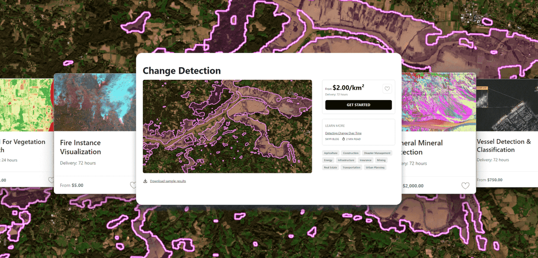
Planet Select: Satellite Imagery Use Cases

energy & utilities asset inspection
Energy & Utilities Asset Inspection
Schedule SkySat Tasking to monitor energy infrastructure for encroachment, expansion, or risk events. Tap into SkySat Archive to establish baselines and measure long-term asset performance.
infrastructure & construction monitoring
Infrastructure & Construction Monitoring
Use SkySat Tasking to capture high-resolution imagery of construction sites, transportation corridors, and infrastructure projects at every key phase. Combine with SkySat Archive to perform before-and-after comparisons, and ensure timelines.
defense & intelligence
Defense & Intelligence
Empower mission-critical situational awareness with SkySat Tasking and SkySat Archive. Capture high resolution imagery for border surveillance, operational planning, and rapid post-event assessment anywhere on Earth. Historical SkySat data provides multi-year context for intelligence validation.
insurance & disaster response
Insurance & Disaster Response
Quickly access SkySat Archive to assess pre-event conditions and task new imagery immediately after floods, wildfires, or hurricanes. High-resolution change detection enables fast insurance claims validation and post-disaster damage assessment.
agriculture monitoring
Agriculture Monitoring
Use SkySat Archive for multi-year crop analysis and SkySat Tasking for near-real-time vegetation health assessment. Detect field-level variations, soil degradation, or flood damage with precision NDVI and multispectral indices.
environmental research
Environmental Research
Combine SkySat Archive with new tasking captures to monitor deforestation, coastal erosion, mining activity, and ecosystem change. Support environmental, social, and governance (ESG) reporting with verifiable satellite evidence.
Start Using Planet Select Today
Join hundreds of organizations already using on-demand satellite imagery
Connect with us
About Planet

Planet Labs PBC (NYSE: PL) is a leading provider of global, daily satellite imagery and geospatial solutions. Planet is driven by a mission to image the world every day, and make change visible, accessible and actionable.

Founded in 2010 by three NASA scientists, Planet designs, builds, and operates the largest Earth observation fleet of imaging satellites. Planet provides mission-critical data, advanced insights, and software solutions to customers comprising the world’s leading agriculture, forestry, intelligence, education and finance companies and government agencies, enabling users to simply and effectively derive unique value from satellite imagery. Planet is a public benefit corporation listed on the New York Stock Exchange as PL.

To learn more visit www.planet.com and follow @planet on X.
vantor_image

PLANET SELECT

Access on-demand satellite imagery with unmatched flexibility through Planet Select. This self-serve satellite imagery platform combines historical satellite imagery from Planet’s extensive archive with new high-resolution satellite imagery captures, delivering comprehensive Earth observation data for informed decision-making.

ORDER NOW

Frequently Asked Questions

Learn how easy it is to search, preview and order high resolution satellite imagery on Planet Select, Powered by SkyFi.

Need more help?

Contact planet select

More SkyFi Products

product Analytics
Starting at $5

Analytics

Transform raw images and datasets into real answers with SkyFi Analytics. Our platform delivers pivotal insights across industries with advanced tools like object detection, hyperspectral signature analysis, and commodity stockpile measurement, empowering you to optimize operations and strategic planning.
product Commercial Imagery
Starting at $25

Commercial Imagery

Task a satellite to capture an image in the future of your area of interest in just a few clicks, set up recurring orders, and purchase existing images from our vast archive of data.
product Open Data
Available for FREE

Open Data

SkyFi's open data program provides comprehensive, free satellite data to broaden analytics use cases and provide crucial data for agriculture, urban planning, and disaster management.
product Vantor

Vantor

On-demand access to Vantor’s WorldView constellation, global basemaps, and 3D terrain models directly on SkyFi. Task new imagery and explore the world in unmatched detail.
product Maxar Connect

Maxar Connect

Maxar Connect was designed with the needs of mission-focused teams in mind, whether they're mapping disaster zones, conducting research, monitoring remote activity, or modeling terrain. Users can now access 30 cm or 50 cm imagery, browse more than a decade of archival coverage, and order a wide range of 3D geospatial products through one centralized interface.
product Maritime AIS Data

Maritime AIS Data

Track global vessel activity with SkyFi’s unified Maritime AIS data. The platform merges satellite, terrestrial, and shipborne AIS feeds to deliver worldwide visibility, anomaly detection, and dark-ship tracking for security, logistics, and compliance missions.
product SkyFi Plugin for ATAK

SkyFi Plugin for ATAK

Access satellite imagery directly within the Android Team Awareness Kit (ATAK). The SkyFi Plugin enables live tasking, archive search, and analytics in the field, giving operators real-time situational awareness even with limited connectivity.
product ICEYE US Direct

ICEYE US Direct

Get direct access to persistent monitoring with real-time SAR intelligence at your fingertips. Explore high-resolution Synthetic Aperture Radar (SAR) imagery on the new ICEYE US self-service platform powered by SkyFi, where you can search the extensive archive or task satellites to simplify acquisition and accelerate decision-making.
product Planet Select

Planet Select

Experience rapid access to the Planet SkySat® constellation for both tasking and archive satellite imagery, powered by SkyFi’s infrastructure. Planet Select lets users monitor high-frequency optical data, order new SkySat captures, and analyze surface changes with ease, ideal for agriculture, infrastructure, and environmental intelligence at scale.
connection_image

Want to Know More?

Contact us