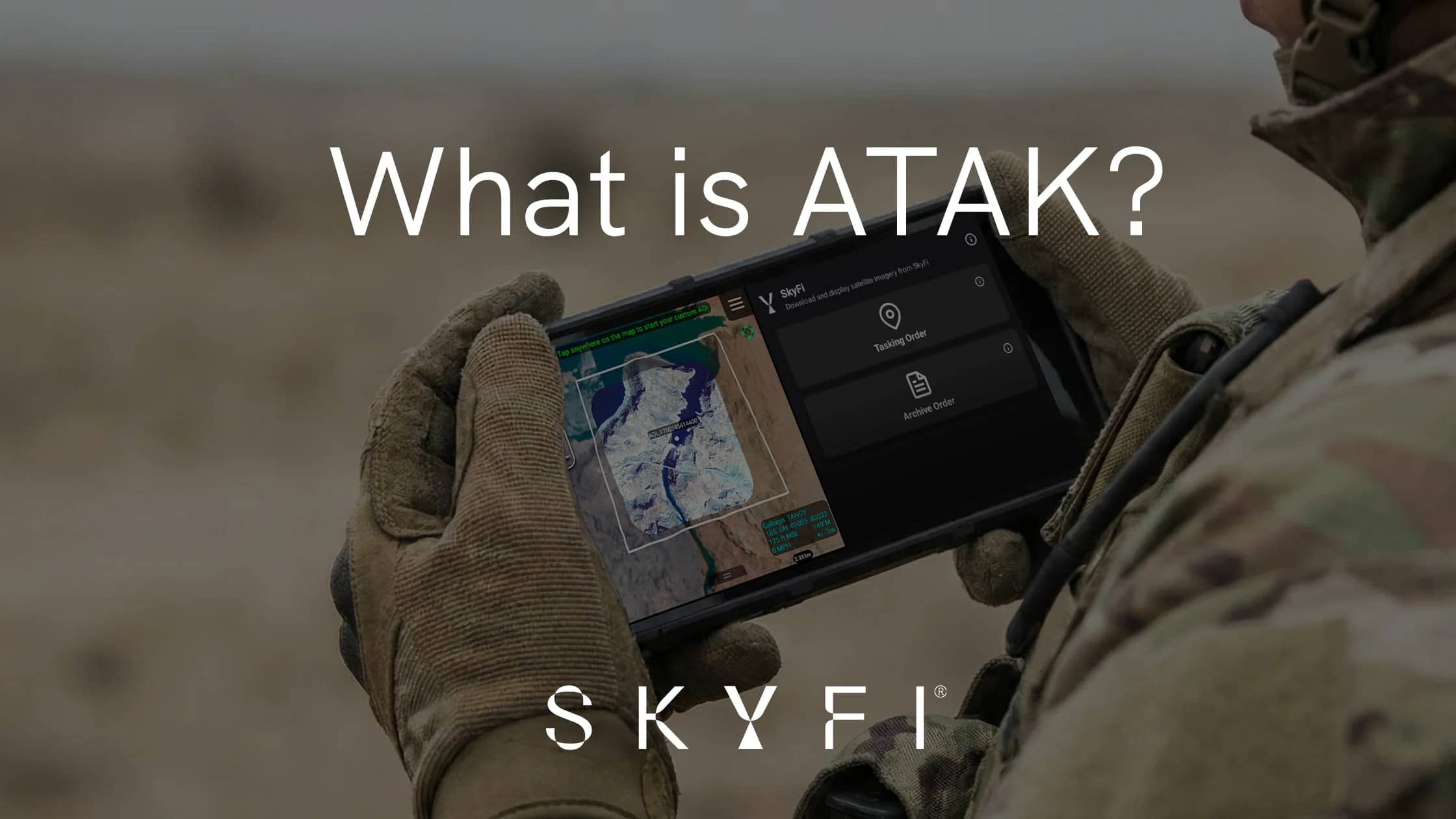
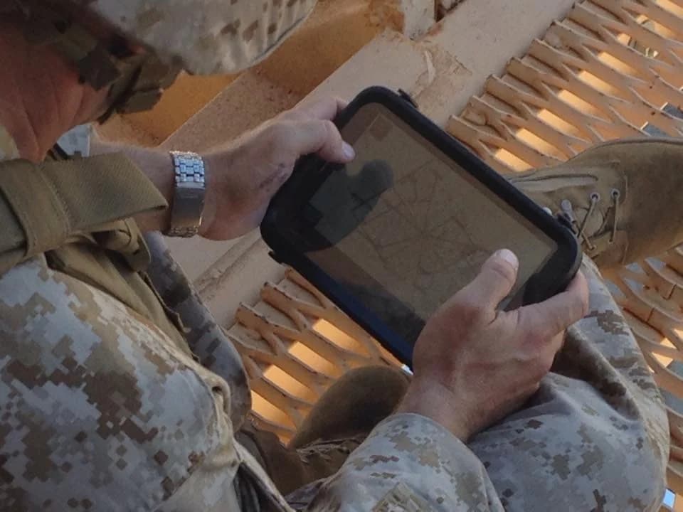
In 2017, during the intense urban combat of the Battle of Mosul, a critical problem faced coalition forces: the inability to share a common operational picture in real-time across disparate units. Units often found themselves relying on voice radios and paper maps - methods that, while functional, have remained largely unchanged since Roman times. The consequence of this "data gap" is a lack of real time situational awareness that can lead to tragic tactical errors and lost initiative. Today, the Android Team Awareness Kit (ATAK) has emerged as the definitive solution to this problem, offering a software core that enables tactical advantage at the edge.
This guide provides a comprehensive breakdown of how ATAK, enhanced by the SkyFi plugin, can be leveraged to give companies, organizations, government agencies, and military units a definitive competitive advantage by incorporating near real-time geospatial data.
What is ATAK? The Swiss Army Knife of Situational Awareness
At its core, ATAK is one of the most unique and peculiar software programs owned by the U.S. Federal Government. It serves as a geospatial mapping engine that allows users at the lowest tactical echelon to quickly "observe, orient, decide, and act" - a decision-making process made famous by John Boyd’s OODA loop.
The TAK Ecosystem: A Platform for Every Mission
While the core functionality remains consistent, the TAK ecosystem is divided into specific versions tailored for different users interested in improving situational awareness with ATAK:
ATAK: The Android-based version, which is the most robust and widely used platform in the ecosystem.
TAK-MIL (Military): Focused on military-specific applications, including precision targeting, enhanced battlefield awareness, and geospatial understanding across all phases of combat operations. Due to its sensitive capabilities, TAK-MIL has strict export controls. This version is often referred to as the Android Tactical Assault Kit.
TAK-CIV (Civilian): Designed for non-military applications such as first responders, emergency management, law enforcement, and non-NATO allies. It contains the core functions of TAK but lacks the combat-specific tools of the MIL version.
iTAK / TAKAware: The iOS experience. iTAK is sponsored by the United States Secret Service, while TAKAware is adopted primarily by the broader first responder community.
TAKX: A Linux-based successor to WINTAK (Windows), designed to run across Web, MacOS, Windows, and Ubuntu. WINTAK is slated to sunset in 2026.
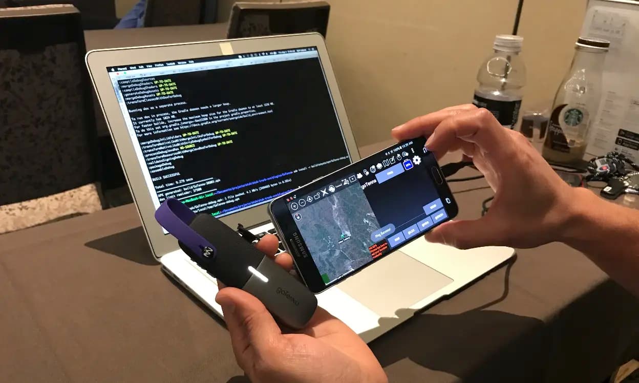
The Power of Open-Source Architecture
The true strength of ATAK lies in its Open-Source Architecture. The TAK Source code is owned by the TAK Product Center, which manages releases and allows government, industry, and allies to develop specific plugins that work with the core engine.
Key Advantages of the ATAK Framework:
Accessibility: Most versions are accessible under EAR99 regulations, meaning they are available to almost all countries and individuals, except those specifically sanctioned.
Flexibility: TAK is cross-platform and can create a common operating picture (COP) across local and wide area networks through a process called "federation".
Scalability: From small teams to large federated instances, TAK has scaled in major operations such as the 2017 Mosul offensive to smaller events such as search and rescue operations conducted by first responders.
Adaptability: The TAK product center and TAK core mapping engine adjusts and adapts to ever changing geospatial products such as 2D, 3D, terrain data, live video streams, and more.
Efficient Data Processing: TAK’s core mapping engine utilizes the best in breed to ensure efficient data processing for geospatial products.
Cost Efficiency: Before TAK, proprietary systems created "silos of excellence" that were expensive and difficult to integrate. TAK serves as a common denominator that is "free" to use, with additive functionality provided by plugins. TAK benefits from Department of War, USG agencies, Foreign Military Sales, Foreign Military Plugins, open source plugins and civilian applications that allow the Core engine to evolve with user needs - more robust on Android, second best would be Windows/Linux, third best would be iTAK/TAKAware.
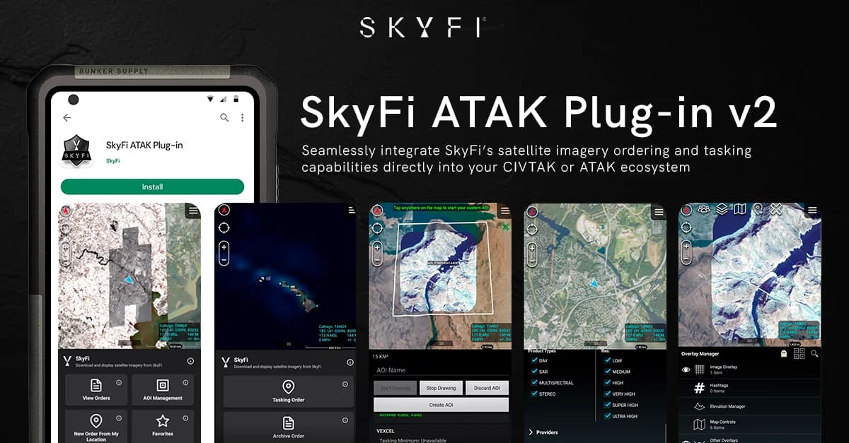
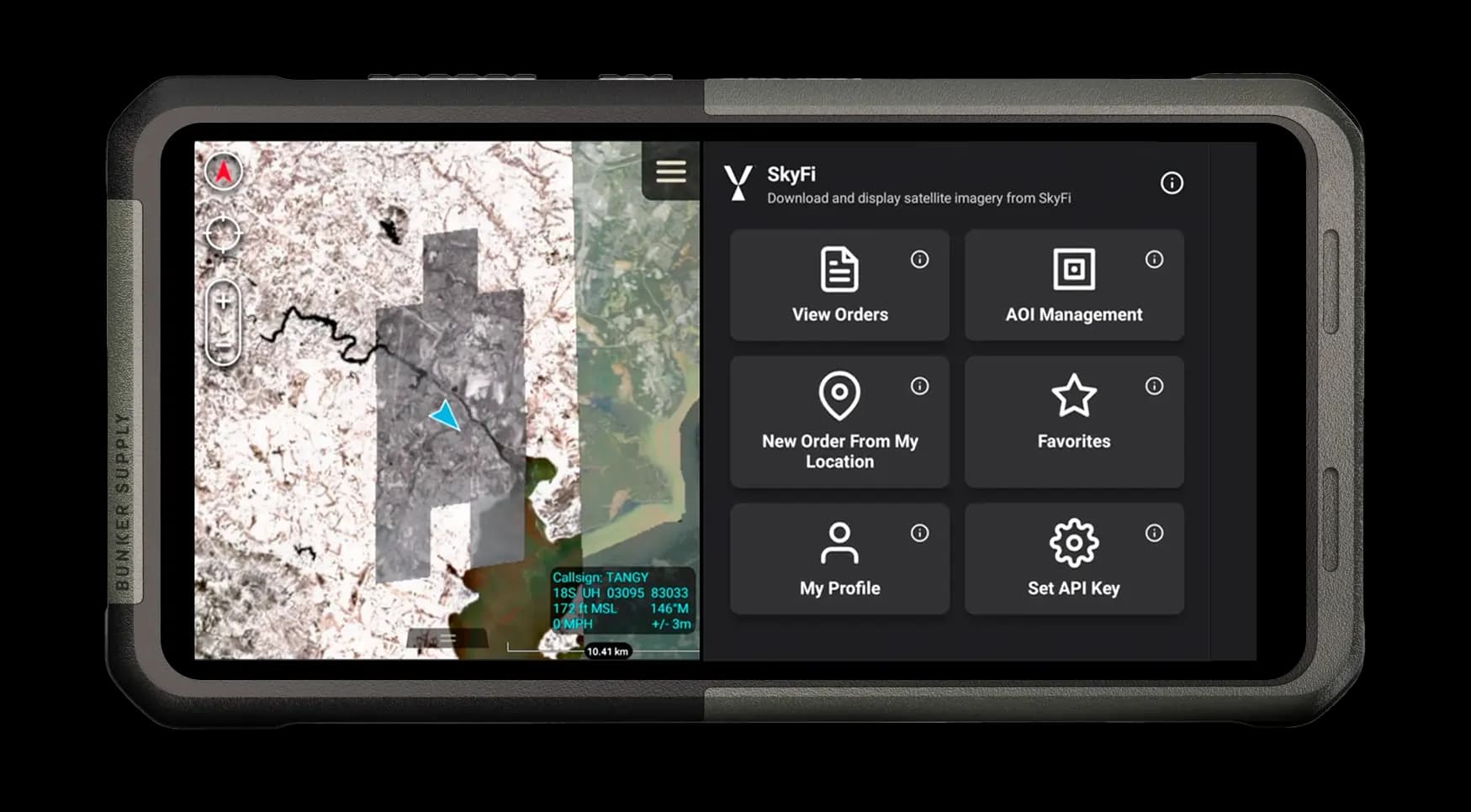
Technical Deep Dive: Plugin Support and the SkyFi Integration
ATAK's utility is magnified by its plugin architecture, which allows users to add specialized tools to the core map. In October 2025, SkyFi introduced an enhanced ATAK Plugin to deliver high resolution commercial satellite imagery to Warfighters and first responders. The SkyFi ATAK plugin is a prime example of this additive power.
Real-Time Intelligence at the Tactical Edge
The SkyFi plugin enables the lowest tactical echelon to purchase, download, and distribute unclassified geospatial data in near-real-time. While agencies like the National Geospatial-Intelligence Agency (NGA) provide imagery, sharing it - even with allied partners - can be difficult due to classification levels (e.g., CUI or Classified). SkyFi bypasses these bottlenecks by providing high-quality, unclassified commercial satellite data that is readily shareable with partners and allies.
Key SkyFi Technical Features:
Commercial High Resolution Optical Imagery: SkyFi provides access to a number of high resolution commercial satellite imagery providers, enabling TAK users to task satellites for near real-time imagery, or to utilize archived imagery.
Commercial SAR Imagery: SkyFi provides Synthetic Aperture Radar (SAR), which allows teams to see through smoke, rain clouds, or nighttime total darkness.
Diverse Constellations: Users gain access to a massive constellation of optical, multispectral, and stereo pair data.
Simplified UI/UX: The SkyFi platform offers transparent pricing and a simple user interface, making complex satellite tasking accessible to non-experts.
Multi-Industry Use Cases: ATAK in Action
ATAK has evolved from a military tool into a versatile dual-use platform with applications across various sectors.
1. Defense and National Security
Beyond the Battle of Mosul, TAK was instrumental during the 2017 Siege of Marawi and the 2021 evacuation of Afghanistan. It remains a staple for all DoD / DoW branches and COCOMs for mission planning, tactical coordination, and real-world event tracking.
In 2025, SkyFi was selected to join the North Atlantic Treaty Organization’s (NATO) Defence Innovation Accelerator for the North Atlantic (DIANA) 2026 Challenge Programme.
As part of the program, SkyFi will make its ATAK plugin available to NATO partners, including its intuitive, user-friendly web platform and mobile app to businesses, governments, and individuals looking to access geospatial imagery and analysis from more than 50 commercial partners providing optical, synthetic aperture radar (SAR), hyperspectral, and aerial imagery.
2. First Responders and Public Safety
Federal and local law enforcement (FBI, USSS, DEA, ATF) use ATAK before executing high-risk warrants and to prepare for National Security Special Events (NSSEs), such as Presidential Inaugurations and the UN General Assembly.
ATAK is also widely used by local governments in advance of and during large events like the New York City Marathon.
In November 2025, FEMA announced plans to spend $625 million to help local and state governments boost cybersecurity, infrastructure protection, training, background checks and other public safety tasks for the 2026 international World Cup soccer tournament. The 11 U.S. host cities are eligible to utilize these FEMA grant funds for security and coordination tools including ATAK.
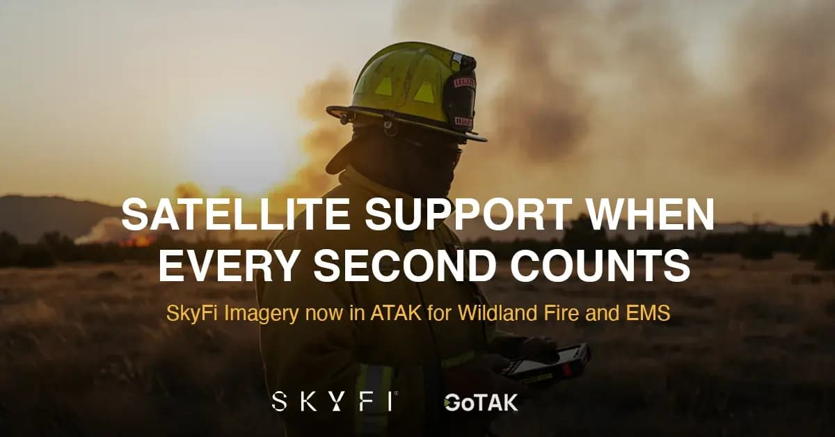
3. Disaster Response
In 2025, the Texas Department of Public Safety (DPS) utilized TAK effectively during massive flooding. By integrating fresh satellite imagery, rescue teams could identify navigable road and bridge routes that were not reflected on standard, static maps, avoiding areas made unsafe by the flood waters.
ATAK can be utilized by local first responders and other government agencies to organize rescue and relief efforts even in the absence of wifi or cellular service following a disaster. The platform enables real-time interagency coordination which is essential to safe, efficient disaster response operations.
4. Environmental and Wildlife Conservation
SkyFi provides comprehensive satellite data and advanced analytics to support monitoring and environmental conservation efforts. This can be used for deforestation tracking, climate change analysis, pollution detection, and wildlife habitat protection.
In countries like Scotland, TAK is used for deer conservation and environmental monitoring. Even individual hunters can use the platform for wildlife tracking and land management.
5. Logistics and Transportation
The military uses specialized plugins for logistics tracking, while the VNS plugin provides offline, turn-by-turn directions for transportation in contested and disconnected environments.
As part of its selection to the NATO DIANA program, SkyFi will refine and expand its geospatial decision-support platform, integrating additional data sources, enhanced AI analytics, and operator-focused workflows to improve mobility and logistics planning in contested and austere environments.
Overcoming Challenges: Training and Hardware
While ATAK is powerful, it is not without challenges. Users must be aware of two primary hurdles:
Training and Plugin Fatigue: ATAK can become overly complex if too many plugins are loaded. It is recommended that End-User Devices (EUDs) only carry the specific plugins needed for the mission.
Hardware Requirements: ATAK is resource-intensive. A general rule of thumb is that hardware older than three years will struggle to process high-end geospatial data and high-resolution imagery.
The Future: ATAK AI Integration and Upstream Analytics
By late 2026 and into 2027, ATAK will see a surge in AI integration. While current uses are limited to Large Language Models (LLMs) for manuals and tactics, the future lies in upstream geospatial analysis.
Providers like SkyFi will be able to feed AI-detected intelligence - such as airfield construction or maritime tracking, directly into the TAK interface, allowing for even faster decision-making.
Conclusion: The World in Your Hands with ATAK
ATAK is more than a map; it is a tool for survival and efficiency. Whether you are a first responder navigating a disaster or a defense agency planning a mission, the SkyFi plugin for ATAK ensures you are never working with outdated information.
SkyFi offers the literal world in your hands, providing the most simple UI/UX ever created for satellite intelligence. Elevate your situational awareness today - download the SkyFi plugin for ATAK on the Google Play Store and gain the edge that comes from space-layer intelligence.
Android Team Awareness Kit FAQS
What is TAK?
TAK stands for Tactical/Team Awareness Kit, a geospatial mapping engine used for situational awareness by military users as well as civilian first responders and emergency managers. Also known as ATAK - Android Tactical/Team Awareness Kit.
What is the ATAK SkyFi Plugin?
The ATAK SkyFi Plugin allows users the ability a truncated experience inside of ATAK natively to order/task new imagery, archive commercial, or archive open data natively. This allows a “single pane” of glass experience within ATAK to gather geospatial insights.
Is ATAK free?
The core software is government-owned and free to eligible users, though specific data (like SkyFi satellite imagery) may require a purchase.
Can I use ATAK on an iPhone?
Yes, via iTAK or TAKAware, though the plugin architecture is currently more robust on the Android (ATAK) version.
Marshall Frith serves as the TAK Solutions Engineer at SkyFi working with government, industry, and technical partners on geospatial solutions for the TAK ecosystem.
Previously he worked as a contractor at the Defense Advanced Research Projects Agency (DARPA) for 14 years. He was the lead Technical SETA on DARPA’s Persistent Close Air Support (PCAS) program that contributed research and development to ATAK. In addition, he also served as the lead technical SETA for DARPA’s Centralized Control of Commercial Drones (C3D) that led to today’s modern TAK UAS tool.


