Navigating Catastrophes: How Satellogic’s Imagery Transforms Emergency Management
In the modern era, the frequency and intensity of natural disasters have surged, placing unprecedented demands on disaster response and management strategies. The integration of advanced Earth observation data, such as Satellogic’s 99 cm resolution satellite imagery accessible through SkyFi, offers a critical tool for addressing these challenges.
This blog delves into the transformative impact of high-resolution Earth observation data on managing the aftermath of earthquakes, floods, wildfires, and hurricanes.
Earthquakes
The aftermath of an earthquake presents a complex challenge, with the need for rapid assessment of structural damage to buildings, roads, and bridges. Satellogic's 99 cm satellite data allows for detailed imaging of affected areas, enabling emergency services to pinpoint areas of devastation and prioritize response efforts. This precise data aids in assessing the extent of damage, facilitating swift and targeted aid to those in need, thus enhancing the effectiveness of rescue operations.
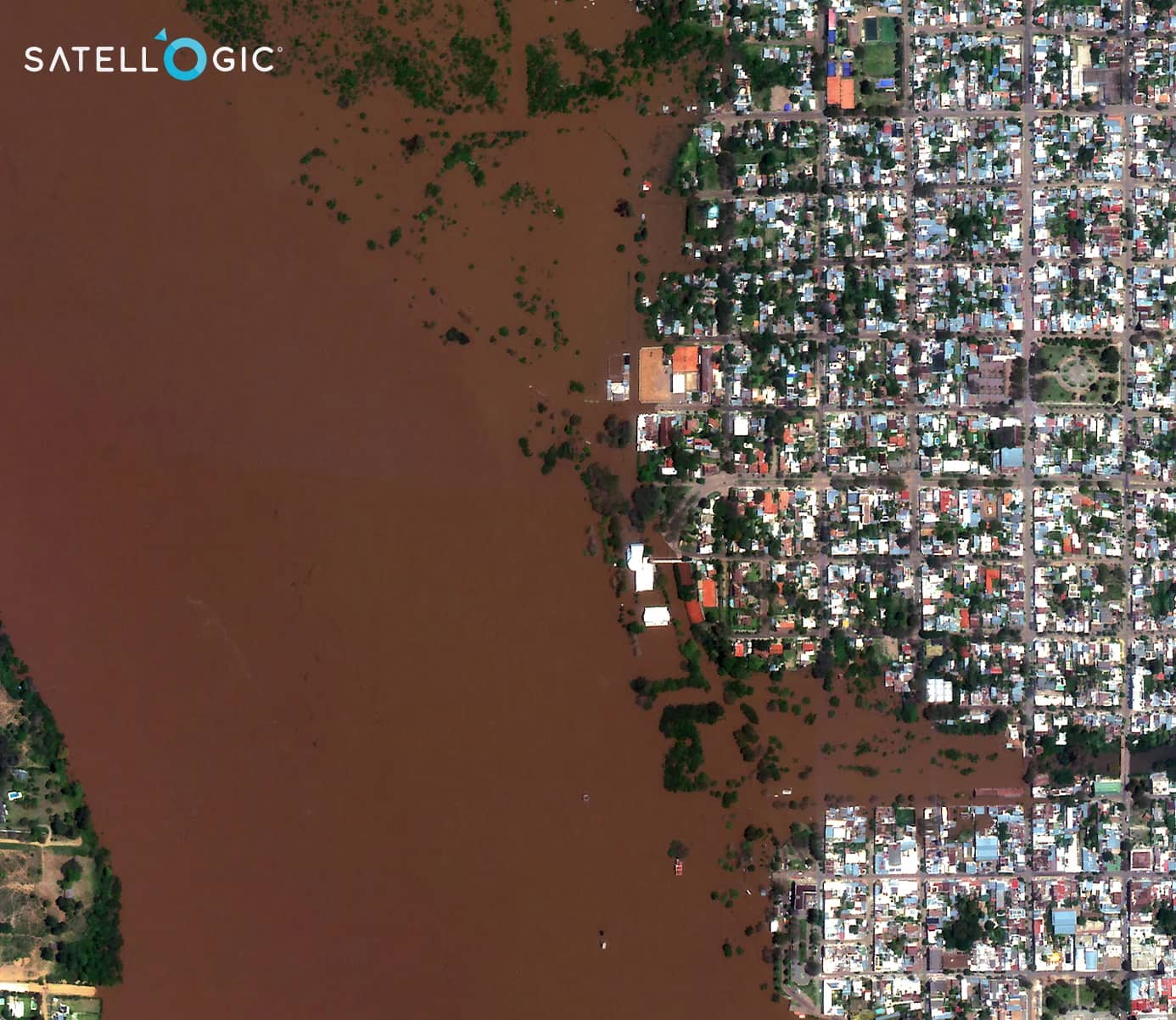
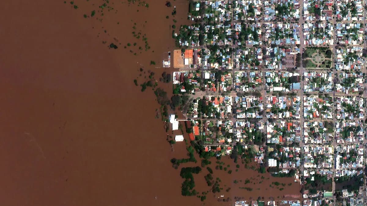
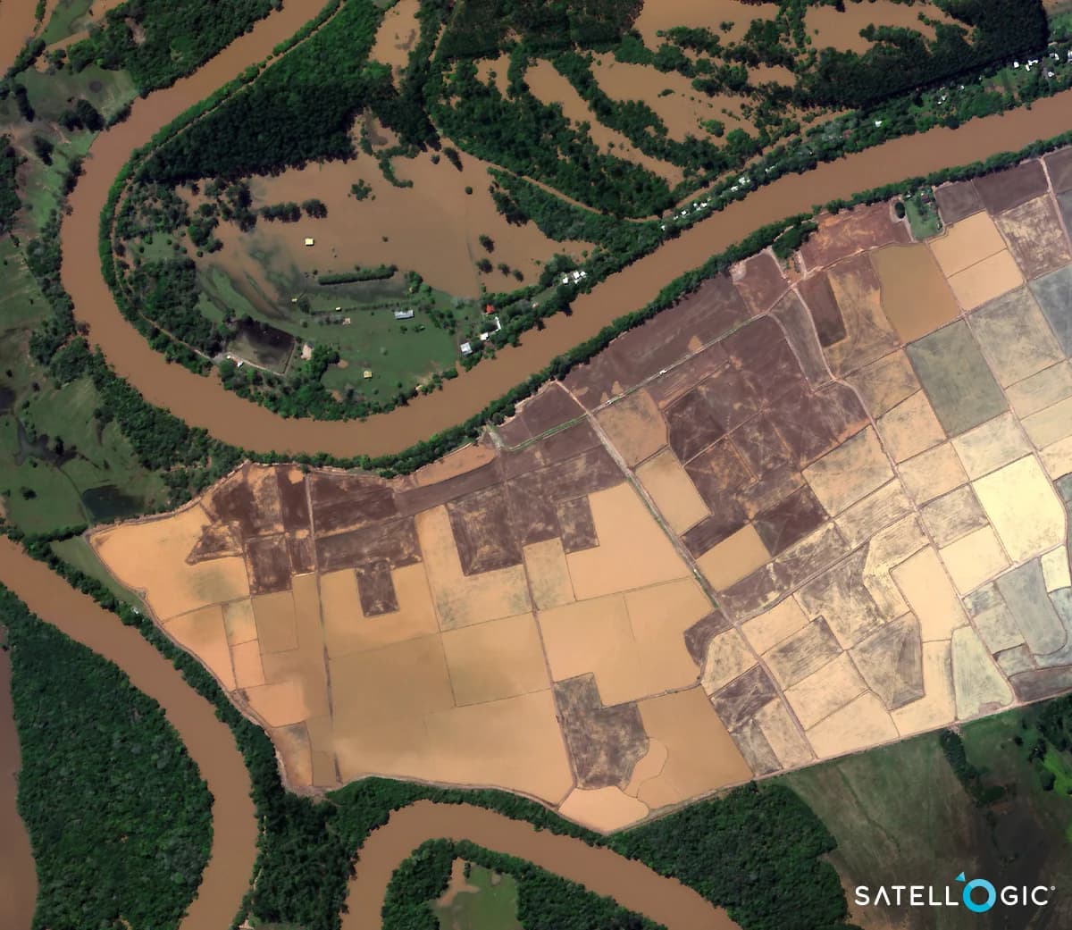
Flooding
Flood events often cover vast areas with water, making ground assessment difficult. Satellite imagery with 99 cm resolution provides a comprehensive view from above, identifying flooded regions, the extent of water inundation, and the impact on communities and agriculture. This information is crucial for planning evacuation routes, delivering relief supplies, and preparing for recovery efforts, ultimately supporting affected populations in navigating the challenges posed by flooding.
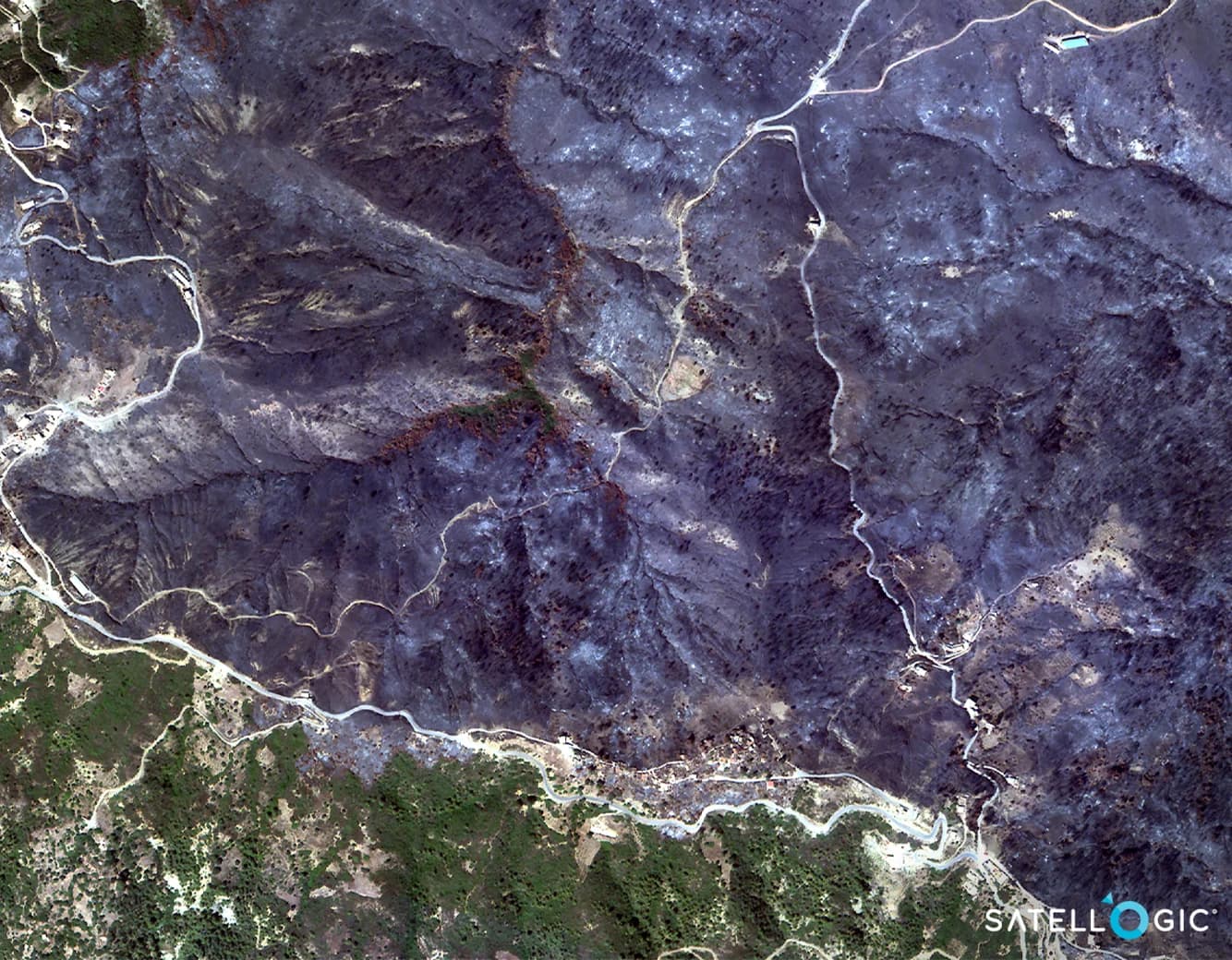
Wildfire
Wildfires can rapidly change direction and intensity, making real-time monitoring essential for effective management. The high-resolution data from Satellogic captures the progression of fires, hotspots, and the extent of burned areas. This information supports firefighting efforts by highlighting critical areas in need of attention and assists in evaluating the environmental impact of the blaze, aiding in the restoration of ecosystems post-fire.
Hurricane
Satellite imagery with 99 cm resolution offers a powerful tool for assessing hurricane-induced damages by comparing before-and-after images. This high-resolution data enables detailed assessments of damage to infrastructure, landscapes, and communities, providing critical information for rapid response and recovery efforts. By monitoring changes with a high revisit rate, it helps identify the most affected areas, guiding emergency services and aid distribution efficiently. This approach ensures a safer, more accurate assessment from above, minimizing risks to personnel on the ground.
SkyFi's platform, by aggregating this data, provides an accessible, user-friendly interface for obtaining these critical observations. The integration of Satellogic's archives enhances SkyFi's offerings, making it easier for responders to plan, execute, and monitor disaster response activities. The availability of a free sample dataset for non-commercial use encourages widespread understanding and application of these technologies in disaster management.
By making Earth observation data more accessible and applicable, SkyFi and Satellogic empower not only disaster response teams but also governments, NGOs, and communities. This capability facilitates more effective preparation, rapid response, and efficient recovery from natural disasters, ultimately contributing to resilience and sustainability in the face of increasing environmental challenges.


