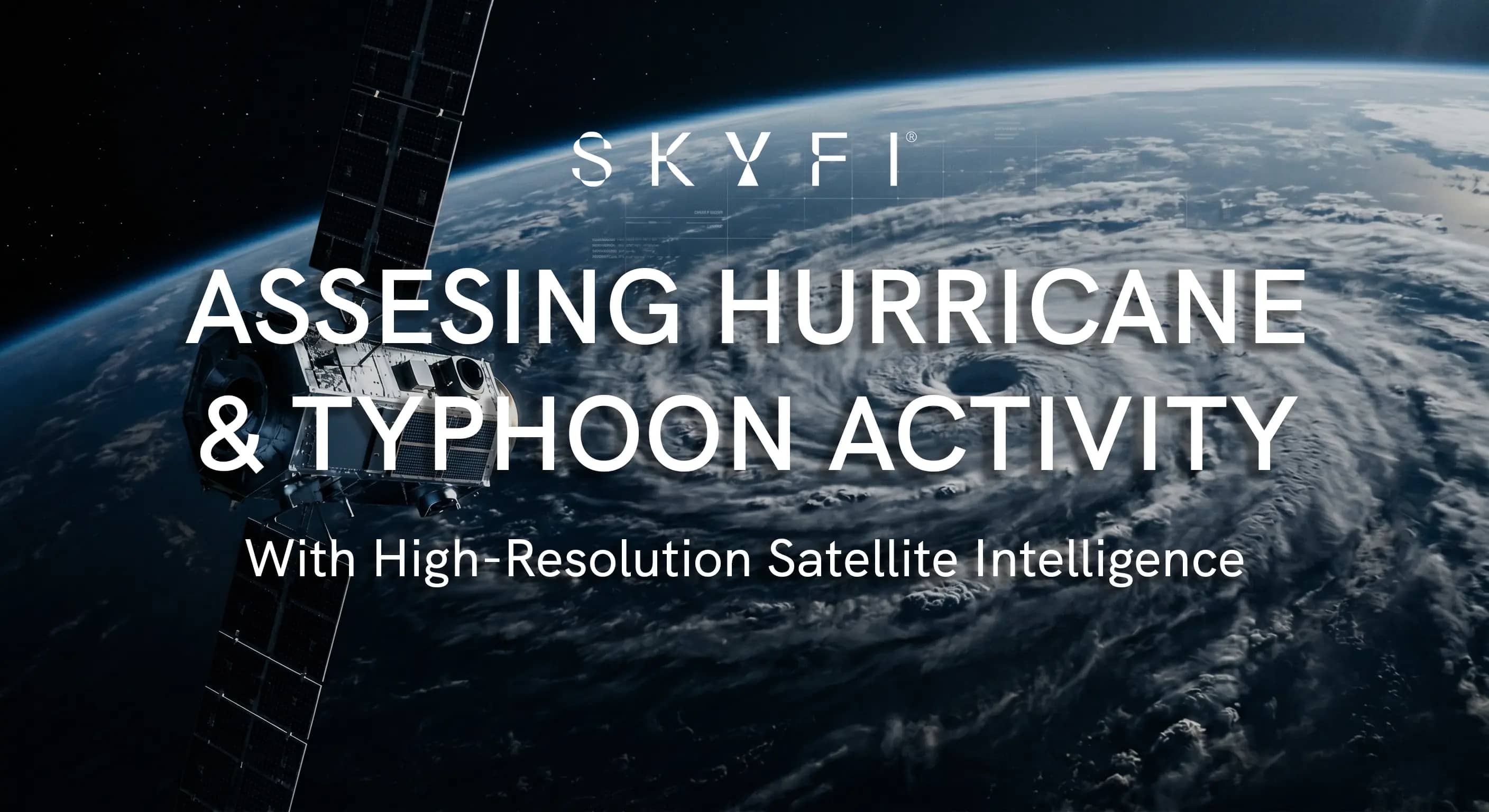
Assessing Hurricane & Typhoon Activity With High-Resolution Satellite Intelligence
As we prepare for the upcoming tropical cyclone seasons, the global climate pattern presents a complex and high-stakes puzzle for risk managers, supply chain operators, and commodity traders across various industries.
The coexistence of strengthening El Niño conditions with a forecast of historically unprecedented sea surface temperatures has created a highly volatile forecasting environment across both the Atlantic and Pacific basins. In this high-stakes landscape, traditional statistical forecasting model limits are being tested.
To bridge the gap between predictive modeling and ground truth, commodity traders, insurance underwriters, and logistics coordinators are increasingly relying on high-resolution satellite and Earth intelligence platforms like SkyFi, one of the best hurricane monitoring websites right now, to analyze assets before, during, and after severe storm impacts.
TLDR
El Niño conditions create opposing hurricane risks across the Atlantic and Pacific, suppressing Atlantic storm activity while supercharging Pacific typhoon intensity. This increases the likelihood of Category 4 and 5 super typhoons threatening major global supply chain corridors.
Even in suppressed Atlantic seasons, a single major hurricane landfall near a high-value asset can trigger catastrophic disruptions for coastal risk managers
SkyFi's satellite intelligence platform supports the full hurricane lifecycle, from SAR-powered assessment to rapid post-storm damage quantification.
The Atlantic Hurricane Paradox: Why It Only Takes One
The upcoming Atlantic hurricane season presents a fascinating meteorological paradox. Historically, El Niño events have acted as an atmospheric suppressor for Atlantic tropical development. The phenomenon increases vertical wind shear across the Caribbean and tropical Atlantic, effectively tearing apart developing tropical disturbances before they can organize into mature hurricanes.
More importantly, seasoned risk managers know that seasonal totals are secondary to localized impacts, including pools of above normal water temperatures. As the historical meteorological maxim states: "It only takes one."
Even in a statistically suppressed or average season, a single major hurricane making landfall near a high-value industrial asset, energy hub, or densely populated coastline can cause catastrophic disruptions. For instance, infamous historical seasons that featured El Niño or El Niño transitions still produced highly destructive landfalls.
An example of this is Hurricane Andrew striking South Florida in August 1992 (the only U.S. hurricane making landfall that year). The risk of rapid intensification (where a storm intensifies by 35 knots or more within a 24-hour window) is significantly elevated when ocean temperatures are this high, leaving coastal operations with compressed timelines to secure infrastructure. This volatility is why monitoring hurricanes in real time has become a non-negotiable part of coastal risk management.
The Pacific Cauldron: El Niño’s Fuel for Super Typhoons
While El Niño acts as a regulatory brake on the Atlantic, it acts as a powerful atmospheric supercharger for the Pacific typhoon season. The shift in warm water eastward across the Pacific alters atmospheric circulation patterns, typically shifting the cyclogenesis zone further east and south into the open waters of the Western North Pacific.
This geographic shift has profound implications for storm intensity:
Extended Tracks: Developing tropical systems spend more time tracking over the warmest waters on Earth before encountering land, allowing them to accumulate immense thermodynamic energy.
Elevated Super Typhoon Risk: Atmospheric dynamics during an El Niño year reduce wind shear in the core Pacific development zones, creating ideal conditions for storms to reach Category 4 or Category 5 equivalent "Super Typhoon" status.
Altered Landfall Trajectories: The steering currents associated with El Niño tend to curve storms northward toward East Asia, increasing the exposure risks for critical manufacturing hubs, major shipping lanes, and ports across Japan, Taiwan, and the eastern coast of mainland China.
For multinational corporations with deeply integrated Pan-Pacific supply chains, the upcoming months demand heightened vigilance. The sheer physical scale and intensity of Pacific typhoons during these cycles can disrupt global maritime shipping and shut down critical manufacturing nodes for weeks.
Leveraging SkyFi’s Satellite Intelligence Platform for Risk Management
In an era characterized by volatile, climate-driven weather extremes, relying solely on static weather alerts is no longer sufficient to protect high-value physical assets. Earth intelligence platforms like SkyFi have revolutionized the concept of situational awareness by democratizing access to high-resolution, near real-time satellite imagery and advanced geospatial insights.
By allowing users to seamlessly task any number of satellites over specific Areas of Interest (AOIs), SkyFi provides a critical overlay of physical truth to complement predictive meteorological models and functions as an effective hurricane forecasting tool.
The utility of integrating SkyFi’s satellite imagery for Atlantic hurricane and Pacific typhoon analysis spans the entire lifecycle of a tropical cyclone event, categorized into two critical operational phases:
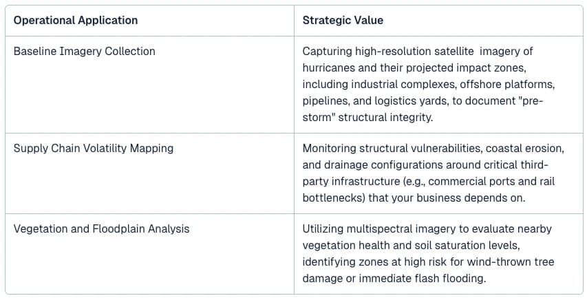
Pre-Storm Asset Auditing and Baseline Establishment
Before a hurricane or typhoon makes landfall, operational resilience depends entirely on proactive preparation. SkyFi enables organizations to establish a precise visual baseline of their assets and surrounding infrastructure.
Post-Storm Impact Assessment and Rapid Recovery
The immediate aftermath of a major tropical landfall is defined by a lack of reliable communication and physical access constraints. This is where SkyFi’s platform delivers its highest return on investment, acting as a safe, instantaneous eye in the sky and an industry leader in hurricane damage assessment.
Overcoming Cloud Cover with SAR
Traditional optical satellites cannot pierce heavy post-storm cloud layers or ongoing torrential rain. SkyFi provides access to Synthetic Aperture Radar (SAR) sensors, a critical hurricane monitoring technology that uses radar waves to capture highly detailed imagery through clouds, smoke, and even in total darkness.
SAR allows operations teams to detect extensive flooding, structural collapses, and coastal storm surge boundaries hours or days before optical satellites can get a clear view.
Rapid Damage Quantification
Once storm clouds clear, SkyFi’s high-resolution (sub-50cm) optical imagery can be immediately deployed to visually audit specific AOIs. This allows claims adjusters, operations managers, and safety executives to conduct a detailed hurricane risk assessment and inspect physical infrastructure without putting field personnel in hazardous environments.
The imagery is sharp enough to transition seamlessly from a macro view of a facility down to micro-level roof details. Adjusters can remotely identify missing shingles, structural tearing, and even subtle shingle dings caused by hail or high-velocity debris, accelerating the claims lifecycle from weeks to hours.
For insurers and underwriters perusing hurricane damage assessment software, SkyFi delivers analysis via high-resolution satellite data at a speed that a traditional on-site evaluation simply cannot offer.
Supply Chain Re-routing and Logistics Optimization
By viewing the broader regional impact, companies can assess whether access roads are washed out, port channels are blocked by debris, or regional power grids are down. This near real-time satellite data and critical hurricane monitoring data enables logistics managers to accurately re-route incoming vessels and cargo streams to unaffected hubs, minimizing costly demurrage fees and production downtime.
Agricultural Diagnostics & Crop Health Assessment
The dual threats of hurricane-force winds and prolonged post-landfall flooding cause catastrophic, yet often visually obscured, damage to regional agriculture. SkyFi’s high-resolution multi-spectral imagery allows risk adjusters and agricultural enterprise managers to assess damage down to individual row crops and specific trees in citrus groves.
Using SkyFi’s hurricane data analysis, operations managers can easily separate fields with minor, recoverable wind stress from catastrophic zones where citrus canopies are stripped or row crops are entirely washed out, allowing them to prioritize emergency response. This granular truth ensures accurate crop insurance adjustments, facilitates fast emergency aid allocation, and protects global supply chain logistics from unexpected shocks.
The Future of Satellite Imagery For Hurricane & Typhoon Analysis
The upcoming Atlantic and Pacific tropical seasons serve as a stark reminder that global weather patterns are becoming increasingly volatile and difficult to categorize using historical analogs alone.
While El Niño introduces competing forces in the Atlantic, the phrase "it only takes one" remains the definitive rule of engagement for coastal assets. Concurrently, the Pacific basin is primed for potentially extreme super typhoon activity that threatens critical global economic nodes.
In this environment, waiting for a storm to hit before assessing options is an outdated operational strategy. Integrating SkyFi’s high-resolution commercial and open satellite imagery platform into standard hurricane analysis and forecast system procedures provides predictive clarity and rapid post-impact.
Thanks to SkyFi’s geospatial intelligence, enterprises and organizations can safeguard personnel, protect billions in physical infrastructure, and maintain supply chain resilience under the most extreme conditions nature can present.
Related Satellite News & Stories from SkyFi
Christopher Hyde serves as a Sales Account Executive at SkyFi, where he supports customers using an Earth Intelligence Platform for geospatial analytics, satellite tasking, and archived imagery access. He is a meteorologist with over 25 years of experience in the weather and geospatial industries, focusing on the application of high-resolution weather data to energy markets, utilities, and global supply chains. His previous experience includes senior sales and management roles at Meteomatics and Maxar Technologies. He also served on the Board of Directors for the Weather Risk Management Association (WRMA).


