
Satellite Imagery for the Energy Industry
With cutting-edge technology to drive operational efficiency and environmental stewardship, SkyFi's Earth Observation Data and analytics delivers solutions set to improve asset monitoring, sustainability compliance, and strategic market intelligence for today's dynamic Energy industry.
Near Real-Time Asset Monitoring:
- Oversee critical infrastructure to instantly identify issues such as pipeline leaks, and other structural weaknesses for asset health.
- Monitor wind farms and solar panels for maintenance needs to strategically deploy manual operations precisely and accurately.
- Track changes in utility infrastructure, including power lines and substations for grid anomalies.
SUSTAINABILITY ANALYSIS:
- Identify and classify the most viable locations and sites for renewable energy projects.
- Evaluate the carbon footprint and environmental compliance of energy operations for regulation adherence and sustainable practice.
- Monitor and track efforts and offset projects, to ensure progress and effectiveness in carbon sequestration and restoration initiatives.
MARKET INTELLIGENCE:
- Track insights into global energy consumption and production rates, all at your fingertips.
- Monitor geopolitical events that affect oil and gas supply chains to remain ahead of market fluctuations.
- Assess the impact of natural disasters to anticipate disruptions and manage risks within the energy market.
POLICY AND PLANNING SUPPORT:
- Aid in the planning of energy infrastructure resilience measures to drive operational resiliency and efficiency.
- Support policy development with update data on urban energy consumption within commercial and residential zones.
- Evaluate the effectiveness of energy subsidies and incentives for accurate reporting.
Tap Into Market Insights with SkyFi
Delivering timely imagery through Earth Observation data and analytics, SkyFi enables government entities, commercial businesses, and research organizations to make informed and strategic decisions for operational accuracy and optimization within today's global energy market.
01

Global Environmental Monitoring
Track the effects of global disasters and phenomenons for asset vitality. Determine environmental dynamics and appropriate response mitigation to ensure the health of infrastructure. View isolated or damage sites for continuous updates and monitoring to determine grid damage and next steps.
02

Efficient Resource Management
Optimize resources to monitor critical factors for sustainable practices. SkyFi delivers precise data to support energy efficiency in agriculture, renewable energy production, grid management, and industrial processes. Leverage updated imagery to identify where to deploy manual operations for asset maintenance.
03

Early Hazard Detection
Identify illegal logging, oil spills, and other harmful activities with satellite data to mitigate environmental damage and ensure adherence to environmental standards and practices. Earth Observation Data provides more than immediate monitoring, allowing you to visualize and prepare for mitigation response.
04

Environmental Regulation & Safety
Assess land use and ensure environmental constraints for site selections. Monitor environmental impacts such as terrain changes and habitat disruptions for accurate and regulatory research. Provide updated data for compliance and reporting requirements throughout every operational stage.
05

Global Oil Inventory
Receive near real-time updates on global oil inventories with this SAR-derived analytics product. By applying proprietary algorithms to satellite imagery continuously collected worldwide, this product can measure oil storage volumes in your regions of choice. Commonly used by traders active in oil markets and equities, and by analysts for insights relating to geopolitics, economics, and commodities.
ADVANCED ANALYTICS FOR ENVIRONMENTAL PROTECTION
SkyFi Analytics For A Global Industry
06

Vessel Detection & Classification
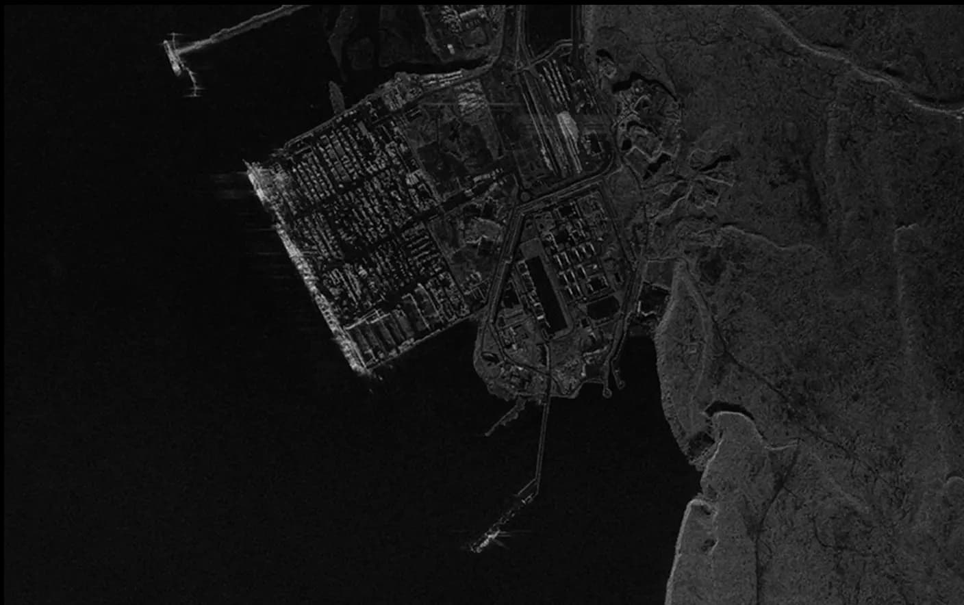
Get a bird's eye view into maritime activities with Vessel Detection and Classification. Using Synthetic Aperture Radar (SAR) data, this product rapidly detects and classifies vessels, providing coordinates and length details for container ships, bulk carriers, crude oil tankers, product oil tankers, and general cargo vessels.
07

Fire Instance Visualization:
Track and visualize fire events with high-resolution satellite data. This analytic provides detailed insights into fire locations, intensity, and spread, enabling effective management and timely response for forest fires or 'bush' fire anywhere in the world.
08

Water Quality & Safety Report:
The Water Quality & Safety Report offers an in-depth look at the factors affecting water quality and public health.This analysis evaluates the presence of harmful substances like PFAS, proximity to Superfund sites, and other environmental risks helping you to ensure that water sources are safe and meet health standards.
09

Digital Surface Model (DSM)
Elevation models prove critical for mining operations providing terrain elevation, slope analysis, and ground truthing, which are crucial for site selection, infrastructure planning, and environmental impact assessments. By utilizing detailed elevation data, experts can precisely evaluate flood risks, optimize building placements, and ensure adherence to local regulations.This capability not only enhances project feasibility studies but also supports sustainable urban development and resilience planning against natural disasters.
10

Custom Annotated Datasets
Create specialized datasets with SkyFi’s Custom Annotated Datasets service. We work closely with clients to curate datasets that meet specific environmental research requirements, ensuring high accuracy and comprehensive data integration. This service supports advanced environmental modeling and precise analysis for conservation and sustainability efforts.
How It Works
Get Access to Near Real-Time Satellite Imagery
SkyFi simplifies access to high-resolution Earth observation data and analytics, providing an intuitive satellite imagery platform that transforms complex imagery data and analysis into quick answers with just a few clicks. SkyFi uses up-to-date technology so that you can view and buy high-resolution imagery up to 7.5 cm resolution, featuring near real-time updates (satellite images captured within the last 24 hours).
01


Signing Up for SkyFi Satellite Imagery
Start exploring without the need for a signup or subscription. SkyFi’s quick and straightforward process opens the door to the world of advanced Earth observation data. With access to optical, Synthetic Aperture Radar (SAR), multispectral, and aerial data, users can monitor the world from multiple sources and across all weather conditions. This multi-sensor approach provides reliable, high-quality intelligence for persistent monitoring, analysis, and decision-making.
02

Exploring and Ordering Precise Imagery
With virtual constellations of satellites and applied analytics, you’ll see why SkyFi is the world’s geospatial data hub. Browse the SkyFi satellite imagery marketplace, task a satellite, or apply geospatial analytics to an image. SkyFi’s updated image archive and ability to task a satellite for a new image allows for a focus on geometrically accurate images that reflect day-to-day operations of businesses and agencies all over the world.
03

Checking Out of SkyFi’s Imagery Marketplace
Simply add satellite images and analytics to your cart and check out. You’ll receive your order via email and within your SkyFi account.
Only Pay for What You Need with Lowest-in-Market, Transparent Pricing
| Single Archive Image | Single Tasking Image |
Starting at $ 15 *High-resolution optical image | Starting at $ 200 *High-resolution optical image |
Comprehensive Coverage
Commercial and open data options available
High Precision & Resolution
Ideal for detailed analysis and strategic planning
Cost-Effective Accessibility
Meets any budget with low minimum order sizes
Diverse Data Types
From optical to SAR, and multispectral to stereo, find the right tools for your job
All-in-one Platform
Get the data and analytics you need in one place.
Swipe to see more
25.00 km
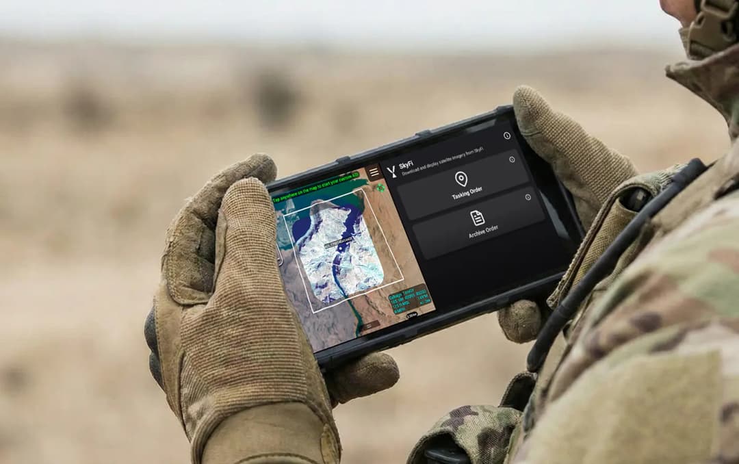
Military & Defense
Defense and security teams use SkyFi to turn satellite imagery and multi-domain sensor data into trusted operational intelligence. Access 150+ satellite sources, apply AI-enabled analytics, and deliver high-fidelity insights directly into COP systems and ATAK for faster, mission-ready decision-making.
Learn More