
Satellite Imagery for Government
SkyFi's Earth observation solutions enable more informed, efficient, and effective governance, ultimately leading to better outcomes for citizens and more accountable public institutions.
URBAN AND REGIONAL PLANNING:
- Support zoning and land use planning with detailed imagery analysis.
- Develop public transportation networks based on population density and mobility patterns.
- Plan and assess public utility services distribution and efficiency.
ENVIRONMENTAL MONITORING AND CONSERVATION:
- Track changes in protected areas to enforce conservation policies.
- Assess the impact of urban development on natural habitats.
- Monitor air quality and environmental pollutants.
PUBLIC SAFETY AND COMPLIANCE:
- Enhance crime prevention strategies with urban monitoring.
- Support disaster relief efforts with real-time damage assessments.
- Monitor border areas for illegal activities and migration patterns.
CIVIC ENGAGEMENT AND PUBLIC SERVICES:
- Enhance community planning with public insights and geospatial data.
- Monitor public infrastructure projects for transparency and accountability.
- Gauge public health drives by analyzing population movements.
Empowering Government Operations
Data-driven solutions are crucial for government decision-making, providing objective insights to complex societal issues. SkyFi enhances this approach by offering timely, comprehensive data through Earth observation imagery and analytics, supporting various aspects of governance across local, state, and federal levels. By leveraging SkyFi's solutions, government bodies can make more informed decisions, enhance transparency, manage resources better, and respond promptly to challenges, ultimately leading to improved outcomes for citizens and more accountable public institutions.
01

Near Real-Time Imagery
SkyFi provides government agencies with near real-time satellite imagery, allowing for timely decision-making and rapid response to emerging situations. This capability supports critical operations such as disaster management, urban planning, and environmental monitoring by providing up-to-date visual data.
02

Global Coverage
SkyFi offers comprehensive global coverage, ensuring government bodies have access to high-resolution satellite imagery from anywhere in the world. This extensive reach is essential for monitoring international borders, tracking global environmental changes, and supporting international cooperation and policy-making.
03

Platform (Marketplace Aggregating Solutions)
SkyFi offers an accessible marketplace designed to tackle complex governmental challenges for both geospatial experts and newcomers. SkyFi's platform empowers agencies to easily discover and utilize tailored datasets and analysis tools, enhancing their ability to solve tough problems and govern effectively.
Advanced Analytics for Government
SkyFi Analytics Applied to Government
04

Annotated Datasets
SkyFi provides detailed annotated datasets that are crucial for government operations. These datasets include but are not limited to:
Naval: Track naval activities and monitor maritime borders for enhanced security and resource management.
SAM (Surface-to-Air Missile) Sites: Identify and monitor SAM sites for national security and defense planning.
Airbase Infrastructure: Assess and monitor airbase infrastructure for strategic planning and operational readiness.
Aircraft: Detect and classify aircraft to enhance air traffic management and security measures.
05

Vessel Detection and Classification
Utilize advanced analytics to detect and classify vessels, providing crucial information on maritime activities. This tool helps monitor illegal fishing, track maritime traffic, and ensure the security of national waters.
06

Infrastructure Resilience Mapping
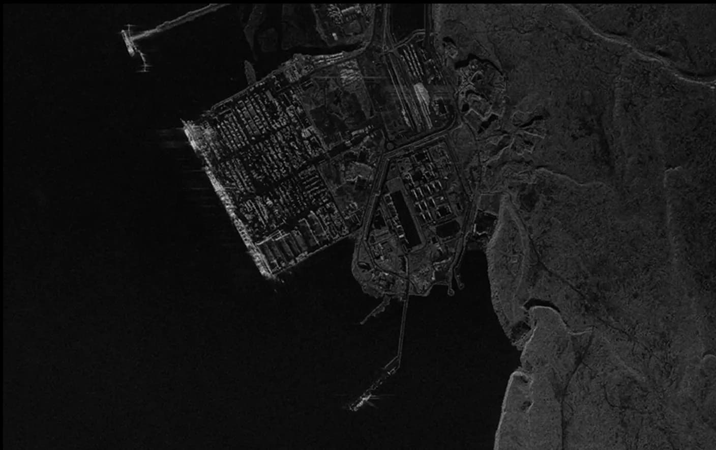
SkyFi’s infrastructure resilience mapping offers detailed insights into the stability and safety of critical infrastructure. By using synthetic aperture radar (SAR) technology, this service helps assess the resilience of roads, bridges, and buildings, aiding in disaster preparedness and risk management.
Tailored Data for Modern Governance


How It Works
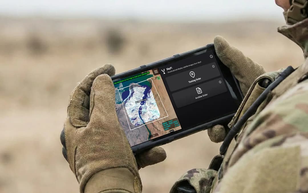
Get Access to Near Real-Time Satellite Imagery
SkyFi simplifies access to high-resolution Earth observation data and analytics, providing an intuitive satellite imagery platform that transforms complex imagery data and analysis into quick answers with just a few clicks. SkyFi uses up-to-date technology so that you can view and buy high-resolution imagery up to 7.5 cm resolution, featuring near real-time updates (satellite images captured within the last 24 hours).
01


Signing Up for SkyFi Satellite Imagery
Start exploring without the need for a signup or subscription. SkyFi’s quick and straightforward process opens the door to the world of advanced Earth observation data. With access to optical, Synthetic Aperture Radar (SAR), multispectral, and aerial data, users can monitor the world from multiple sources and across all weather conditions. This multi-sensor approach provides reliable, high-quality intelligence for persistent monitoring, analysis, and decision-making.
02

Exploring and Ordering Precise Imagery
With virtual constellations of satellites and applied analytics, you’ll see why SkyFi is the world’s geospatial data hub. Browse the SkyFi satellite imagery marketplace, task a satellite, or apply geospatial analytics to an image. SkyFi’s updated image archive and ability to task a satellite for a new image allows for a focus on geometrically accurate images that reflect day-to-day operations of businesses and agencies all over the world.
03

Checking Out of SkyFi’s Imagery Marketplace
Simply add satellite images and analytics to your cart and check out. You’ll receive your order via email and within your SkyFi account.
Only Pay for What You Need with Lowest-in-Market, Transparent Pricing
| Single Archive Image | Single Tasking Image |
Starting at $ 15 *High-resolution optical image | Starting at $ 200 *High-resolution optical image |
Comprehensive Coverage
Commercial and open data options available
High Precision & Resolution
Ideal for detailed analysis and strategic planning
Cost-Effective Accessibility
Meets any budget with low minimum order sizes
Diverse Data Types
From optical to SAR, and multispectral to stereo, find the right tools for your job
All-in-one Platform
Get the data and analytics you need in one place.
Swipe to see more
25.00 km
Military & Defense
Defense and security teams use SkyFi to turn satellite imagery and multi-domain sensor data into trusted operational intelligence. Access 150+ satellite sources, apply AI-enabled analytics, and deliver high-fidelity insights directly into COP systems and ATAK for faster, mission-ready decision-making.
Learn More