
How PLOT Software Harnesses Geospatial Data: Construction Jobsite Monitoring with Satellite Imaging (Updated 2026)
By Evan Achiron
In the construction industry, having accurate and up-to-date information is vital for successful project management. PLOT, a leading provider of construction planning software, realized the need for high-resolution and recent satellite imagery to effectively manage jobsites. However, their existing imagery fell short in providing the necessary level of detail and timeliness. By partnering with SkyFi, a provider of high-quality Earth observation imagery, PLOT was able to overcome these obstacles and significantly improve their jobsite oversight capabilities.
“Our clients are literally changing the face of the earth and therefore they need custom, ad hoc, immediacy in their imagery that only SkyFi has been able to deliver.” Chris Callan · CEO & Founder
Overcoming Limitations and Gaining an Edge:
PLOT's previous struggles with outdated satellite imagery limited their ability to assess site conditions, track changes, and provide clients with the most up-to-date information. "Most of our job sites have integrated some level of drone program because it is a problem that is so necessary, difficult, and worthwhile. SkyFi has made it so easy to acquire recent satellite imagery that we are already seeing the need for drone flights and processing being pulled back," Chris said.
Key Takeaways (TLDR):
Real-Time Site Monitoring: PLOT replaces outdated, months-old imagery with SkyFi’s high-resolution satellite data, providing a "present-day" view of jobsite progress and conditions.
Cost-Effective Alternative to Drones: SkyFi’s on-demand satellite imagery reduces the need for expensive, labor-intensive drone flights and manual data processing.
Enhanced Logistics & Compliance: High-definition imagery allows for precise mapping of building footprints and roadways, ensuring construction stays within permitted boundaries and respects land-use ordinances.
Proactive Environmental Stewardship: Stakeholders can monitor soil disturbance, erosion, and drainage paths in real-time, identifying potential environmental risks before they require costly remediation.
Automated Change Detection: By comparing historical and current satellite layers, PLOT can pinpoint unplanned expansions, potential delays, or deviations from original blueprints.
Overcoming Limitations and Gaining an Edge
PLOT's previous struggles with outdated satellite imagery limited their ability to assess site conditions, detect and track changes, and provide clients with the most up-to-date information.
"Most of our job sites have integrated some level of drone program because it is a problem that is so necessary, difficult, and worthwhile. SkyFi has made it so easy to acquire recent satellite imagery that we are already seeing the need for drone flights and processing being pulled back," Chris said.
Benefits of Using Satellite Data for Construction Job Sites:
Improved Jobsite Oversight
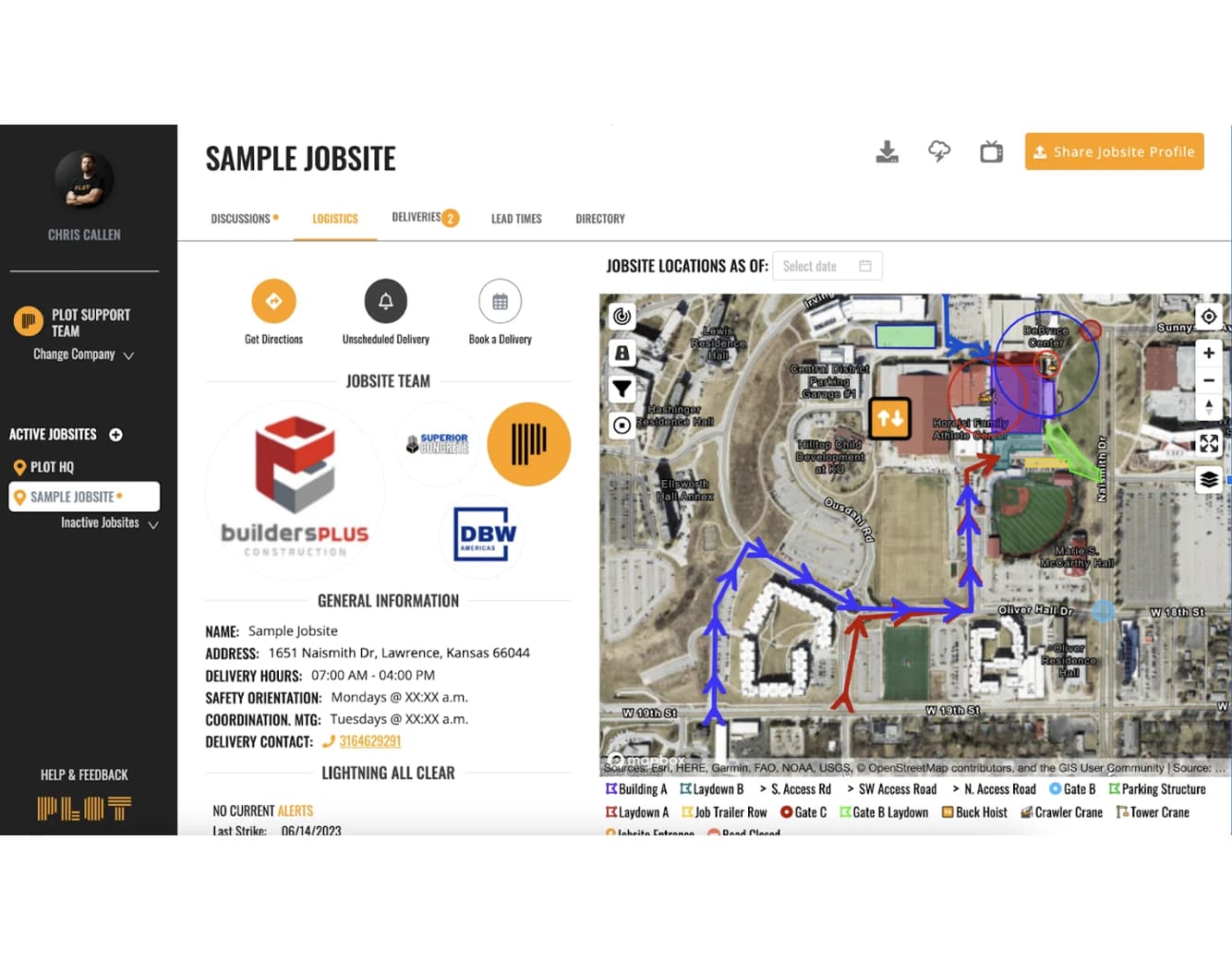
With the higher resolution imagery from SkyFi, PLOT's construction software could now offer detailed views of the job sites, including precise building footprints, roadways, and other essential features. This enhanced oversight empowered PLOT to closely monitor site conditions and make informed decisions throughout the construction process.
SkyFi’s satellite imagery allows PLOT to identify significant site changes over time, which allows for stakeholders to pinpoint potential unplanned expansions, delays, or deviations from approved construction plans.
Imaging can also be used to ensure that construction stays within permitted boundaries, respects buffer zones, complies with land-use ordinances, and refrains from encroaching on protected areas, waterways, or public land.
Up-to-Date Services for Construction Companies
By integrating SkyFi's imagery into their software, PLOT expanded their service offerings. Chris shared, "SkyFi gets us a good image of what our job sites look like today, not six months ago. So we can direct people to the reality that is the present."
PLOT utilized the accurate and up-to-date imagery to offer value-added products such as Jobsite Logistics Maps and comprehensive reports, further enhancing their clients' experience and setting them apart from competitors.
Efficient Communication and Collaboration
The availability of current and detailed satellite imagery facilitated better communication with clients and stakeholders. "PLOT could easily share visual representations of the job sites, illustrating progress, challenges, and proposed solutions," emphasized Chris.
Transparent and efficient communication fostered trust, collaboration, and streamlined decision-making throughout the construction process.
Environmental Impact Monitoring
SkyFi’s satellite imagery helps PLOT identify potential environmental interferences caused by construction, including deforestation, soil disturbance, erosion, or encroachment into protected areas, allowing stakeholders to be made aware of issues before it is too late. Satellite imaging can also help spot changes in water bodies, drainage paths, or sediment runoff.
SkyFi’s satellite imaging can confirm whether environmental relief efforts are being correctly implemented on construction sites. Their imagery is especially valuable in areas with infrequent or inconsistent on-site inspections. Satellite imaging provides a more consistent view than traditional field reports ever could.
How PLOT & SkyFi’s Partnership is Changing the Construction Industry
The partnership between PLOT and SkyFi marked a turning point in the construction industry. By integrating SkyFi's satellite imagery into their construction planning software, PLOT not only overcame the limitations they faced but also embraced innovation and forward-thinking practices.
The combination of high-resolution satellite imagery, enhanced geospatial image pricing accuracy, value-added products, and improved communication capabilities propelled PLOT to the forefront of their industry.
In the words of Chris, "These are easy wins for us. When anything is simple and obvious, that's something I lean into heavily." As PLOT continues to leverage the power of SkyFi's satellite imagery, their construction software remains a cornerstone for professionals seeking efficient jobsite oversight, accurate cost estimation, and unparalleled client satisfaction.
Need Simple Jobsite Coordination? Get PLOT
By Evan Achiron