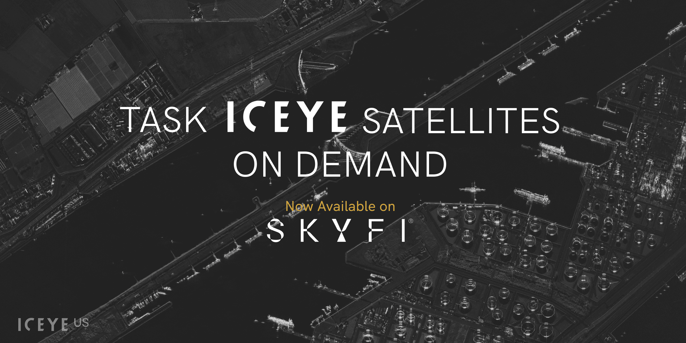
ICEYE US SAR Tasking Is Now Live on SkyFi: 24/7, All-Weather Earth Intelligence for Every User
By SkyFi
SkyFi users can now task ICEYE satellites directly through the SkyFi platform. This integration brings the world’s largest commercial SAR constellation into a simple, self-serve interface, giving defense, commercial, and research customers unprecedented access to persistent, all-weather Earth observation.
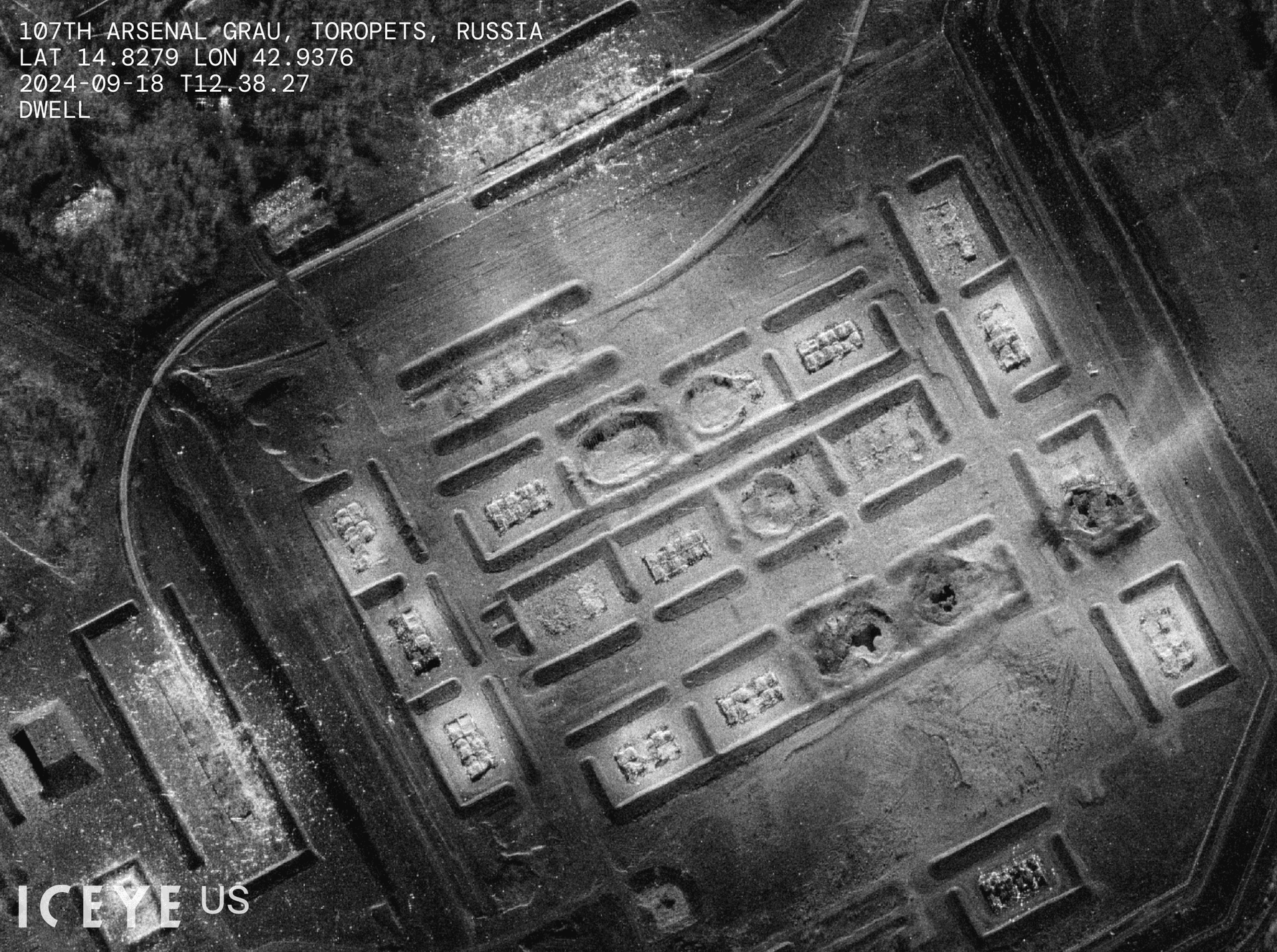
With ICEYE US onboard, SkyFi adds another industry-leading provider of radar imagery to its platform. Whether it’s monitoring a coastline at night, assessing flood damage during a storm, or tracking vessel activity in difficult conditions, SAR tasking from ICEYE US provides reliable, high-resolution intelligence from anywhere on Earth.
A New Level of Persistent Monitoring
Traditional optical satellites are powerful, but they are limited by sunlight and cloud cover. ICEYE US SAR imagery removes those constraints.
Using advanced phased-array radar, ICEYE satellites can capture data through any weather at any time. The constellation supports highly responsive tasking and flexible collection modes. SkyFi users can choose everything from 50 cm spotlight imagery to ultra-wide 10,000 square kilometer scans, depending on mission needs.
This integration gives organizations the ability to maintain persistent monitoring over the areas that matter most. Maritime security teams can keep eyes on dark shipping. Emergency responders can evaluate flooding even when storms block optical sensors. Infrastructure operators can track changes on the ground with consistent cadence and reliability.
Simple Tasking. Mission-Ready Results.
The ICEYE US integration follows the same streamlined workflow SkyFi users already know. Tasking an ICEYE SAR satellite is as simple as:
Drawing an area of interest
Selecting SAR and the preferred capture mode
Checking out and downloading through the web or mobile app
Enterprise customers can automate everything through SkyFi’s tasking APIs. This makes it easy for defense teams, intelligence programs, and commercial platforms to incorporate SAR into large-scale monitoring workflows.
The result is a frictionless way to order radar imagery that previously required complex contracting, long lead times, and specialized expertise.
Unlocking Critical Use Cases Across Industries
ICEYE US SAR data expands what SkyFi users can accomplish across multiple sectors:
National security: border surveillance, activity tracking, mission planning Maritime: vessel detection, dark ship monitoring, port congestion analysis Emergency response: flood mapping, storm damage assessment, fire impact analysis Infrastructure & energy: pipeline monitoring, encroachment, asset security Supply chain & commercial intelligence: construction tracking, port monitoring, large-area economic signals
For organizations that rely on timely information, SAR provides the reliability needed to make confident decisions even in adverse conditions.
Strengthening SkyFi’s Earth Intelligence Platform
SkyFi’s mission is to make Earth observation accessible and actionable for everyone. Adding ICEYE US advances that mission by delivering mission-grade radar intelligence through a platform that anyone can use.
This partnership builds on SkyFi’s growing multi-sensor network of optical, SAR, aerial, hyperspectral, and thermal providers, along with SkyFi’s integrated analytics suite and API-first workflows. For users who need real-time monitoring, high revisit rates, and resilient tasking options, ICEYE US is now one of the most powerful satellite imagery sources available in the SkyFi marketplace.
Now Available on Web, Mobile, and via API
ICEYE US tasking is now live for all SkyFi customers. Users can request imagery directly on the SkyFi web platform, in the mobile app, or through developer APIs for automated tasking.
This is a major step toward SkyFi’s vision: bringing mission-grade Earth intelligence to everyone, everywhere.
If your team needs persistent monitoring, night-time surveillance, rapid disaster assessment, or all-weather intelligence, you can start tasking ICEYE US satellites today.
About SkyFi
SkyFi is a self-service Earth Intelligence Platform that allows users to run built-in geospatial analytics, task satellites, and access archived imagery. The dual-use platform supports both civilian and defense use cases, with flexible ordering options, transparent pricing, and API access for large-scale workflows.
Customers can use SkyFi's web platform, mobile app, or developer APIs to manage Earth observation projects without needing contracts or in-house GIS teams.
Learn more at www.skyfi.com
About ICEYE US
At ICEYE US, we equip U.S. government agencies, defense contractors, and commercial enterprises with access to timely, reliable, and actionable persistent monitoring. Leveraging the world's largest constellation of advanced synthetic aperture radar (SAR) satellites, we deliver critical insights—anywhere on Earth, regardless of weather or light conditions.
Driven by innovation and a commitment to national security, ICEYE US is a trusted partner in addressing complex challenges, from disaster response and defense operations to environmental change and scientific discovery. Our state-of-the-art solutions enable decision-makers to act with confidence in safeguarding lives, infrastructure, and assets.
Based in the heart of Southern California's defense-tech innovation hub, we are a mission-focused, technology-driven organization, pushing the boundaries of what's possible in Earth observation.
Learn more at www.iceye.us
By SkyFi


