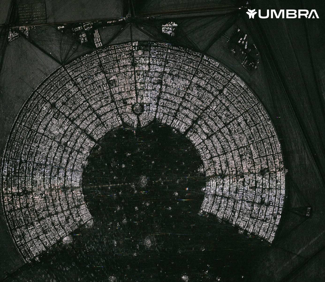
Advanced geospatial technology allows us to explore the world in ways previously unimaginable. For anyone needing consistent, clear data on any location, regardless of the weather or time, synthetic aperture radar (SAR) is an incredibly powerful tool.
Leveraging SAR technology, platforms like SkyFi are redefining how we view and monitor our environment. By translating raw radar signals into accessible imagery and data, SAR opens a world of possibilities for industries such as environmental science, disaster response, agriculture, and beyond.
TL;DR (Too Long; Didn’t Read)
SAR uses microwave radar signals instead of visible light, allowing it to capture detailed imagery through clouds, rain, smoke, and darkness, making it the most reliable remote sensing tool for continuous global monitoring.
Key applications span environmental monitoring, disaster response, agriculture, infrastructure, defense, and maritime surveillance, with real-world deployments in Costa Rica and the Himalayas demonstrating SAR's ability to detect earthquakes and landslides.
SkyFi makes high-resolution SAR data accessible on demand with no contracts required.
What is Synthetic Aperture Radar?
Synthetic Aperture Radar, or SAR, uses radar signals instead of traditional visible light, making it capable of capturing images in almost any condition. Where optical satellites need sunlight and clear skies, SAR’s microwave-based technology allows it to "see" through clouds, rain, and even at night. As a result, SAR technology provides uninterrupted, accurate data for vital global monitoring.
Why is SAR Essential in Today’s World?
SAR’s unique imaging abilities make it an essential tool in remote sensing. Imagine the Amazon rainforest during a rainy season or a remote mountainous area frequently covered by clouds.
SAR captures images and data in places and conditions like the Amazon where traditional optical methods would fall short. This continuous visibility is invaluable for scientists, urban planners, and disaster response teams alike, who rely on SAR to observe, assess, and act on changes in the landscape.
How Does Synthetic Aperture Radar Work?
At its core, SAR technology relies on a few important concepts. SAR satellites emit microwave signals toward the Earth, which bounce off surfaces back to the sensor.Highly detailed synthetic aperture radar images are built by measuring these signals' travel time and strength, revealing key physical characteristics. Here’s how it breaks down:
Range and Azimuth: SAR determines a target's location by measuring the “range” (the line-of-sight distance from the satellite to the target) and “azimuth” (the direction along the satellite's flight path). This two-dimensional measurement helps SAR provide precise location details.
Wavelengths and Depth: Different SAR wavelengths can penetrate varying surface layers. Short wavelengths capture surface-level features, such as vegetation tops, while longer wavelengths can penetrate deeper, reaching soil layers beneath. This flexibility makes SAR ideal for diverse applications.
Incidence and Look Angle: SAR uses these angles to create high-resolution images based on how the radar beam interacts with the surface. By adjusting the look angle, SAR captures surface data from different perspectives, enhancing detail and accuracy.
Key Applications of SAR Technology
The consistency and detail provided by SAR data make it incredibly valuable across numerous fields. Here are just a few ways SAR’s all-weather, all-light capabilities make an impact:
Environmental Monitoring
SAR plays a crucial role in tracking environmental changes. It’s used to observe deforestation, monitor glacier movement, and assess wetland health. For environmental scientists, SAR’s ability to detect subtle surface changes is invaluable for tracking shifts in delicate ecosystems over time.
Disaster Response and Assessment
When natural disasters strike, SAR can immediately assess the situation. Whether an earthquake, flood, or wildfire, SAR satellites provide clear images through smoke, clouds, or rain, enabling emergency teams to determine the extent of the damage and prioritize resources.
Agriculture and Soil Health
SAR data helps farmers monitor crop health, assess soil moisture, and plan around flood risks. Using SAR, agricultural experts can track seasonal changes and predict conditions that affect yield, making SAR a powerful tool for sustainable and precision farming.
Infrastructure and Urban Development
SAR is frequently used in urban planning, where detailed elevation models and infrastructure monitoring are essential. Planners and developers use SAR data to monitor land shifts, construction progress, and even infrastructure integrity, making it an indispensable resource for cities and construction projects.
Defense and Security
SAR's all-weather, day-and-night imaging capability makes it a critical tool for military and intelligence operations. It supports reconnaissance, surveillance, and target detection, while also enabling the identification of concealed structures, underground infrastructure, and ground movement patterns that provide actionable strategic intelligence.
Oceanography and Maritime Surveillance
SAR plays an important role in monitoring ocean surface conditions, including currents and wind patterns, as well as tracking maritime activity across open water. These capabilities support safe navigation, marine ecosystem research, and the detection of unauthorized fishing operations in protected or regulated zones.
Real-World Examples of SAR in Action
Across the world, SAR applications showcase its versatility and value. Here are a few examples of synthetic aperture radar uses:
SAR in Costa Rica
In Costa Rica, for instance, SAR data is used to monitor forest cover, even in the cloud-dense rainforest, aiding conservation efforts.
SAR data was also used to analyze ground deformation from seven shallow earthquakes in Costa Rica between 2016 and 2020, finding measurable surface deformation in three of the seven events. Researchers confirmed that SAR can effectively monitor shallow earthquakes above magnitude 5.7 in Central America.
It was concluded that freely available SAR data could form the foundation of a geodetic earthquake catalogue for Central America, improving regional seismic hazard maps.
How SAR Helps the Himalayas
In the Himalayas, SAR enables the tracking of landslide risks, where mountainous terrain and cloud cover would otherwise limit visibility.
SAR satellite data was used to monitor the slow-moving Guthitar landslide along a critical road corridor in Nepal, detecting approximately 76 mm of cumulative ground deformation between 2020 and 2024. It was concluded that SAR data offers a scalable approach for early warning and risk mitigation along critical infrastructure corridors where conventional monitoring is logistically and financially prohibitive.
The Future of SAR Technology
The future of SAR is promising. As more advanced satellites are launched, they will bring higher SAR resolution and faster digital processing of synthetic aperture radar data.
For global users, this means more reliable data for pressing needs, from climate monitoring to disaster readiness. As SAR technology improves, more industries are expected to adopt it as a go-to solution for geospatial challenges.
Get High-Resolution SAR Imagery With SkyFi
SAR’s contribution to geospatial technology is invaluable. Through SkyFi's unique platform, SAR data is made accessible to industries and users who rely on accurate, continuous insights into our changing world.
With its potential to inform decisions across diverse sectors, SAR is transforming remote sensing and, by extension, the way we understand and respond to global challenges. As SAR technology and its applications grow, platforms such as SkyFi will be key in helping people across multiple industries, whether it be researchers or policymakers, get a clearer view of our planet.
Synthetic Aperture Radar (SAR) FAQs
How is SAR different from traditional satellite imaging?
Unlike optical satellites that rely on visible light, SAR uses microwave signals, allowing it to function in all weather conditions and at any time of day.
Can SAR see below the surface?
SAR can penetrate certain surface layers, such as vegetation, depending on the wavelength used. This makes it useful for studying soil moisture, forest density, and more.
Is SAR data difficult to interpret?
SAR data can be complex due to the way it captures backscatter signals rather than visible images. However, platforms like SkyFi simplify SAR data, making it accessible for users across various industries.
Related Satellite News & Stories from SkyFi
Evan Achiron is the Head of Marketing and Communications at SkyFi where he is responsible for growing the company’s brand positioning and thought leadership. He is an experienced brand builder and B2B marketer with particular experience in GovTech SaaS, Climate Tech AI, public policy, and government advisory industries.