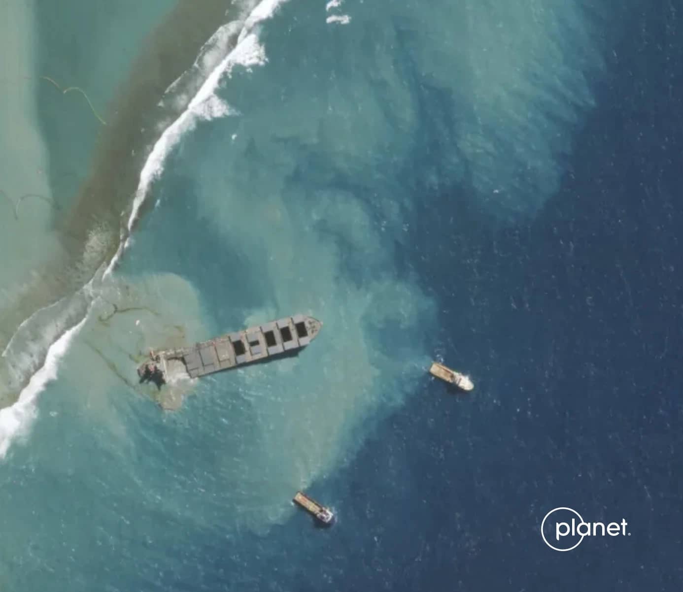
Navigating Disasters: The Impact of Satellite Imagery on Oil Spill Management
Oil spills are among the most destructive environmental disasters, impacting marine ecosystems, coastal areas, and local economies. Effective monitoring and management of these spills are crucial. At SkyFi, we recognize the vital role that satellite data plays in detecting and managing oil spills. Here, we share our perspective on how satellite technology contributes to this effort.
Let's start by covering some important aspects of this topic.
How does satellite imagery help the environment?
Satellite imagery aids environmental protection by mapping water resources, human settlements, grasslands, and invasive plant species. This detailed mapping allows for the development of more informed and sustainable management plans to address climate-driven changes and shifts in natural resources. As a result, local communities and conservation efforts are better supported.
How is remote sensing used in oil spill detection?
Remote sensing techniques for oil spill detection primarily involve passive observation of the sea surface. This includes the use of cameras in the visible and infrared spectra to detect and map oil spills. While ultraviolet and near-infrared wavelengths are also employed, they are used less frequently.
Why do we take images of oil spills from space?
Images of oil spills taken from space provide critical data for the oil and gas sectors. These images allow for close monitoring of offshore fields and help assess the impact when spills occur. The data gathered supports response efforts and aids in the evaluation of spill consequences.
How does SkyFi enhance oil spill management?
SkyFi enhances oil spill management by providing comprehensive satellite data that covers vast ocean areas, offering timely updates through frequent satellite passes, and ensuring the safety of response teams by minimizing the need for hazardous area exposure. This data is essential for effective spill detection, response, and post-spill analysis, ultimately contributing to better environmental protection and management strategies.
The Function of Satellite Data in Oil Spill Monitoring
Remote Sensing Technologies
Satellite remote sensing involves using sensors to gather data about the Earth's surface. This data provides essential information on various phenomena, including oil spills. By observing changes in the sea surface, satellites can identify oil slicks that may not be visible from the ground or air.
How Satellite Data Supports Oil Spill Management
Wide Coverage
Satellites cover extensive areas of the ocean, providing comprehensive data collection that would be impractical with traditional methods alone.
Timeliness
Frequent satellite passes ensure that updated information is available regularly, enabling timely responses to oil spills.
Safety
Using remote sensing reduces the need for human observers in hazardous areas, ensuring the safety of response teams.
Applications Beyond Detection
Post-Spill Analysis
Satellite data is crucial for assessing the long-term environmental impacts of oil spills and the effectiveness of response strategies.
Policy and Planning
The data supports evidence-based policymaking and planning, helping to understand the causes, frequency, and effects of oil spills.
Preventative Measures
Continuous monitoring helps identify potential risks and implement measures to prevent future spills.
The Future of Oil Spill Management with Satellite Data
Satellite data has fundamentally improved how we detect, monitor, and manage oil spills. This technology provides essential insights that guide effective response and recovery efforts. As we continue to advance our capabilities, the role of satellite data in protecting our oceans and coastlines will remain indispensable. At SkyFi, we are committed to utilizing satellite technology to ensure more effective environmental monitoring and disaster management. Our goal is to provide the best possible tools for safeguarding our planet from the adverse effects of oil spills and other environmental hazards.
Learn more by visiting the SkyFi platform.