Open Satellite Data Confirms Island Off the Coast of Japan – High-Resolution Tasking on the Way
Yesterday, SkyFi was tagged in a X post with the request to task a high-resolution satellite image to monitor and confirm the following:
The underwater volcano is erupting so forcefully off the coast of Japan that it's led to the formation of a new island. The islet lies in the Ogasawara island chain more than 1,000 km south of Tokyo in the Pacific Ocean.
This captivating natural event has stirred curiosity worldwide, and it's no surprise that the Earth observation community was eager to get a closer look. However, when it comes to pinpointing the exact coordinates of a newly formed island, uncertainty prevails. This is where the power of satellite imagery and the importance of open data come into play.
Navigating Uncertainty with Open Data
At SkyFi, we are no strangers to the intricate dance of Earth observation, and we understand the importance of certainty, especially when spending money and resources on commercial data. When news of the volcanic eruption and the emerging island reached us, we were intrigued but cautious. How could we confirm the location of this newfound wonder without a shadow of doubt?
To crowdsource the coordinates, we turned to social media, where the collective wisdom of the online community could potentially lead us in the right direction. A few people recommended coordinates, but we knew that uncertainty persisted. To provide our users with accurate and verified information, we had to take the extra step.
Enter Open Data: A Ray of Certainty
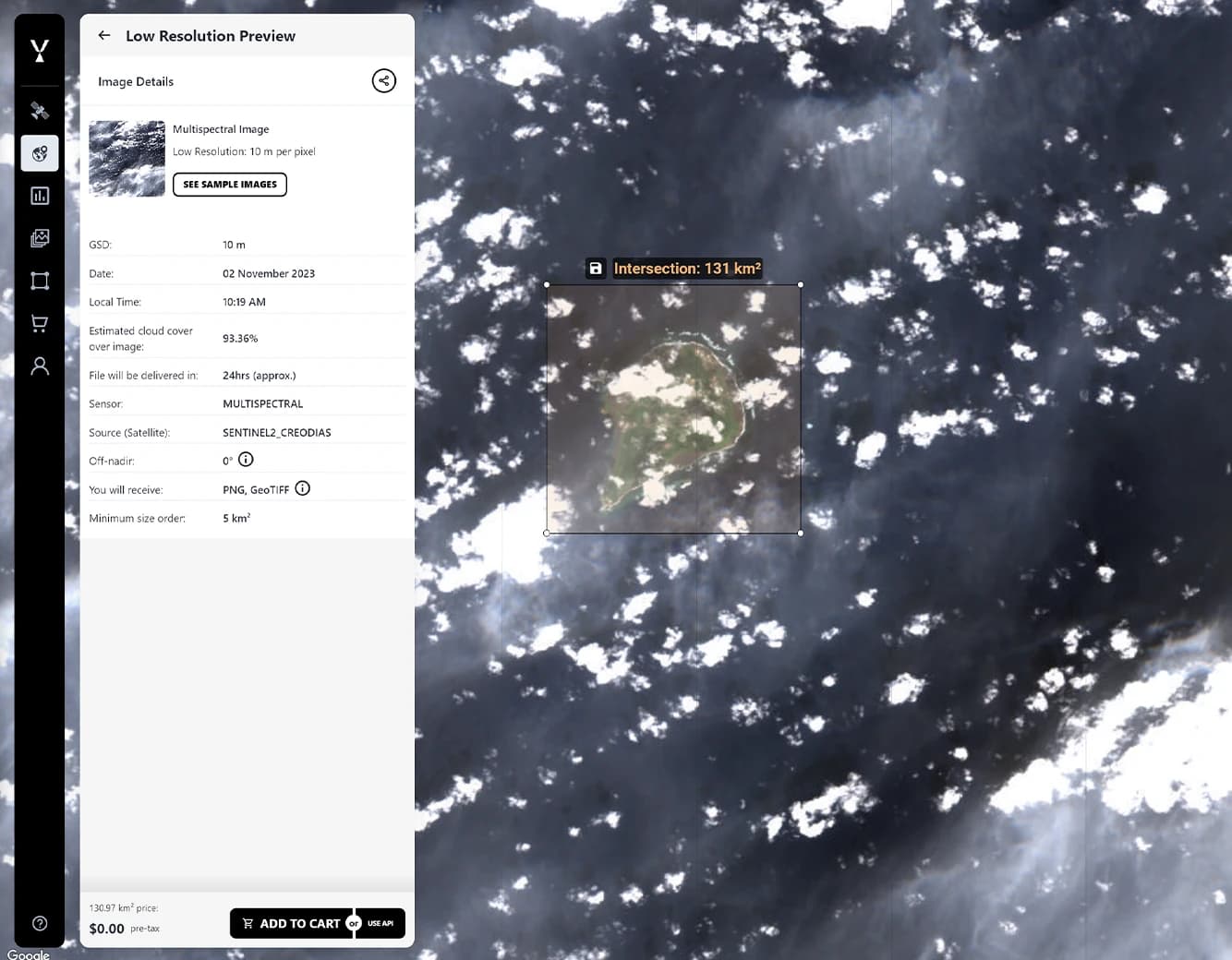
In the realm of satellite imagery, "open data" is a term often associated with the free accessibility of Earth observation data. We took the coordinates recommended by social media users and searched the open data available on the SkyFi platform, specifically the Sentinel-2 imagery. This data, updated every five days, offers a multispectral view of our planet.
The most recent image was captured on November 2, 2023. We cropped the segment we needed and checked out, completely free.
Analyzing Multispectral Clues
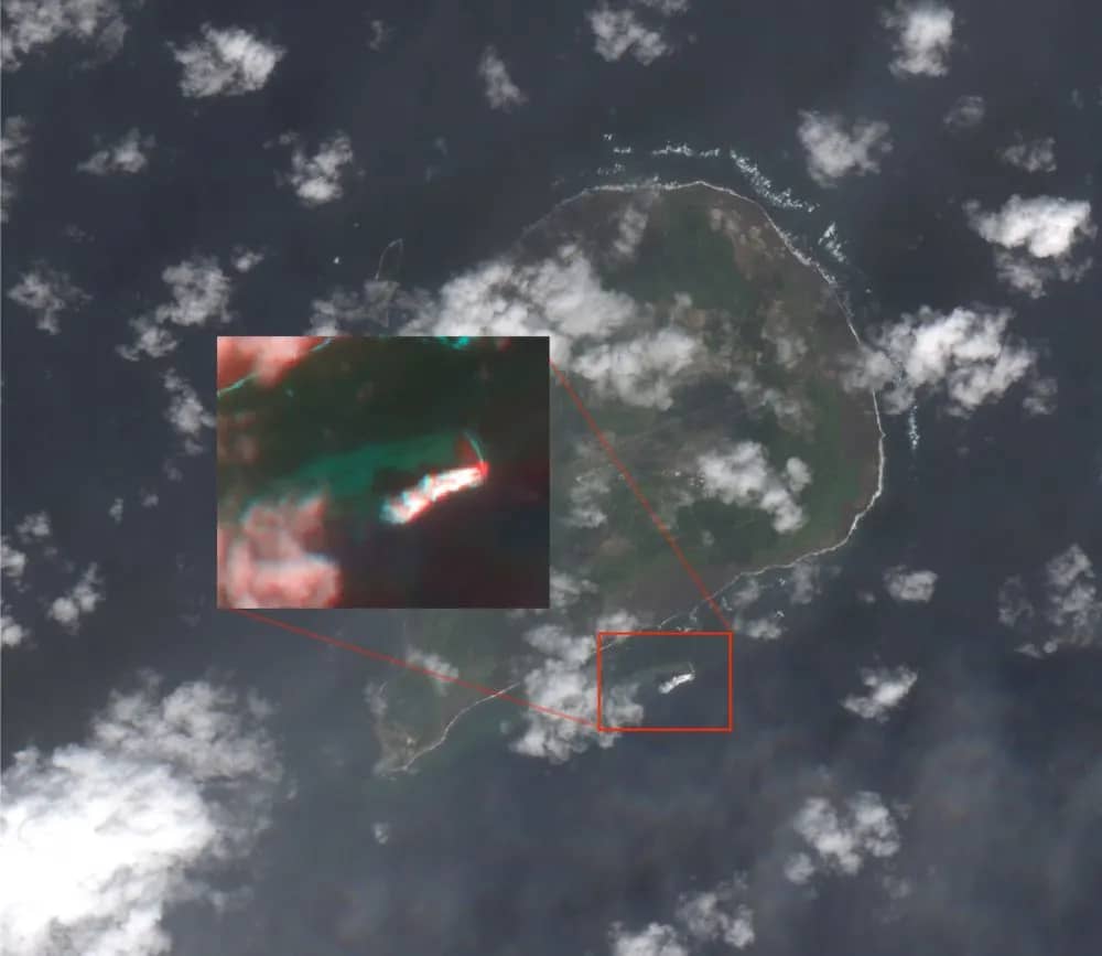
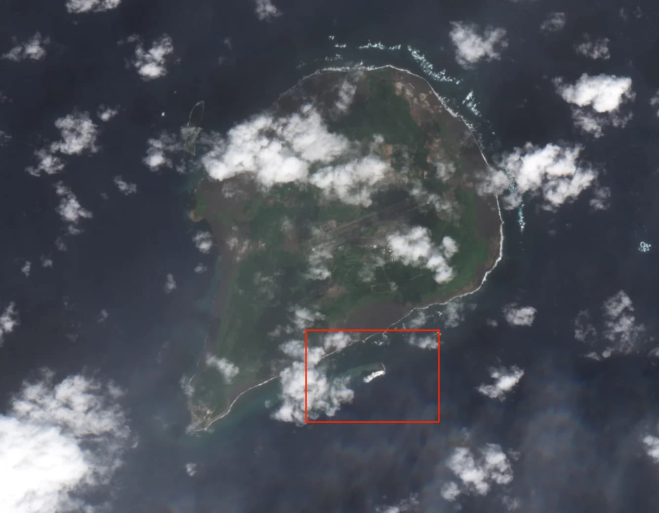
Shortly after checkout, we received the image via email, but it was quite cloudy. From previous information, we believe the underwater volcano is erupting on the southern side of the island.
Cloudy? No problem. This is where the beauty of multispectral imagery comes into play. With the ability to adjust color bands, we were able to unveil vital information. Our GIS expert took a closer look and found that band 11 was notably brighter than the others. This indicated an energy emission, a telltale sign of volcanic activity. Furthermore, the "smoke" cloud from the island was remarkably low compared to other clouds, evident from the length of shadows in the image.
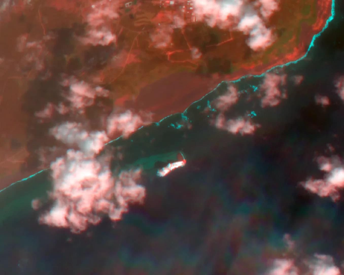
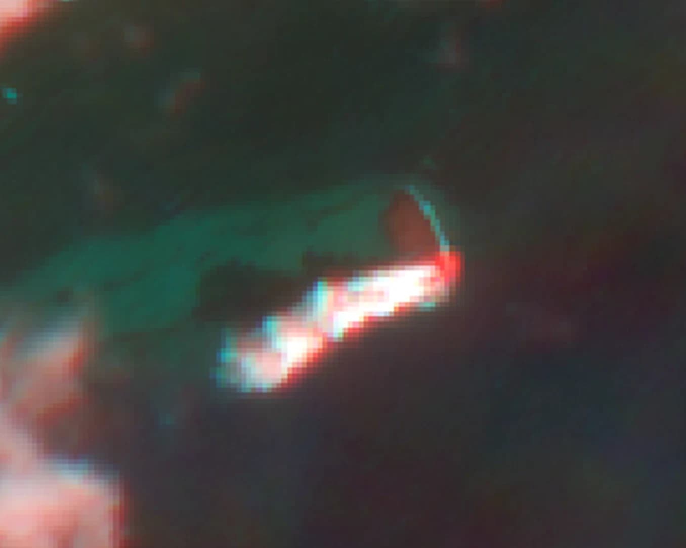
The verdict was clear: the volcanic island was indeed emerging, and it was swiftly growing. We had the reassurance we needed, and our users could have confidence in the accuracy of the information.
The Power of Open Data: A First Step
This story is a testament to the power of open data in the world of satellite technology. It serves as a reminder that open data isn't just about accessibility; it's about certainty. It's the first step in unraveling the mysteries of our world, providing a solid foundation upon which further action can be taken.
In the days to come, we'll be tasking a commercial satellite to capture an image of this captivating natural phenomenon. But it's open data that led the way, reassuring us of the island's existence and guiding us on this remarkable journey of discovery.
Join the Conversation
As we witness the birth of this volcanic island, we invite you to join the conversation. Do you have questions about satellite technology, open data, or the incredible natural events shaping our world?
Share your thoughts and curiosities, and together, we'll explore the boundless possibilities of satellite technology and the reassurance that open data brings to the forefront.
Stay tuned for more updates from SkyFi as we continue to unveil the wonders of Earth observation, one satellite image at a time.