SkyFi and Pixxel Partner to Expand Access to Hyperspectral Satellite Data
April 2025 – SkyFi announces a partnership with Pixxel to integrate high-resolution hyperspectral satellite data into the SkyFi platform. This collaboration brings advanced spectral imaging capabilities to SkyFi users, making Pixxel’s hyperspectral imagery more accessible for applications in agriculture, mining, energy, environmental monitoring, and infrastructure assessment.

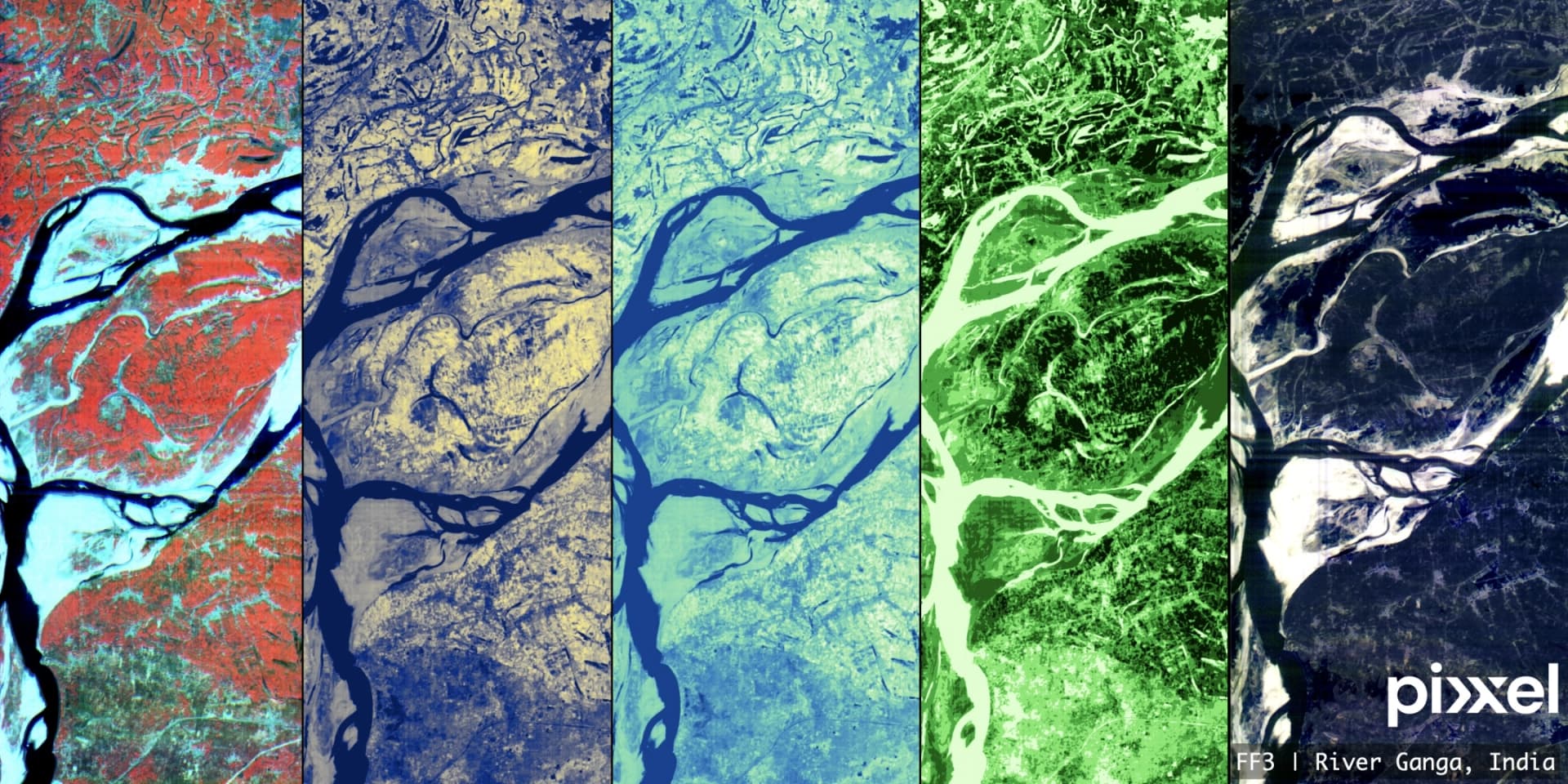
Pixxel’s satellite constellation captures data across hundreds of spectral bands, offering significantly more detail than traditional multispectral sensors. The Firefly constellation provides imagery in the Visible and Near Infrared (VNIR) range (470-900 nm) with 150 spectral bands, while the Honeybee constellation, once launched, will extend coverage into the Shortwave Infrared (SWIR) range (470-2500 nm). These satellites deliver a 5-meter Ground Sample Distance (GSD), enabling fine-grained analysis of surface materials.

The integration of Pixxel’s hyperspectral data into SkyFi’s platform means customers will be able to select predefined band combinations optimized for specific applications, including:
Vegetation Health Assessment: Bands tailored to detect chlorophyll content, plant stress, and crop health.
Mineral Exploration: Identification of specific mineral signatures for mining and resource evaluation.
Water Quality Monitoring: Detection of dissolved organic matter, sediment levels, and pollutants.
Urban Planning and Infrastructure: Differentiation of materials in construction and land-use analysis.
By integrating Pixxel’s data with SkyFi’s existing hyperspectral analytics, users can extract material composition, monitor environmental changes, and conduct high-precision mapping without the need for specialized processing. SkyFi’s on-demand access, API integration, and built-in analytics tools ensure that this data is usable across industries without requiring in-depth technical expertise.
"This partnership with Pixxel represents a major step in expanding access to advanced hyperspectral data," said Luke Fischer, CEO of SkyFi. "Our goal is to provide users with the most comprehensive remote sensing capabilities, and Pixxel’s data significantly strengthens our ability to serve industries that require precise spectral analysis."
Pixxel’s hyperspectral imaging offers daily revisit capabilities and a global coverage cycle of 24 hours, making it possible to track changes over time with high frequency. Three Firefly Satellites were launched in January 2025, with three more scheduled for July 2025. As the constellation grows, the volume of available data will continue to increase, providing even greater opportunities for detailed remote sensing applications.
"SkyFi’s platform is transforming how people engage with satellite imagery, and we're excited to build on this collaboration," said Aakash Parekh, Chief Commercial Officer at Pixxel. "As Pixxel scales its constellation and expands spectral coverage, partnerships like this are key to making the data practically useful. SkyFi’s intuitive access model, paired with our rich hyperspectral imagery, helps users go from imagery to insight faster. We’re excited to see the new use cases and applications this will enable across industries.”
SkyFi users will be able to purchase Pixxel’s hyperspectral imagery directly through the SkyFi web and mobile applications starting in Q2 2025.