Best Maritime Visibility: Why AIS Works Best When Paired With High-Res Satellite Imagery (Updated 2026)
For analysts, investigators, and intelligence teams, AIS is often the first open data source used to monitor vessel behavior, detect patterns, and flag suspicious activity. But for high-stakes maritime operations, first is not the same as enough.
AIS has a fundamental vulnerability: it depends on vessels to report themselves. When ships go dark, manipulate their position data, or operate in congested corridors where signal collisions corrupt the feed, the picture disappears exactly when it matters most. For defense and intelligence professionals, that gap is not a technical inconvenience. It is an operational blind spot that bad actors have learned to exploit.
Fortunately, SkyFi AIS offers uninterrupted visibility and defense satellite imagery data for Maritime Domain Awareness (MDA) across oceans, exclusive economic zones (EEZs), and congested transit corridors. Unlike other feeds that rely on a single collection method, SkyFi merges terrestrial, vessel-borne, and high-resolution satellite data into one clean stream of AIS data. This allows defense professionals to track vessel movement even in areas where spoofing, message collisions, or dark activity are common.
Follow along for a deep dive into enhancing your maritime visibility with AIS and high-resolution satellite imaging.
Key Takeaways (TLDR):
Holistic Maritime Awareness: SkyFi merges satellite, terrestrial, and vessel-borne AIS data into a single stream, overcoming the limitations of single-source feeds like signal "dark spots" or coastal receiver range limits.
Combatting "Dark" Activity: By combining AIS tracking with high-resolution satellite imagery, defense teams can perform position validation to identify vessels that have intentionally disabled their transponders or spoofed their locations.
Superior Coverage in Congested Zones: While standard satellites struggle with message collisions in high-traffic areas like the Strait of Hormuz, vessel-borne AIS acts as a mobile sensor network to maintain tracking continuity.
Historical Intelligence Modeling: SkyFi provides access to AIS archives dating back to 2018, allowing analysts to build long-term defense models, recognize rendezvous patterns, and investigate historical sanctions evasion.
Environmental Analytics: Beyond defense, integrated AIS data enables precise mapping of carbon emissions by tracking individual vessel speed and energy consumption across global trade routes.
What is AIS?
AIS, or Automatic Identification System, is a radio-based protocol used by ships to broadcast key information such as identity, position, heading, and speed. Originally built for collision avoidance, it now plays a crucial role in maritime tracking, security, and surveillance.
How is Satellite AIS Data Collected?
Satellite AIS collects data from ships anywhere on the globe, including areas far from coastlines. This is the only way to see vessel activity across the open ocean. However, satellites struggle in dense shipping zones where overlapping messages cause high drop rates. This is where terrestrial and vessel-borne AIS data comes in handy.
Terrestrial vs. Vessel-borne AIS Data
Terrestrial AIS uses receivers near coastlines to gather broadcasts from ships within about 40 nautical miles. This is reliable for port surveillance and nearshore monitoring but has no reach beyond land-based infrastructure.
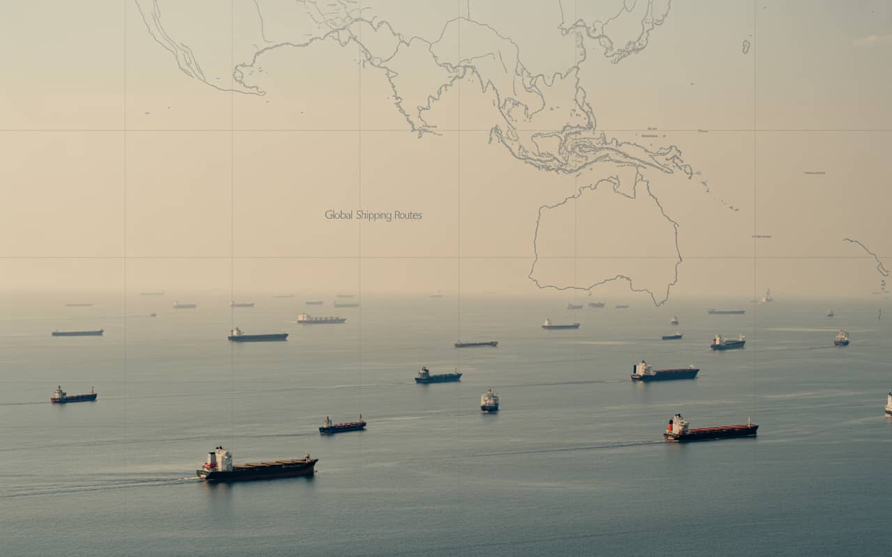
Vessel-borne AIS is collected directly from ships with onboard receivers. These ships act as mobile sensors, capturing signals that satellites and shore stations often miss. This is especially useful in high-traffic areas like the South China Sea and the Strait of Hormuz, where vessel density causes signal interference.
What Defense and Intelligence Use Cases Require Total Satellite Visibility?
SkyFi utilizes satellite AIS data collection for a variety of different purposes over multiple industries, including energy, environmental operations, and for government agencies.
Position Validation and Dark Activity Tracking
Many vessels involved in sanctions evasion or illegal fishing disable their AIS or manipulate identity fields. SkyFi’s multi-source feed and commercial satellite imagery technology helps identify gaps and inconsistencies that can indicate tampering.
SkyFi’s position validation services monitor this activity to determine if there is a real threat. Near real-time AIS satellite data allows for verification of exact vessel location and an early indication of danger.
Observing Global Trade and Shipping Analytics
Tanker-to-tanker transfers are often used to mask cargo origins. This type of trade typically occurs in remote or congested waters. Having uninterrupted AIS coverage via satellite data helps analysts reconstruct vessel rendezvous and co-travel behavior.
8+ Years of AIS Satellite Data Helps Build Long-Term Defense Models
Analysts studying vessel patterns over time rely on historical data. SkyFi offers AIS dating back to 2018 with consistent formatting, allowing for complete maritime domain awareness. This near real-time satellite data makes it easier to train machine learning models and support investigations.
Satellite Monitoring of Chokepoints and Exclusive Economic Zones (EEZs)
Regions like the South China Sea or the Strait of Hormuz are hotspots for geopolitical tension. SkyFi’s vessel-borne AIS helps monitor high-density traffic where satellites often lose coverage.
Assessing the Impact of Maritime Transport on Carbon Emissions
AIS geospatial data analytics can be used to track precise vessel movements and speeds, in turn allowing for the calculation of total energy consumption. Carbon emissions can then be calculated for individual ships, fleets, or ports.
AIS also allows for the exact mapping of the geographical distribution of carbon emissions. This helps locate high-pollution areas and track emission patterns over time.
How to Access AIS on SkyFi
AIS can be found on the SkyFi app. Simply select your region and date range in order to view, download, or stream the AIS feed. No subscription or long-term contract is required. Choose CSV format or connect through the SkyFi API.
Maritime Defense Satellite Imagery FAQs
Can I order AIS data by region and date?
Yes. You can purchase AIS data for a specific port, sea lane, or region by the day or week.
What happens if a ship disables AIS?
SkyFi cannot see a vessel while its AIS is off, but analysts can infer patterns using historical traffic density and co-travel data.
Which data fields are included?
AIS data includes ship name, Maritime Mobile Service Identity (MMSI), International Maritime Organization (IMO) identification number, vessel type, position, speed, heading, estimated time of arrival (ETA), and timestamped history.
How is this different from MarineTraffic?
MarineTraffic depends heavily on coastal receivers, whereas SkyFi integrates satellite and vessel-borne data, giving broader coverage and better performance in congested zones.
Related Satellite News & Stories from SkyFi
Sources: