What Are the 3D Geospatial Products Available in Maxar Connect?
By SkyFi
Update (October 2025): Maxar Intelligence has officially rebranded as Vantor. All references to “Maxar” in this article now refer to Vantor, which continues to provide the same gold-standard satellite imagery, basemaps, and 3D terrain data trusted worldwide.
Read more about the rebrand: Maxar Rebrands as Vantor and Lanteris — What to Know
Maxar Connect provides access to a wide range of 3D geospatial data. These products help users measure height, surface features, buildings, and terrain with precision. Each dataset is built using Maxar's satellite-based modeling techniques and is available in standard formats compatible with GIS and 3D platforms.
Below is a breakdown of each product available:
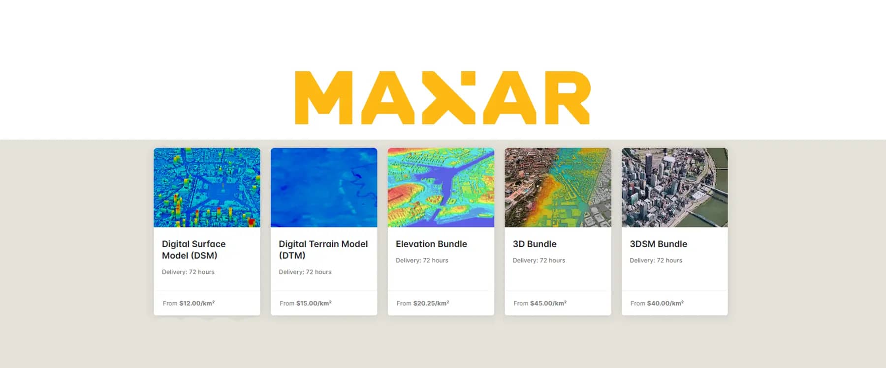
Digital Surface Model (DSM)
A raster model that shows the true height of everything on the surface — terrain, trees, buildings, and other structures.
Options:
Post spacing: 0.5m, 1m, 2m, 4m
Vertical system: EGM96, EGM2008, Ellipsoid
Price: 12.00 credits/sqkm
Digital Terrain Model (DTM)
Similar to DSM but removes all objects above ground. This shows the bare-earth elevation only.
Options:
Post spacing: 0.5m, 1m, 2m, 4m
Vertical system: EGM96, EGM2008, Ellipsoid
Price: 15.00 credits/sqkm
Elevation Bundle
Includes both DSM and DTM together for users who need to compare surface heights and ground elevation in the same area.
Options:
Post spacing: 0.5m, 1m, 2m, 4m
Vertical system: EGM96, EGM2008, Ellipsoid
Price: 20.25 credits/sqkm
3DSM Bundle
A photorealistic 3D surface model with textures and visual depth. Good for modeling cities or terrain in 3D with high detail.
Options:
Formats: 3D Tiles, r3db, collada, i3s
Price: 40.00 credits/sqkm
3D Bundle
A full package including 3DSM, 50 cm DSM, and 50 cm true orthorectified imagery. Offers alignment across 3D and 2D layers.
Options:
Formats: 3D Tiles, r3db, collada, i3s
Price: 45.00 credits/sqkm
3D True Ortho
Maxar’s True Ortho imagery is a distortion-free 2D product built from 3D modeling. It removes tilt and parallax, giving you consistent, top-down views across the entire area. Every feature is aligned in x, y, and z, making it well-suited for mapping, planning, and measurement tasks that require precision.
Each product requires a minimum order size of 10 sq km. These datasets are built to support planning, analysis, and modeling needs across sectors like construction, defense, insurance, and environmental work.
Visit maxar.skyfi.com to access them.
By SkyFi