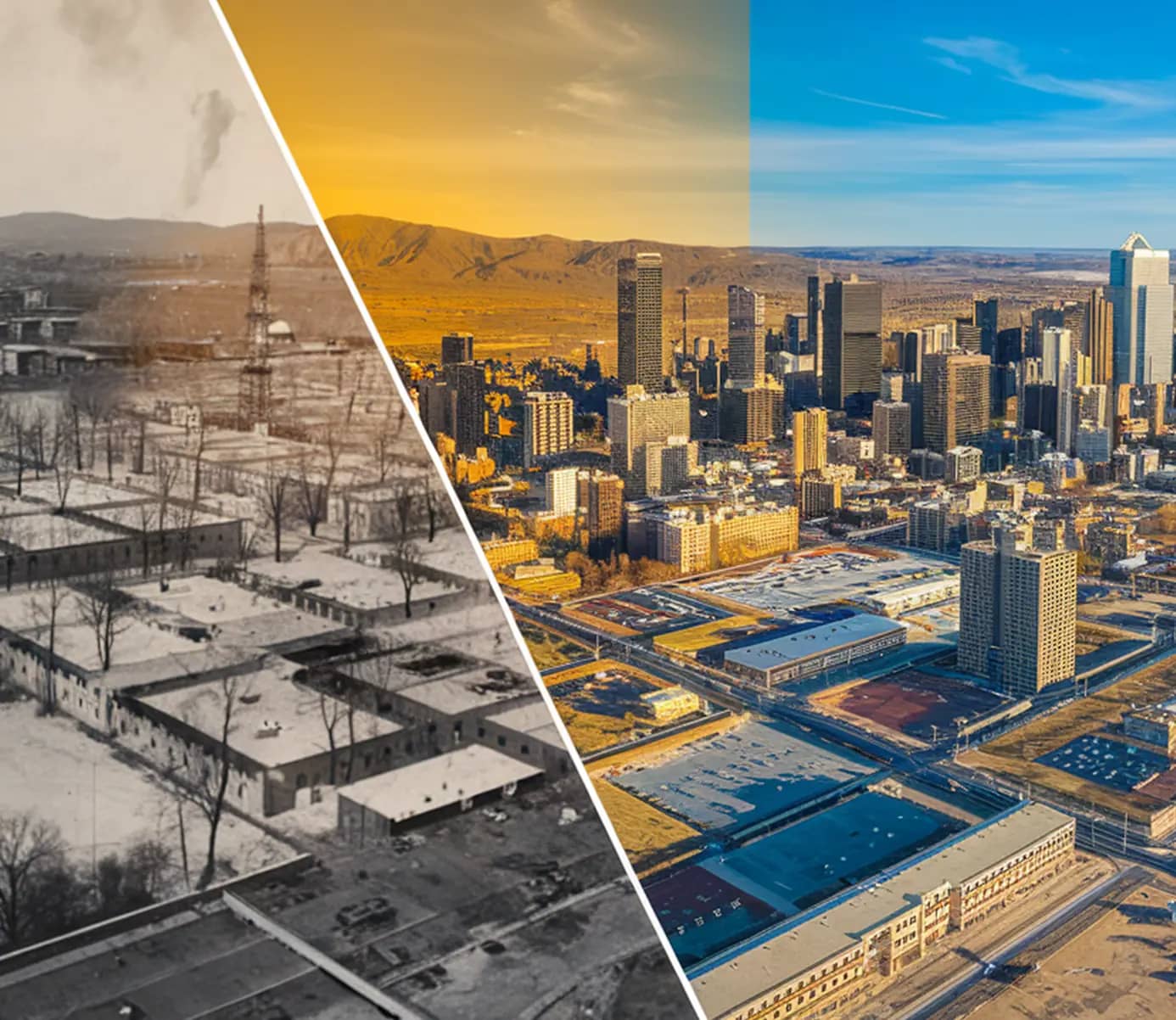
What is Temporal Resolution in Remote Sensing?
In the world of remote sensing and satellite imagery, temporal resolution plays a crucial role in understanding Earth’s changing landscapes.
For those using platforms like SkyFi to analyze remote sensing data, temporal resolution is a key feature that enables tracking changes across time.
This capability allows scientists, planners, and even private sectors to observe and analyze trends from urban development to environmental shifts, all from a unique, time-based perspective.
Let's dive into the full definition of temporal resolution for remote sensing and why it’s a fundamental component of effective Earth observation.
TL;DR (Too Long; Didn’t Read)
Temporal resolution describes how frequently a satellite captures imagery of the same location, ranging from multiple times per day to once every several weeks.
Higher temporal resolution suits fast-moving events like floods and wildfires, while lower temporal resolution works better for slower changes like urban growth or glacial retreat.
Urban growth tracking is one of the most important applications of temporal resolution, giving city planners insight into population density, infrastructure needs, and environmental impact in rapidly developing regions.
What Does Temporal Resolution Mean for a Remote Sensing System?
Temporal resolution in remote sensing is defined by how frequently a sensor captures data of the same location. This can range from capturing temporal imagery of a region every few minutes to every few years, depending on the sensor’s orbit, purpose, and capabilities.
For example, satellite sensors that pass over the same area daily offer high temporal resolution, allowing for close monitoring of rapid changes. In contrast, remote sensing systems that revisit the same area annually might be better suited for studying slower changes, such as gradual deforestation or glacial melt.
The higher the temporal resolution, the more frequently satellite data is gathered, enabling finer, more detailed analysis. This is essential for applications like tracking seasonal crop health, monitoring coastal erosion, or observing city expansion.
The Role of Temporal Resolution in Urban and Environmental Studies
To further explain the concept of temporal resolution in remote sensing, let’s go over some applications. Temporal resolution in remote sensing has a substantial impact on many different industries and sectors.
Here’s what it means for urban development and environmental monitoring specifically:
Tracking Urban Growth and Informal Settlements
One of the important applications of temporal resolution in remote sensing is tracking urban growth, especially in rapidly developing regions. Urban areas are constantly changing, with new construction, roads, and infrastructure altering the landscape.
For regions where informal settlements or slums are growing quickly, high temporal resolution data is essential for city planners and policymakers. This data can provide insights into population density, infrastructure needs, and environmental impacts, supporting better urban management.
Observing Environmental Changes and Disaster Response
For environmental monitoring and remote sensing of environment characteristics, temporal resolution helps us understand dynamic natural processes. For example, by regularly observing a forested area, we can detect changes in vegetation health and track deforestation over time.
Temporal resolution also becomes critical in responding to natural disasters. During events like floods or wildfires, high temporal resolution data can show the event’s progress, helping disaster management teams allocate resources more effectively and potentially saving lives.
Types of Temporal Resolution in Remote Sensing
High Temporal Resolution
High temporal resolution refers to sensors that frequently revisit the same area, sometimes as often as multiple times per day. This is especially useful for monitoring fast-moving events such as weather changes, urban traffic, or even crop growth cycles.
High temporal resolution is also valuable for applications like short-term environmental monitoring, allowing analysts to detect and respond to changes almost in real time.
Low Temporal Resolution
On the other hand, low temporal resolution involves capturing data over longer intervals, such as once every few weeks or even annually.
This level of temporal detail is often sufficient for slower processes, like tracking long-term environmental changes (e.g., forest recovery after logging) or urban growth over decades. Low temporal resolution is often more cost-effective and data-efficient for such applications.
Advances in Temporal Resolution Technology
Remote sensing technology has made significant advancements, allowing for higher temporal resolution with improved accuracy and frequency. Newer satellite constellations and advanced data processing techniques mean we can capture and analyze data with increased granularity.
For example, with improvements in both satellite sensors and processing algorithms, we can now track minute-by-minute changes across vast regions, enabling deeper insights and more effective monitoring across various industries.
Spatial Resolution vs. Temporal Resolution in Remote Sensing
Spatial resolution determines the level of detail analysts can extract from satellite imagery in remote sensing applications. A finer resolution makes it possible to identify specific objects and features on the ground, from individual crop rows in precision agriculture to structural damage on a single building after a disaster.
Temporal resolution determines how useful satellite imagery is for tracking change over time. A higher revisit rate allows remote sensing teams to monitor dynamic events like wildfires, flooding, or urban development as they evolve rather than observing a single static moment.
Choosing the right balance between spatial and temporal resolution depends entirely on the use case. The main difference between spatial and temporal resolution in remote sensing lies in fixed vs. continuous monitoring.
Applications that require detailed inspection of a fixed location prioritize spatial resolution, while applications that require continuous monitoring of a changing area prioritize temporal resolution.
Why Temporal Resolution Matters in Remote Sensing Applications
Temporal resolution in remote sensing increases productivity and enhances workflows for a variety of tasks in a multitude of industries. Read on for more details about its applications and use cases.
At a glance, the following industries are actively using remote sensing with temporal resolution:
Agriculture
Environmental Management
Military & Defense
Financial Sector
Insurance
Energy
Mining
Construction & Real Estate
Government
Let’s explore the role temporal resolution plays in each case:
Agriculture and Crop Monitoring
In agriculture, temporal resolution is vital for tracking crop growth and health throughout the growing season.
High temporal resolution allows for frequent updates on factors like soil moisture, vegetation health, and crop density, which are essential for improving yield and managing resources effectively.
Water Resource Management
Temporal resolution is also essential for water resource management, where monitoring bodies of water over time can reveal patterns in water availability, seasonal changes, and even pollution levels.
Regular observations of rivers, lakes, and reservoirs can help in managing water resources, predicting shortages, and taking preemptive actions.
Climate Change and Environmental Conservation
Climate change researchers use temporal resolution and remote sensing for the environment to understand how variables like ice cover, vegetation growth, and sea level rise over time.
By analyzing high-frequency data, scientists can observe patterns and predict future environmental shifts, providing critical insights for conservation efforts and climate policies.
Military and Defense
Temporal resolution gives defense and intelligence teams a time-based record of activity across installations, borders, and areas of interest. Analysts can detect changes in equipment positioning, vehicle movement, and construction activity that would go unnoticed from a single snapshot.
Financial Services
Temporal resolution grants financial analysts the ability to track physical asset activity over time rather than relying on a single point-in-time observation.
Repeated captures of ports, oil storage facilities, and commercial sites reveal patterns in inventory, traffic, and operational output before that data appears in public reports.
Insurance
For insurance companies, temporal resolution and frequent satellite revisits make it possible to establish accurate baselines, document the progression of a damaging event, and support faster and more defensible claims assessments.
Energy
Pipelines, power lines, and remote infrastructure can shift, degrade, or be encroached upon gradually over time. A consistent revisit cadence lets energy teams detect those changes early, before a minor anomaly becomes a costly or dangerous operational failure.
Mining
Open-pit progression, tailings dam changes, and land disturbance all develop over months and years. Repeated satellite captures give mining operations a reliable visual record of site evolution, supporting both internal monitoring and regulatory compliance documentation.
Construction and Real Estate
Construction timelines are inherently time-dependent, and temporal resolution gives project managers and investors an objective view of site progress at every stage.
Comparing captures across weeks and months makes it easy to verify milestones, spot delays, and document conditions before and after development activity.
Government
Government agencies use temporal resolution to monitor how land, infrastructure, and border regions change over extended periods. Regular captures support long-term infrastructure assessments that a single image cannot provide.
Matching Temporal Resolution to Your Use Case with Rowan
Picking the right revisit rate means understanding both the pace of change you are tracking and the cost implications of capturing more frequently than necessary.
Rowan, SkyFi's AI navigator for geospatial and satellite data, asks the right questions and surfaces the options that work.
Whether you are monitoring a construction site weekly or tracking vessel activity hourly, Rowan identifies which providers can deliver that cadence, shows you what imagery you already have, and surfaces cloud-cover context when optical sensors are involved.
Set up your monitoring cadence with Rowan.
The Importance of Temporal Resolution in Remote Sensing
By understanding temporal resolution in remote sensing, we gain a valuable perspective on how time-based data enhances the effectiveness of Earth observation.
Platforms like SkyFi allow users to access this crucial data, making it easier than ever to stay informed on the changes occurring across our planet.
Temporal Resolution in Remote Sensing FAQs
What is temporal resolution in remote sensing?
Temporal resolution in remote sensing refers to how frequently images or data are captured of the same area, which allows us to track changes over time.
Why is temporal resolution important?
Temporal resolution is essential because it provides the necessary timing data to monitor and respond to changes, from daily crop health assessments to tracking urban sprawl over years. Higher temporal resolution allows for more precise and timely interventions.
What is the difference between spatial and temporal resolution in remote sensing?
While temporal resolution deals with the frequency of data collection, spatial resolution focuses on the level of detail within each image, referring to the size of the smallest object that can be detected. Both are important, but they serve different purposes in data analysis.
What factors impact temporal resolution?
Several factors impact temporal resolution, including
satellite orbit
revisit frequency
sensor capabilities
Some satellites revisit the same spot daily, while others may take weeks to return, depending on their orbital path and intended purpose.
Can high temporal resolution always be achieved?
Not always. Achieving high temporal resolution often requires a constellation of satellites or advanced data fusion techniques, which can be costly and require complex data management. For long-term studies, lower temporal resolution may be sufficient and more practical.
What are some practical applications of temporal resolution?
Temporal resolution is widely used in agriculture, urban planning, water management, disaster response, and climate change studies. It enables consistent monitoring of changes, helping industries and governments make informed decisions based on up-to-date data.