New: Rowan, your AI navigator for Earth observation.Find, compare, and order satellite imagery faster
Robinhood Agents

SkyFi Satellite Intelligence

Satellite observations of the U.S. sites behind Robinhood's top traded stocks. Every answer arrives with the image, the count, and the time the satellite took the picture.

Satellite Intelligence does not provide investment advice, recommendations, or predictions.
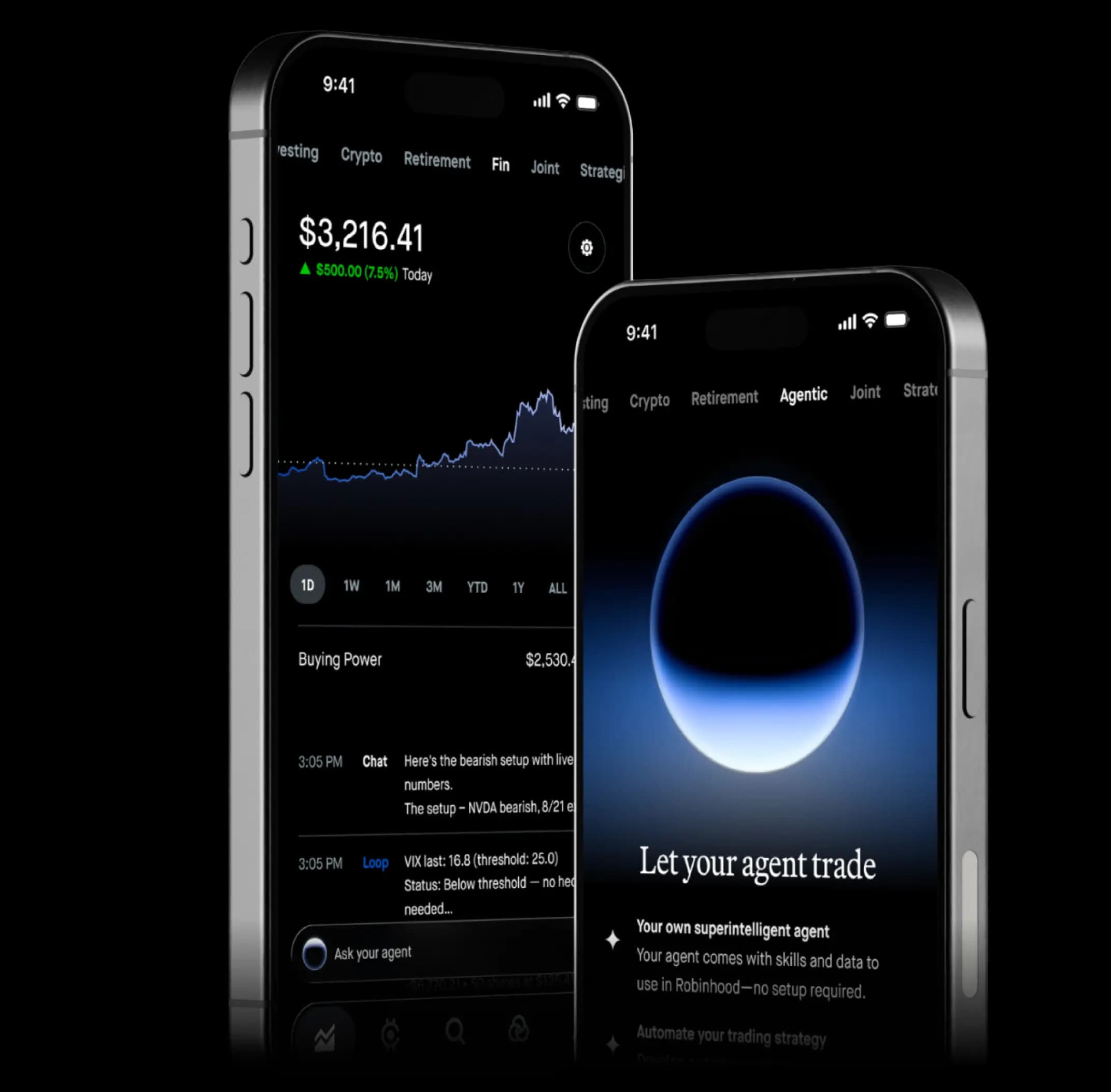
Robinhood Agents on mobile, with market data and an AI agent conversation

Satellite monitoring used to require an institutional data budget

Counting cars in a parking lot or trucks at a fulfillment center from space is one of the most powerful forms of alternative data. For years, that kind of monitoring stayed with institutions that could afford large data contracts.

Satellite Intelligence puts a recurring set of these observations inside the Robinhood agent a customer already uses. One question returns one dated, quantified observation.

Before

Sold mainly to institutions with large data budgets

Delivered as datasets that need analysts to read

With Satellite Intelligence

Asked in plain language, inside a Robinhood agent

Answered with an image, a number, and a capture time

Answers that show their work

Each observation comes back as data the customer can factor into their decision.

A date on every answer

Each result carries the planned frequency and actual capture time, so the age of the count is never a guess.
A date on every answer_image

An image to check

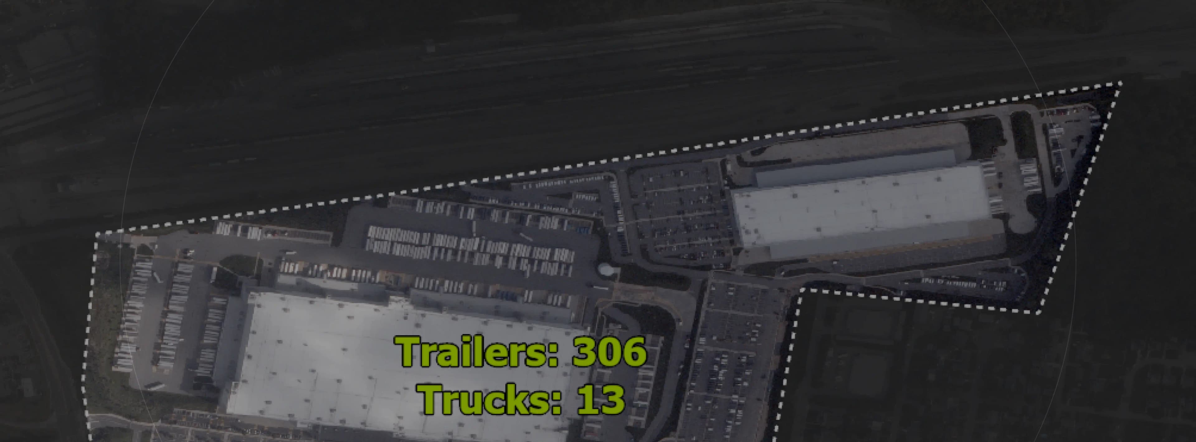
The count arrives outlined on the satellite capture itself. The user can view the full optical image in addition to the number.
An image to check_image

Four kinds of sites

Vehicle factory yards, fulfillment hubs, data center builds, and theme park lots, monitored weekly or monthly.
Four kinds of sites_image

No new tools to learn

No GIS software and no imagery orders. The customer asks the agent they already use.
No new tools to learn_image

How it works

Ask a question. Get an observation.
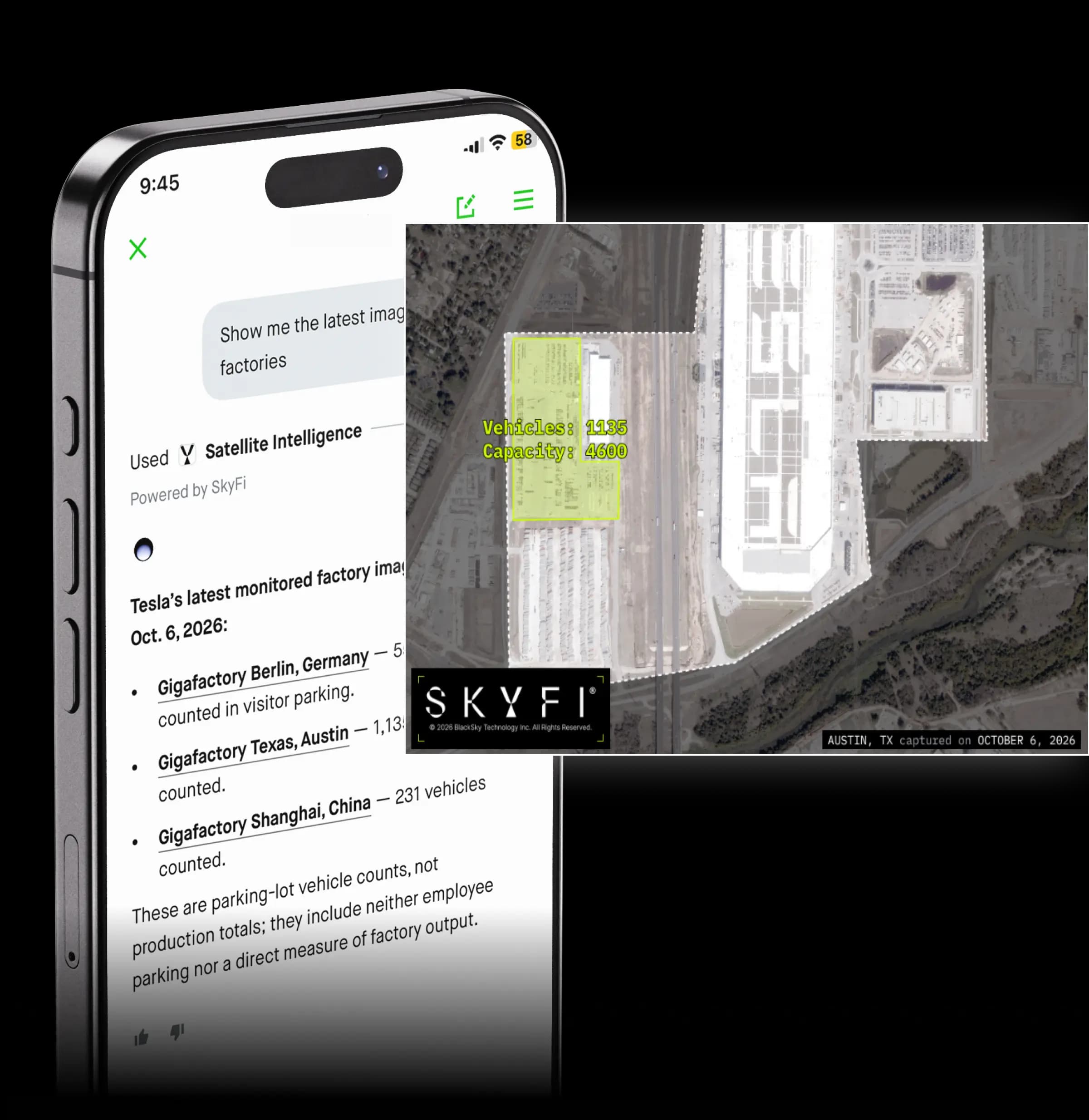
A SkyFi satellite observation with measured areas and detected vehicles alongside the Robinhood agent answer

The Robinhood agent reaches SkyFi over the Model Context Protocol (MCP), the open standard that connects AI agents to outside data.

  1. Ask

    The customer asks about a monitored site
    Ask in plain language. Name the type of site and the period of interest.
  2. Retrieve

    SkyFi returns the latest observation
    The agent calls SkyFi over MCP. SkyFi sends back its most recent capture of the site with the analysis attached.
  3. Answer

    The answer shows image, number, and date
    The capture time tells the customer exactly how recent the number is.

Frequently Asked Questions

SkyFi Satellite Intelligence answers questions about monitored U.S. sites with a satellite image, a count, and a capture time. These answers cover how to add it, what it costs, how recent the data is, and where the imagery comes from.

Satellite images are pictures taken at a specific day and time, not a live video. Satellites take new pictures on a schedule when they are available and the sky is clear. Each result shows when the picture was taken, so you can see how recently it was captured. Analysis is published after it is finished, showing the latest available results.

Each location is updated with a target frequency. Vehicle plants, fulfillment centers, and theme parks are usually captured a few times a week, while data center construction sites are updated about every two weeks because changes happen more slowly. Clouds can prevent a capture attempt, so the time between updates may vary. If that happens, another image is attempted as soon as possible.

Coverage at launch is a fixed set of facilities, grouped into four domains: vehicle production plants, warehouse fulfillment centers, theme parks, and data center construction sites. You can ask which companies and facilities are covered through Robinhood’s agent and get the current coverage list. Custom locations and additional companies are not available as part of this subscription.

Satellites take pictures of the ground much like a camera, so weather and other conditions can affect what they see. Clouds, haze, and smoke may hide part or all of a location. If too much is hidden to make an accurate count, the result is marked as not reported. Shadows and the angle of the sun can also make the same location look different between images.

The breakdown shows which areas were reported and which were not, helping you see whether a change is real or caused by something obscuring the image. If part of a location was hidden by weather, that area may be left out of the total, making the number look lower even when activity did not change. A count includes only the areas that could be measured in that capture.

SkyFi uses AI to analyze the images first, followed by a review from a trained person. The reviewer checks and makes any necessary corrections to the results within the measured areas before they are published. Nothing is published until the review is complete.

The counts are measurements of what was visible in a single satellite image, reviewed for quality control before publishing. These are not audited figures, and differences between captures may reflect measurement variation rather than a change on the ground. The measurements describe specific areas at a location, not the whole business. Vehicles are counted as vehicles, without identifying make, model, or purpose.

Each observation includes a satellite image of the location, with the measured areas outlined and detected objects marked. The imagery has enough detail to count vehicles, but it is still far less detailed than a street-level view. People cannot be identified, and details such as faces and license plates are not visible. The image can be viewed in the Robinhood app, but downloadable image files and mapping data are not included with this subscription.

The Robinhood agent creates a new answer each time you ask, so the wording may be different even though the underlying measurements from SkyFi remain the same. Numbers from other sources may also differ because they may measure different locations, times, or types of activity. SkyFi’s analysis represents what was measured in specific areas at a specific moment, rather than an official figure reported by the company.

Robinhood support is your first point of contact for anything to do with this subscription, including billing, cancellation, and errors. If a location shows no recent observation, that usually means a capture attempt was affected by weather or satellite availability and the next observation is pending.
Satellite imagery of a fulfillment center with measured areas outlined and counts of 306 trailers and 13 trucksRobinhood Agents

SkyFi Satellite Intelligence

Learn more