SkyFi ArcGIS Widget
Search, task, and order satellite imagery without leaving ArcGIS
The SkyFi ArcGIS Widget puts archive search, satellite tasking, preview, and ordering inside your Esri Experience Builder applications — find open and commercial imagery and order it in the same window where your team already works.
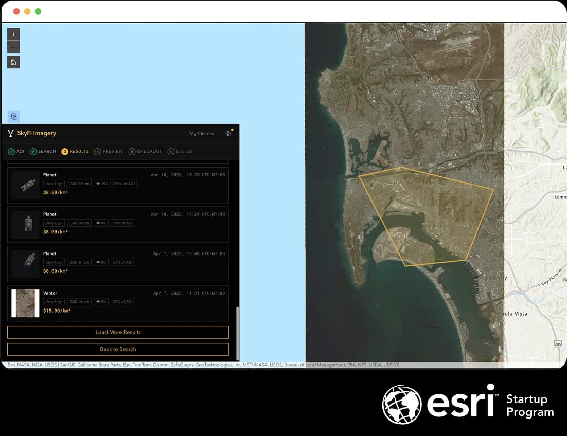
What the widget is
The SkyFi ArcGIS Widget is a native custom widget for Esri Experience Builder, built with input from commercial enterprise users. Once a portal administrator registers it, it drops into any Experience alongside your existing maps and layers.
From inside that Experience, an analyst can search SkyFi's archive, task a new satellite capture, and place an order against the organization's budget — without exporting an AOI, converting a file, or switching to another tool.
The widget runs inside ArcGIS Enterprise.
What it brings into ArcGIS
Everyone knows what ArcGIS can do. The widget adds the part that used to live somewhere else: SkyFi's ordering surface, inside your Experience.
Search open and commercial imagery. Define your area of interest from a polygon layer already on the map, or upload a shapefile, then search across SkyFi's provider network.
Task a new capture when the archive isn't enough. Set a capture window and request fresh imagery from across SkyFi's partner ecosystem.
Preview before you buy. See a result on the map against your other layers before committing to the order.
See transparent, per-square-kilometer pricing. Compare results across providers with resolution, capture date, cloud cover, and price shown up front.
Order in the same window. Place the order inside the Experience, billed to your SkyFi organization — no separate checkout, no re-keying an AOI.
The archive order flow
Ordering existing imagery runs through a single guided flow inside the widget: define an area, search, review results, preview, check out, and track status — all without leaving the map.
Set your area of interest (AOI)
Pick features from a polygon layer on the map or upload a shapefile to define where you want imagery.
Search the archive
Filter by capture date, cloud cover, product type, and resolution across SkyFi's provider network. To request new imagery instead, switch to Tasking and set a capture window.
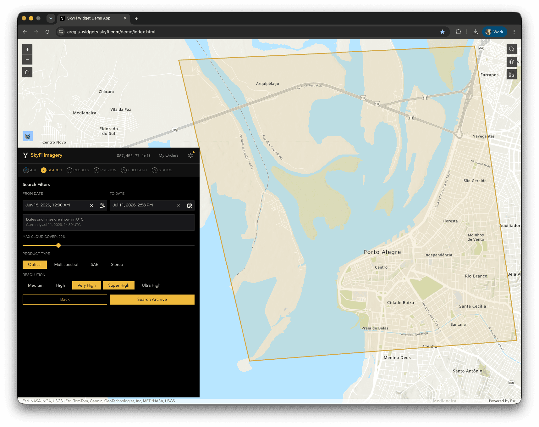
Filter the archive by date, cloud cover, product type, and resolution. Compare results
Review matching captures side by side, each showing provider, resolution, cloud cover, AOI coverage, and per-square-kilometer price.
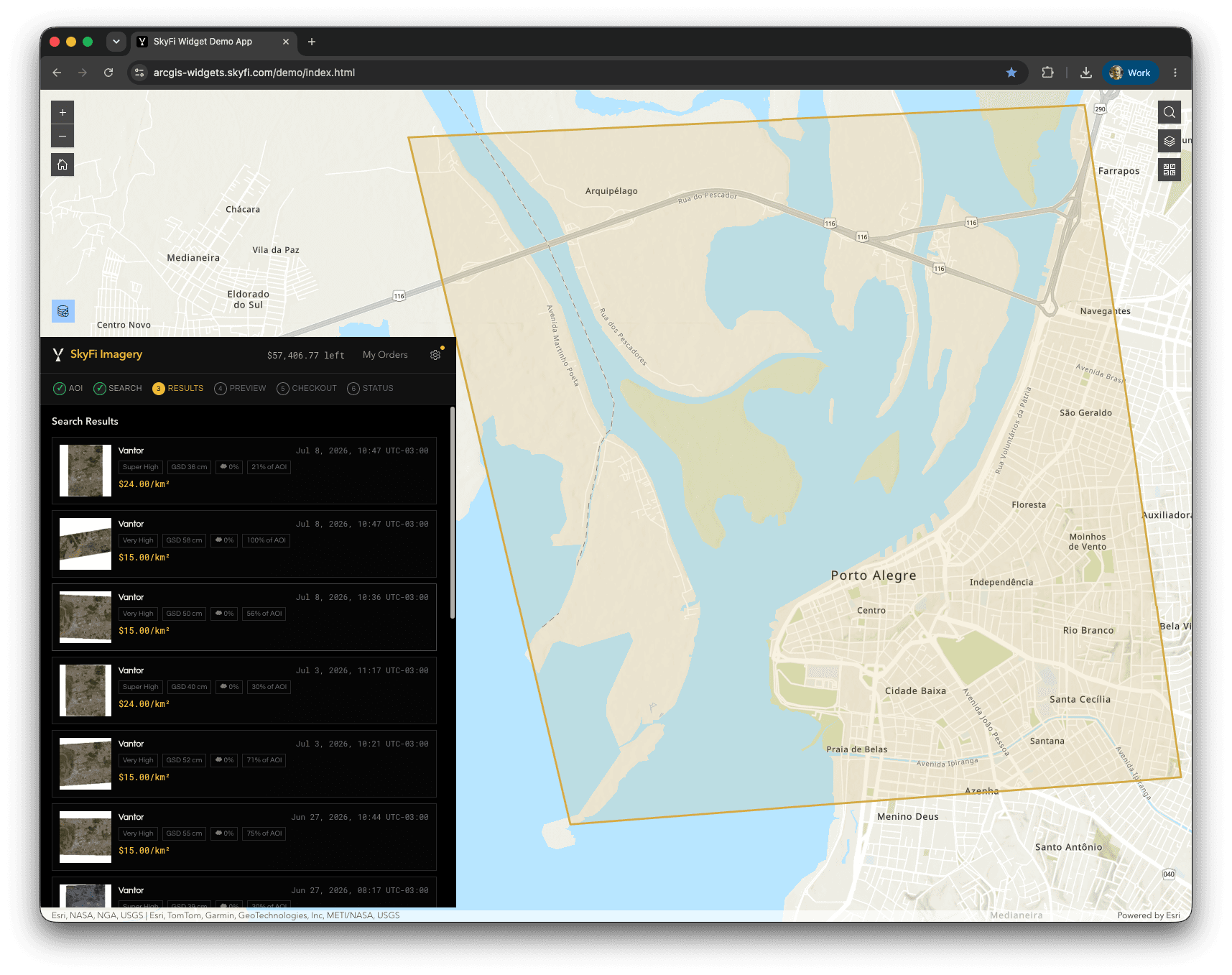
Compare captures across providers with pricing shown up front. Preview
Overlay a low-resolution preview on the map, against your existing layers, before committing to the order.
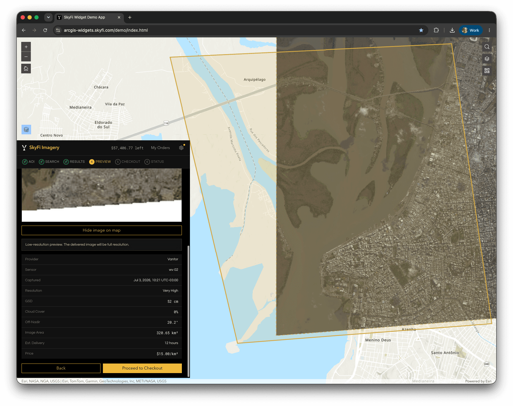
Preview a result on the map before you order. Check out
Confirm the order against your organization's budget and place it in the same window.
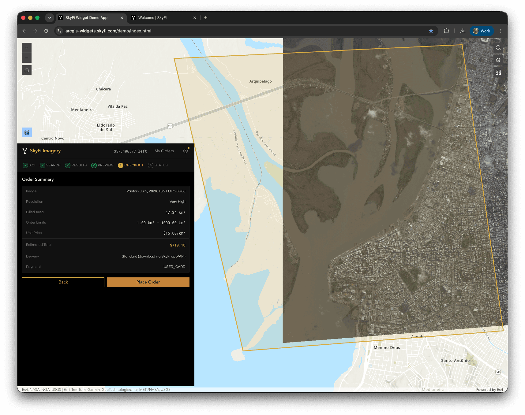
Confirm and place the order against your organization's budget. Track status
Follow the order through to delivery from the same panel.
The tasking flow
When the archive doesn't have what you need, task a new capture instead. Switch to Tasking in the widget and request fresh imagery over your area of interest. The flow is shorter: define an area, configure the capture, check out, and track status.
Set your area of interest (AOI)
Pick features from a polygon layer on the map or upload a shapefile to define where you want the new capture.
Configure the capture
Set the capture window and options for the request across SkyFi's partner ecosystem.
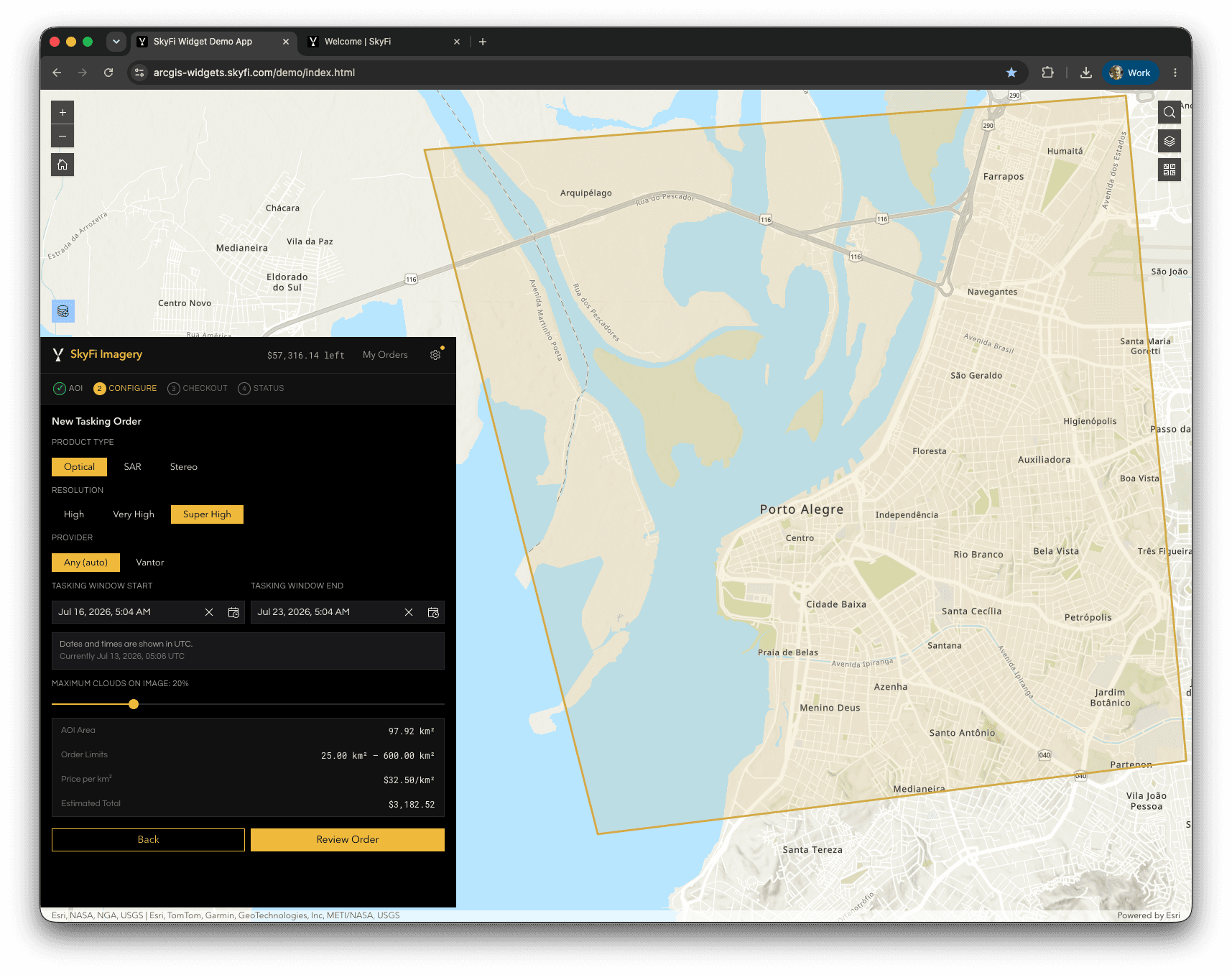
Set the capture window and options for the tasking request. Check out
Confirm the tasking request against your organization's budget and place it in the same window.
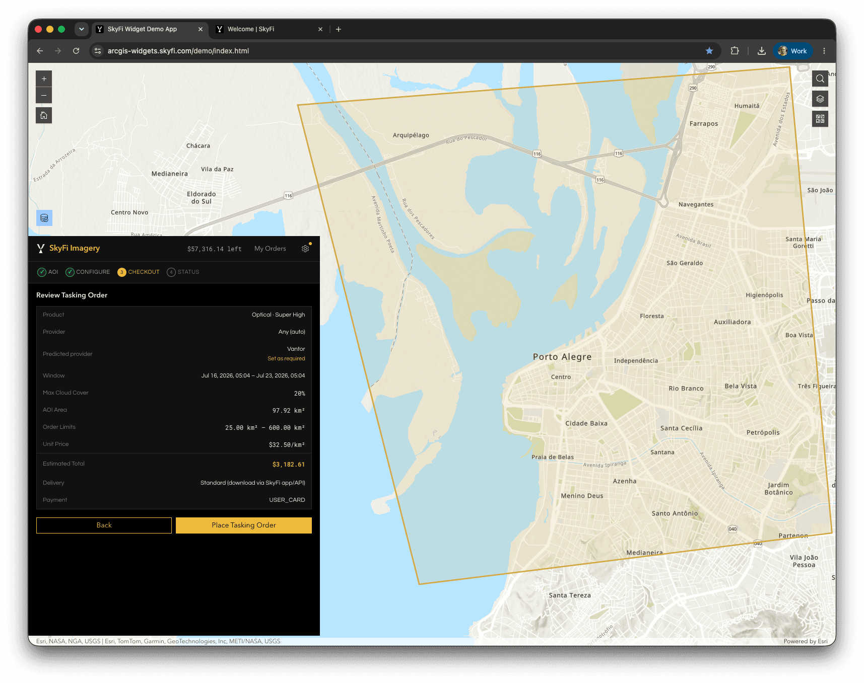
Confirm and place the tasking request against your organization's budget. Track status
Follow the tasking request through to delivery from the same panel.
Before you start
You'll need:
A SkyFi Pro or Enterprise account. The widget is available to SkyFi Pro and Enterprise customers.
ArcGIS Enterprise 12 or later. The widget is an Enterprise custom widget; ArcGIS Online does not currently support custom widgets of this type.
A widget build matching your ArcGIS Enterprise version. SkyFi ships a build per supported release (currently 12.0 and 12.1); you'll register the matching one in Part 1.
Portal administrator access to register the widget (one-time).
A SkyFi API key to authenticate ordering.
Setup — Part 1: Register the widget
Do this once, as a portal administrator. Only administrators can register custom widgets.
Sign in as an administrator.
Registering a custom widget requires admin rights on the portal.
Go to Content → New item → Application.
Choose the application type: Experience Builder widget.
Enter the manifest URL for your ArcGIS Enterprise version and click Next:
Register the build that matches your portal's ArcGIS Enterprise version.
- ArcGIS Enterprise 12.0
https://arcgis-widgets.skyfi.com/skyfi-imagery-enterprise-12.0/manifest.json - ArcGIS Enterprise 12.1
https://arcgis-widgets.skyfi.com/skyfi-imagery-enterprise-12.1/manifest.json
- ArcGIS Enterprise 12.0
Give it a title
(for example, "SkyFi Imagery") and save.
Set sharing.
Adjust organization and group sharing settings to control who can use the widget.
Setup — Part 2: Add and configure it in an Experience
Open Experience Builder
in the portal and open or create an Experience.
Add the SkyFi Imagery widget
to a page from the Insert-widget panel.
Add a Map widget, then connect it.
In the SkyFi widget's settings, set the Map Widget, add your SkyFi API key, and set any defaults.
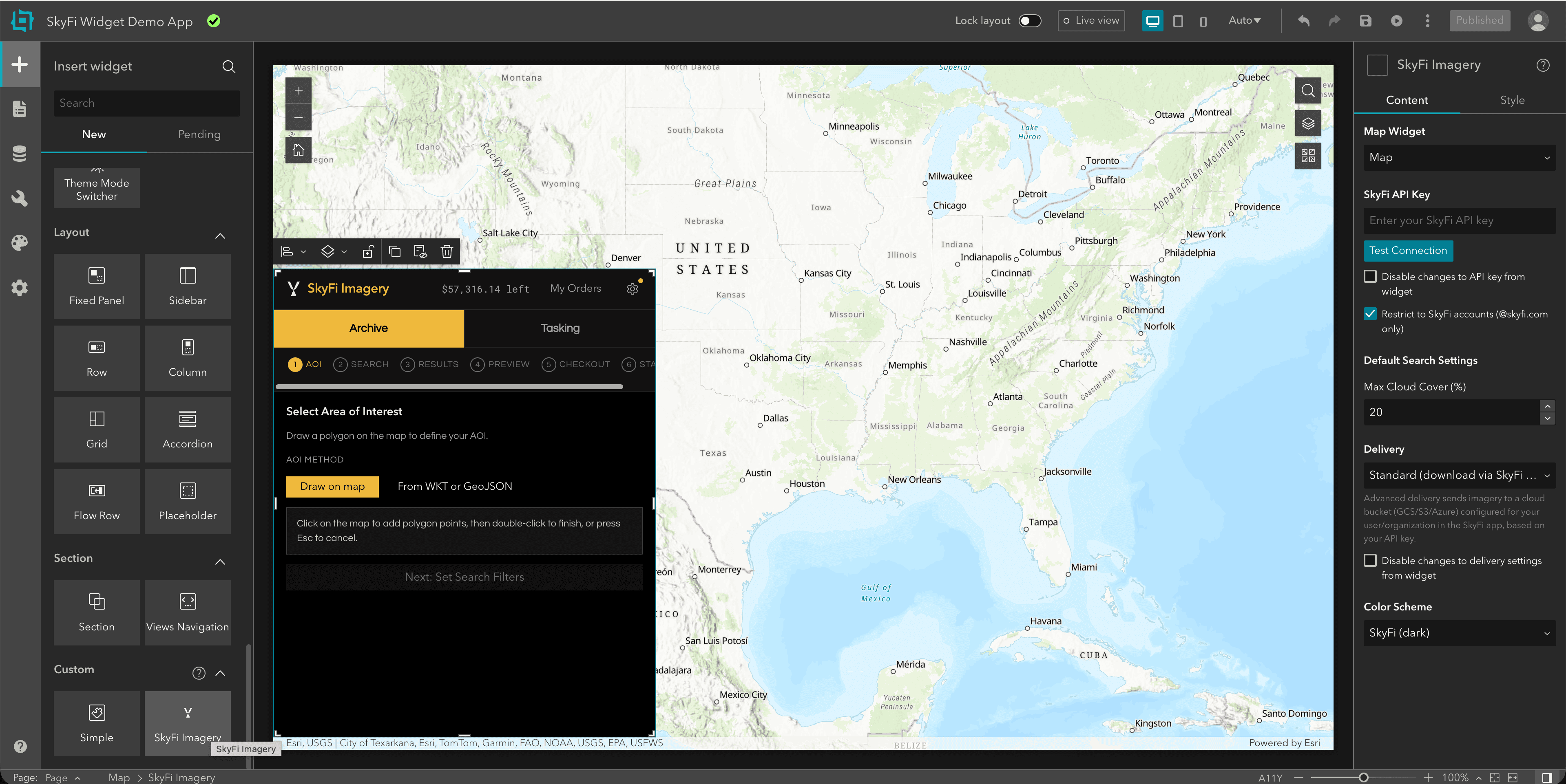
Add your SkyFi API key in the widget's settings. Save or publish
the Experience, then use it or share it with your team.
Bring SkyFi into your ArcGIS environment
See the widget in action, or come find us at the Esri booth.