Planet Select: A Simplified Way to Order High-Resolution Satellite Imagery, Powered by SkyFi
Planet Labs PBC has rebranded Single Order Tasking to Planet Select. The update introduces a streamlined experience for accessing SkySat® Tasking and SkySat Archive through a platform developed by SkyFi using the same foundation as its own intuitive interface.
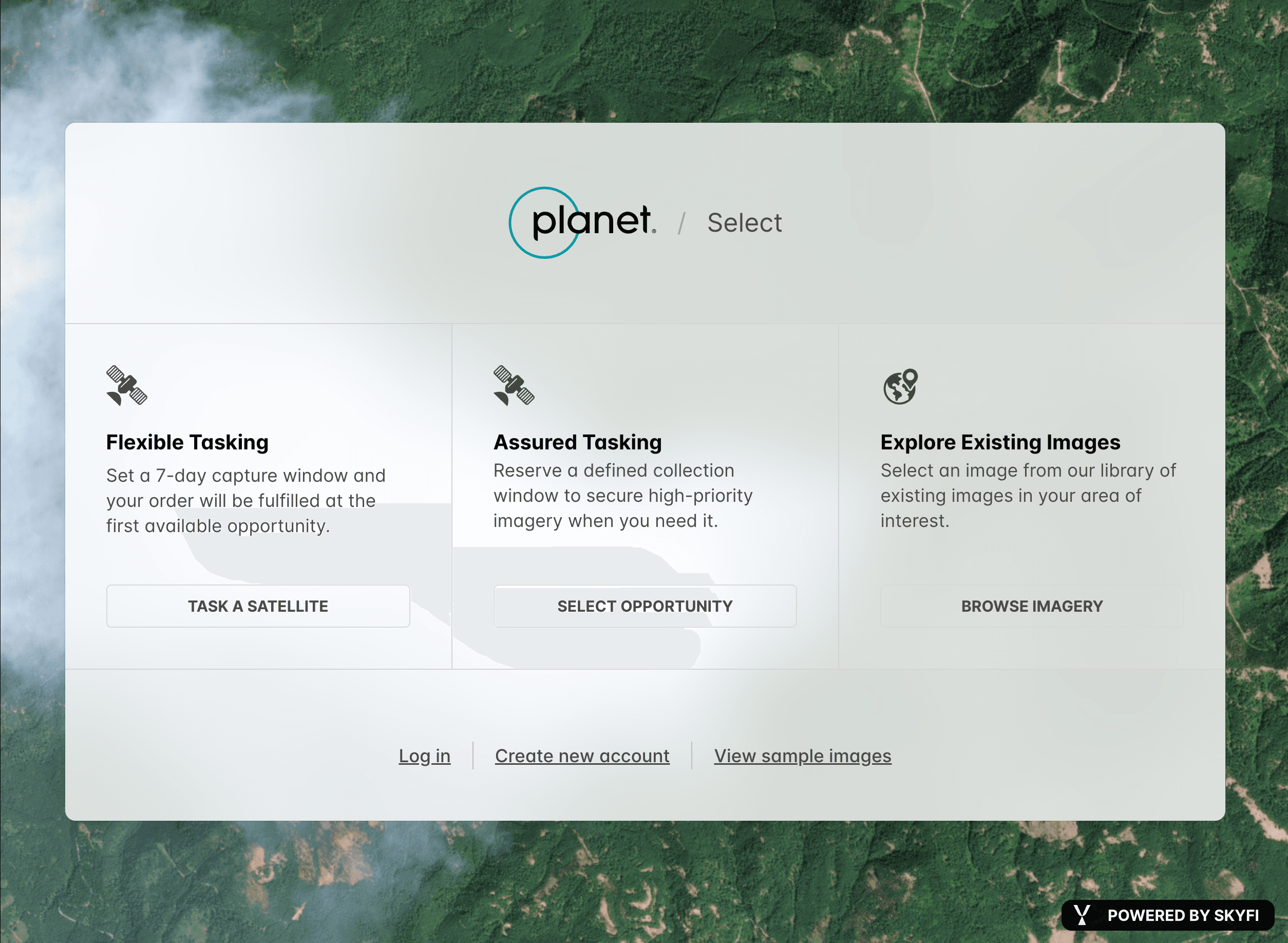
From Single Order Tasking to Planet Select
The previous Single Order Tasking portal allowed customers to order individual SkySat captures. Planet Select expands that concept. The platform now includes both new image tasking and historical archive satellite imagery access, all through a single interface.
The rebrand reflects Planet’s goal to make satellite data easier to access and use. It is designed for organizations or individuals who need high-resolution imagery for research, monitoring, or operational planning but prefer a transactional, pay-as-you-go model.
New Capability: Access to the SkySat Archive
A key update in Planet Select is access to the SkySat Archive, a large collection of past imagery available on demand. Users can search for existing satellite images covering their area of interest, compare data across multiple years, and analyze visible change without requesting a new task.
The archive option gives customers an efficient path to historical satellite imagery that supports long-term analysis, project verification, and situational reference.
How Planet Select Works
The Planet Select process is designed for clarity and speed.
Log In or Create an Account Access the Planet Select portal, define your Area of Interest (AOI) using the map, or upload GeoJSON or KML files.
Order Imagery: Archive or Task New Choose from the archive or request a new capture. Review cloud cover, dates, and resolution before checkout.
Checkout and Download Complete your order online and receive your imagery via the SkyFi interface. Archive data is delivered immediately. New tasking is completed within your selected capture window.
Imagery is available in GeoTIFF, PNG, and metadata formats for direct use in standard geospatial tools.
About Planet Labs PBC
Planet Labs PBC (NYSE: PL) is a leading provider of global, daily satellite imagery and geospatial solutions. Planet is driven by a mission to image the world every day, and make change visible, accessible and actionable.
Founded in 2010 by three NASA scientists, Planet designs, builds, and operates the largest Earth observation fleet of imaging satellites. Planet provides mission-critical data, advanced insights, and software solutions to customers comprising the world’s leading agriculture, forestry, intelligence, education and finance companies and government agencies, enabling users to simply and effectively derive unique value from satellite imagery. Planet is a public benefit corporation listed on the New York Stock Exchange as PL.
To learn more visit www.planet.com and follow @planet on X.
About SkyFi
SkyFi is a self-service Earth Intelligence Platform that allows users to run built-in geospatial analytics, task satellites, and access archived imagery. The dual-use platform supports both civilian and defense use cases, with flexible ordering options, transparent pricing, and API access for large-scale workflows.
Customers can use SkyFi's web platform, mobile app, or developer APIs to manage Earth observation projects without needing contracts or in-house GIS teams.
Learn more at www.skyfi.com
A More Direct Way to Access Satellite Data
Planet Select, powered by SkyFi, offers direct access to both new and archived SkySat imagery without contracts or subscriptions. It supports customers who need high-resolution satellite data quickly and with transparent pricing.
Planet and SkyFi continue to expand access to Earth observation data for users across commercial, research, and government sectors.
Learn More
Visit planet.skyfi.com to view pricing, register for an account, and start ordering imagery today.
Ileisa Lambert is SkyFi’s Director of Partnerships, where she leads a global ecosystem of satellite, data, and analytics providers, expanding access to Earth intelligence across commercial and government markets.


