Can You Get a Live Satellite View of Your House?
The short answer: not in real time. The longer answer is more interesting, and the imagery available today is far better than most people expect.
Here's what "live satellite view" actually means, what the best free tools offer, and how to access current satellite imagery of any location on Earth.
What "Live" Really Means in Satellite Imagery
No consumer satellite service streams live video of the ground like a CCTV camera. What people usually mean by "live satellite view" is one of three things:
Near-real-time imagery:
captured within the last few hours or days
Frequently updated imagery:
refreshed daily, weekly, or monthly
On-demand tasking:
ordering a satellite to photograph a specific location
Most free tools, including Google Earth, show basemap imagery that can be months or years old. The imagery looks current, but the timestamp tells a different story. Google Earth's default view in many regions reflects imagery that was captured 1–3 years ago.
Truly current satellite imagery exists, captured within the last 24–72 hours. Accessing it is the question.
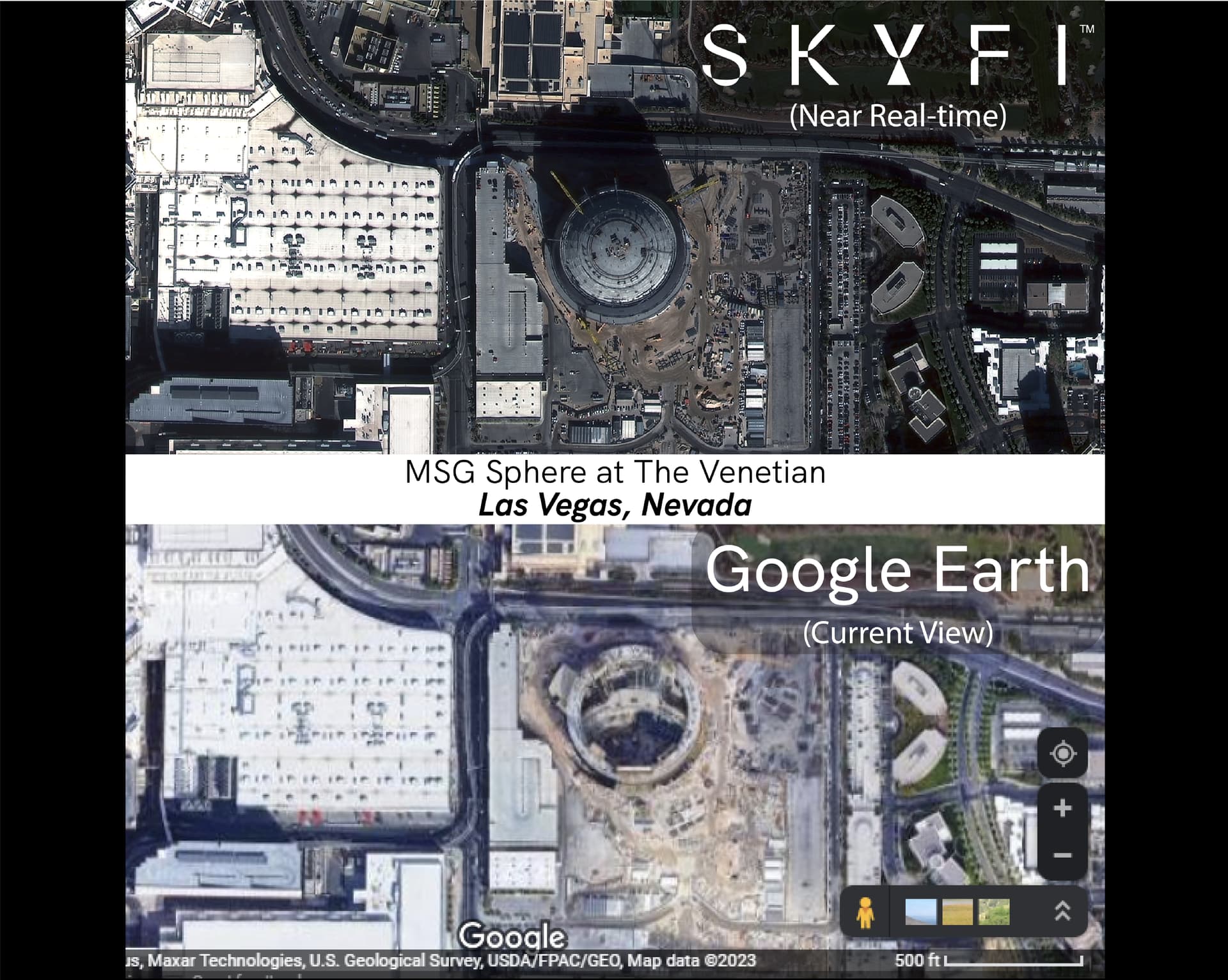
Why Google Earth Isn't "Live"
Google Earth is the world's most recognized satellite viewer, but it has a fundamental limitation: it's a static mosaic. Google assembles imagery from multiple satellites and providers, stitches it together, and serves a single composite image. That image doesn't update in real time.
Google Maps' satellite layer is similar. It's a cached basemap, not a live feed.
Neither service shows events that happened today, or even this week. For a view of recent activity (a construction project, a weather event, a change in land use) you need imagery with a verifiable capture date.
What Tools Actually Offer Near-Current Imagery
Several options provide genuinely recent satellite imagery, ranging from free open data to commercial platforms:
Free Options
NASA Worldview Near-real-time imagery from NASA's MODIS and VIIRS sensors, updated daily. Resolution is medium (~250m–500m per pixel), so you won't see your house, but you'll see regional weather, fires, and large-scale events from today.
Copernicus Browser ESA's Sentinel-2 satellite revisits most locations every 5 days and captures optical imagery at 10m resolution. The Copernicus Browser lets you browse this freely along with other satellites from the Sentinel missions. You can see your region as it looked within the last week.
SkyFi SkyFi provides free access to ESA Sentinel-1 (radar) and Sentinel-2 (optical) imagery through its archive. You can search any location, filter by date, and view recent pre-processed imagery at no cost. The platform also offers commercial imagery down to 7.5cm resolution, if you need more detail.
→ Explore free satellite imagery on SkyFi
Commercial Options (For Detailed, Recent Imagery)
If you need to see a specific location as it looks this week, or order imagery of it on demand, commercial satellite platforms offer:
Imagery archives
with capture dates you can verify, at resolutions from 50cm down to 7.5 cm
Satellite tasking:
scheduling a satellite to photograph your AOI within 24–72 hours
Global coverage
across optical, radar (SAR), and thermal sensors
SkyFi aggregates imagery from 300+ satellites, with transparent per-km² pricing and no minimum spend required. Archive imagery starts at $5/km².
Can Satellites See My House Specifically?
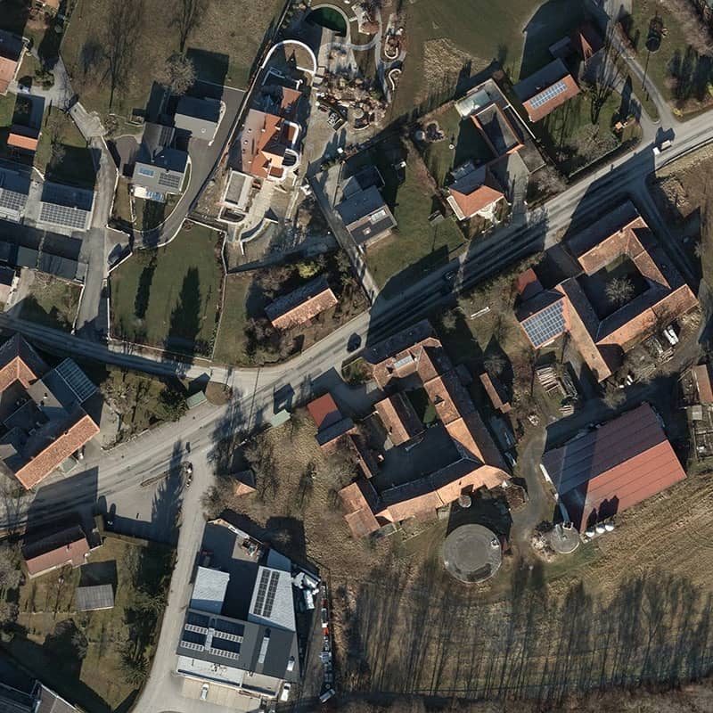
Yes. At sufficient resolution, commercial satellites can image individual buildings, vehicles, and structures. At 30–50cm resolution, you can clearly identify:
Buildings and rooftops
Vehicles in parking lots
Construction progress
Pools, solar panels, landscaping changes

At 30 cm resolution (available via Vantor satellites on SkyFi), the level of detail is significant, comparable to a low-altitude aerial photograph.
What satellites can't do: resolve individual faces, look through rooftops, or capture video. All satellite imaging is still photography: a snapshot at a moment in time.
How to Get a Satellite Image of Your House
Here's the quickest path to seeing recent satellite imagery of your location:
Go to
or download the SkyFi app (iOS / Android)
Search your address
or navigate to your location on the map
Open "Existing Images"
and select either "Commercial" for paid high-resolution imagery or "Open" for free imagery.
Select a recent scene
(Sentinel-2 covers most locations every 5 days)
Preview and download:
no subscription required for Sentinel data
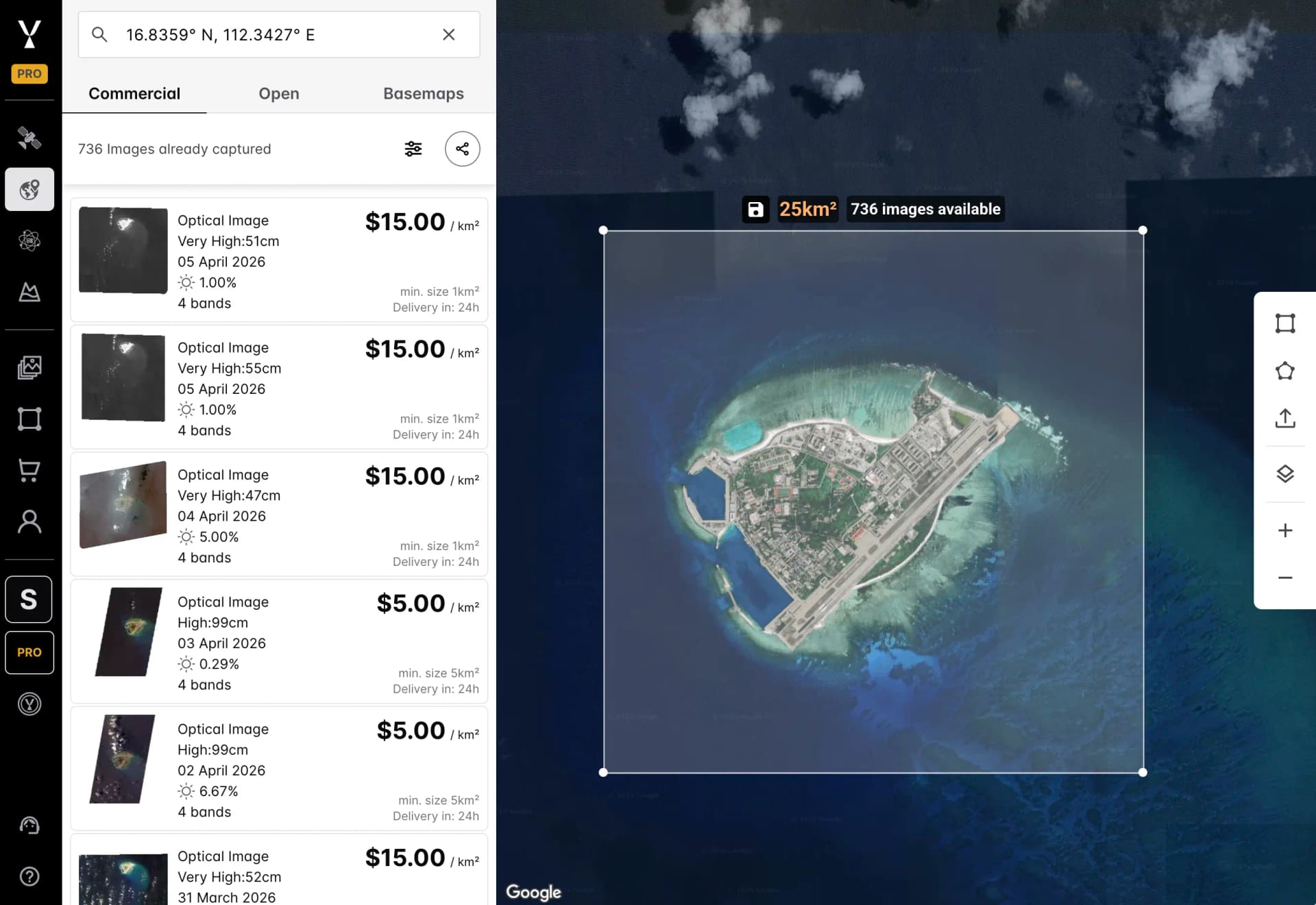
For higher-resolution imagery of your specific property, you can order commercial archive imagery starting at $5/km², or task a satellite for a new collection.
Frequently Asked Questions
Is there a truly live satellite feed of Earth? The International Space Station streams live video from orbit (NASA TV / HDEV), but it's not pointed at specific locations on demand. Some geostationary weather satellites update every 10–15 minutes at continental scale. For specific locations at high resolution, no live feed exists. Only recent imagery is available.
How often does Google Earth update? Google Earth updates its imagery on no fixed schedule. Urban areas may be updated annually but rural areas can go 2-3+ years between updates. There's no way to request an update, and no capture date is shown in the default view.
What's the most current satellite imagery I can access for free? ESA's Sentinel-2 imagery is updated every 5 days and is available free and pre-processed via SkyFi Open Data or Copernicus Browser. It's 10m resolution: good for regional views, not individual buildings.
Can I task a satellite to photograph my house? Yes. Commercial satellite tasking services, including SkyFi, let you order a new satellite collection for any location. You define the area, resolution, and timing. Imagery is typically delivered within 24–72 hours of capture. Pricing starts around $12km² for optical tasking at 50cm resolution.
Does Google Maps show live traffic but not live satellite? Correct. Google Maps shows live traffic data (aggregated from GPS signals), but the underlying satellite/aerial imagery is a static basemap, not a live feed.
What resolution do I need to see my house clearly? At 50cm resolution, you can identify your rooftop and vehicles. At 30cm, you can see structural details clearly. At 7.5 cm, you can read large text and see individual features with high clarity. Most commercial satellites accessible via SkyFi offer 30-50cm resolution in archive, with 7.5 cm available from aerial sources.
The Bottom Line
No satellite service shows your house in real time. What does exist is near-real-time imagery: free, accessible, and genuinely current, from satellites that pass overhead every few days.
For most people, Sentinel-2's free 10m imagery via SkyFi Open Data is the best starting point. For high-resolution current imagery of a specific property or AOI, commercial archive or tasking options give you imagery as recent as yesterday, at resolutions that make individual buildings clearly visible.
→ Explore satellite imagery of your area, free on SkyFi
References:
https://www.earthdata.nasa.gov/data/instruments/sentinel-2-msi
https://dataspace.copernicus.eu/ecosystem/services/copernicus-browser
Last updated: June 2026. SkyFi provides access to imagery from 300+ satellites and aerial sources. Pricing and availability subject to change.
Kat Tungol is the Product Marketing Manager at SkyFi, with a background in remote sensing and professional training as a licensed geologist. She works at the intersection of geospatial science and product marketing, translating complex Earth observation capabilities into clear, practical value for users.


