The SkyFi Platform
One platform for geospatial data
Task satellites, search the global satellite imagery archive, run analytics, and order 3D models. Access multiple data types across optical, SAR, multispectral, hyperspectral, and thermal sensors, as well as stereo imagery and aerial data.
Satellite & aerial sources
Partners
Standard delivery
Users worldwide
Used by more than 10,000 organizations around the world


Earth intelligence
One platform.Every geospatial answer.
The geospatial industry was built on six-month sales cycles and seven-figure minimums. SkyFi rebuilt it as one provider-agnostic platform where you can search the archive, task new collections, run analytics, and order 3D products. On-demand access with transparent pricing.
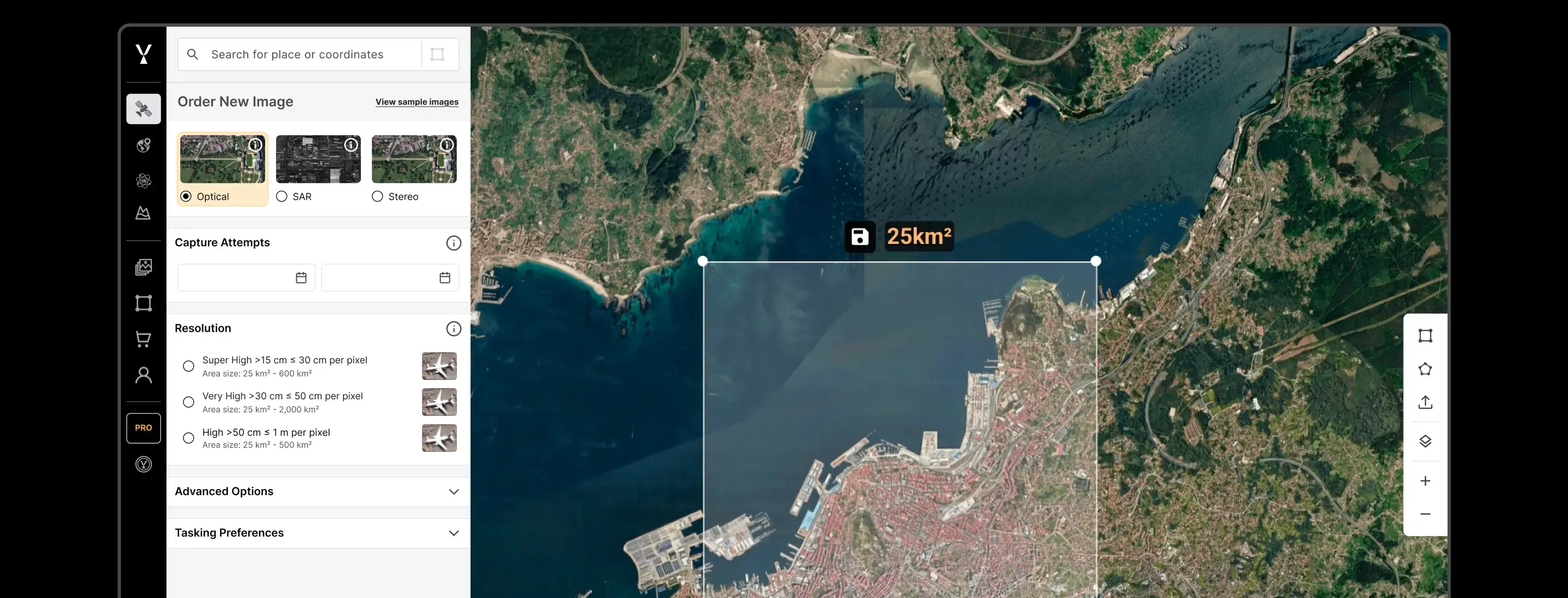
Tasking
Task a satellite from the world's leading providers
Define an area, pick a sensor, set your cloud-cover threshold and acquisition window. SkyFi routes the order to the right provider, monitors the collection, and delivers when it's done.
- Priority and assured tasking modes
- Multi-provider pass selection across global partners
- Monitoring campaigns and recurring collections
- Next Available Capture in under 24 hours
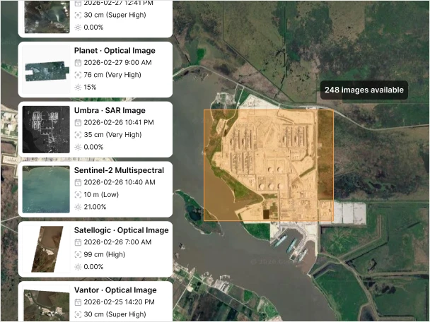
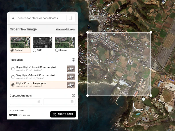
Archive
Search the archive from over 300 satellites
Filter by location, date, resolution, sensor, and cloud cover across the full geospatial partner archive. Preview before you buy. Pay per km². Download and analyze the same day.
- Global imagery archive from all sensor types
- Scene preview before purchase
- Transparent per-km² pricing
- Vivid Mosaic basemaps from 15 cm HD
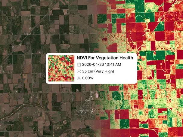
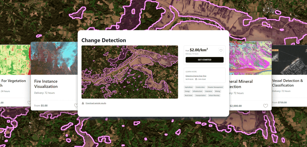
Geospatial analytics
From imagery to answers, automatically
Turn raw scenes into structured intelligence. SkyFi runs 34 analytics products across vegetation, water, change detection, classification, carbon, and maritime.
- NDVI for vegetation health
- NDWI for standing water
- Forest carbon measurements
- Maritime AIS
- Custom projects
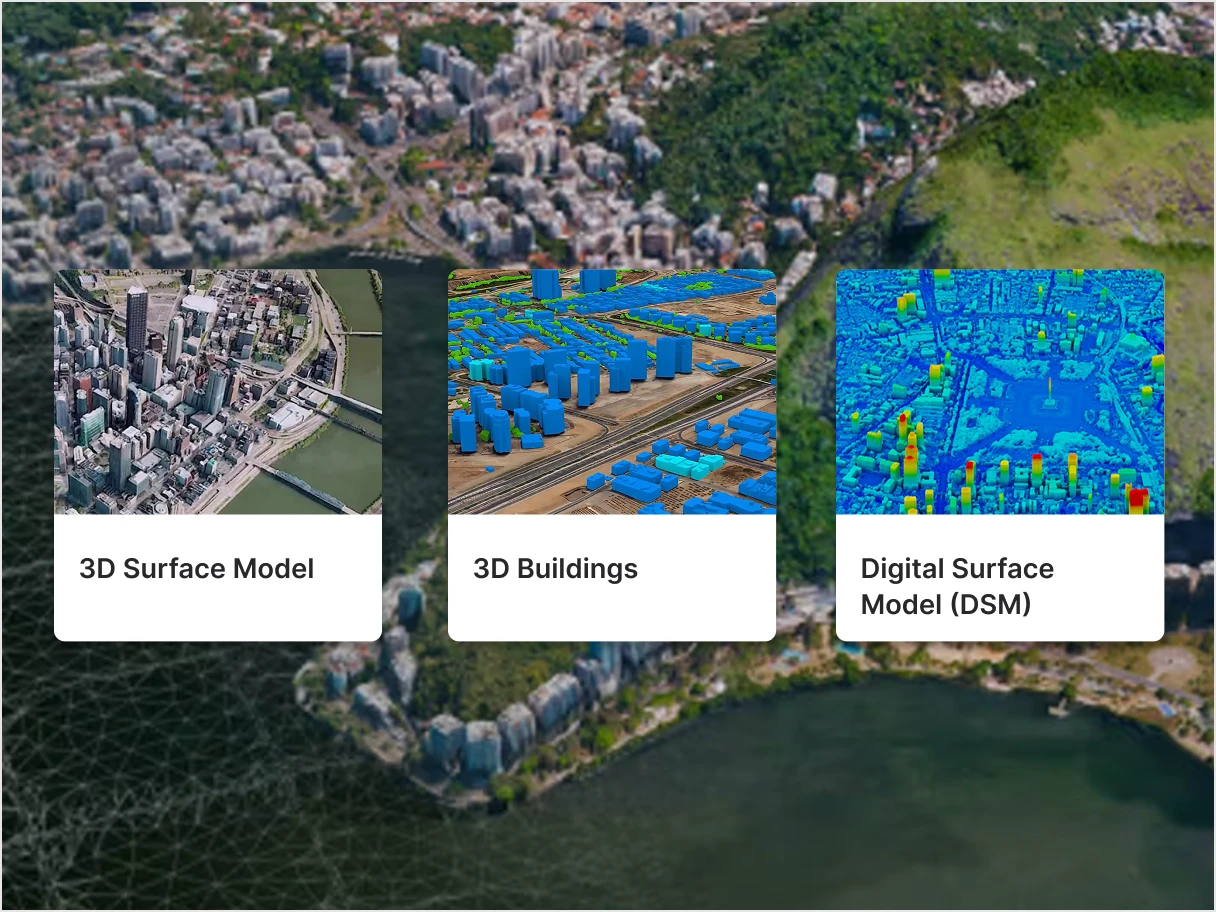
3D products
3D terrain models, delivered in under 12 hours
Generated from Vantor's 30 cm satellite imagery via patented 3D reconstruction. Order globally, get back surface models, elevation grids, point clouds, and parallax-free orthos.
- 3D Surface Model (3DSM)
- True Ortho
- Point cloud, DSM, DTM, DHM
- 3D buildings and vegetation extraction
Access
Use SkyFi wherever your workflow lives.
01
Web Platform
Browser interface for search, tasking, analytics, and 3D ordering.
app.skyfi.com
02
Mobile App
iOS and Android for ordering imagery and monitoring AOIs from the field.
iOS · Android
03
Developer API
Programmatic access to search, tasking, analytics, and order management for any geospatial workflow.
REST · Webhooks
04
Cloud Delivery
Imagery delivered directly to AWS S3, Google Cloud Storage, or Azure Blob.
S3 · GCS · Azure
Multiple sensors on one platform
Match the sensor to the question. SkyFi unifies optical, SAR, multispectral, hyperspectral, thermal, stereo, and aerial under a single search, ordering, and delivery pipeline.

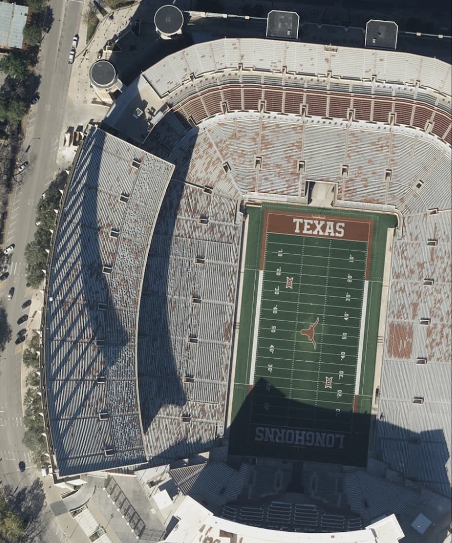
Optical
High-resolution, photo-realistic satellite imagery in the visible spectrum, commonly used for mapping, infrastructure monitoring, environmental analysis, and commercial decision-making.
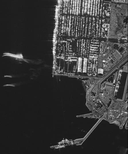
Synthetic Aperture Radar (SAR)
All-weather, day-night satellite imagery generated using radar signals, ideal for monitoring through clouds, smoke, and darkness in maritime, disaster, and infrastructure applications.
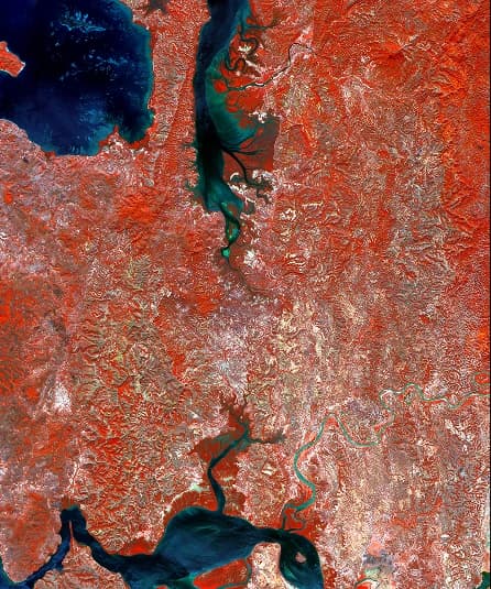
Multispectral
Satellite imagery captured across visible and infrared bands, enabling geospatial analysis such as vegetation health, land use classification, and environmental change detection.
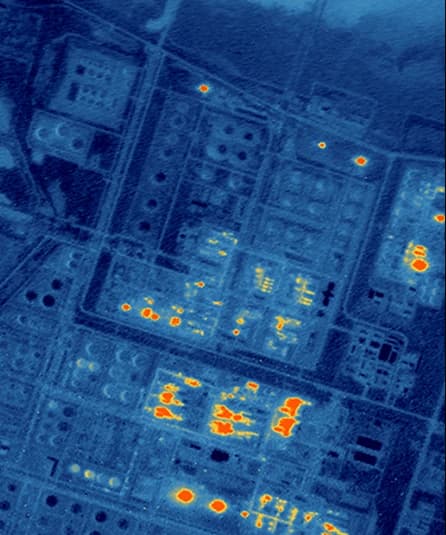
Thermal
Satellite imagery that captures heat signatures day or night, used for wildfire detection, energy infrastructure monitoring, industrial activity tracking, and environmental anomaly detection.
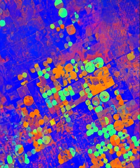
Hyperspectral
High-dimensional satellite imagery captured across hundreds of spectral bands, revealing material and chemical signatures for mineral exploration, crop health analysis, and environmental monitoring.
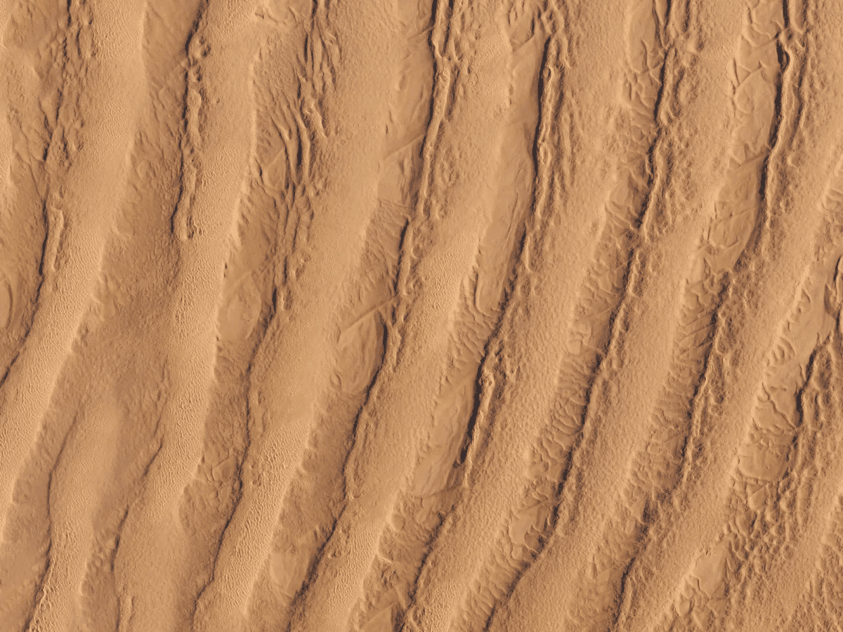
Aerial
Ultra-high-resolution geospatial data collected from aircraft and stratospheric balloons, providing detailed imagery for localized mapping, asset inspection, and precision planning.
Frequently Asked Questions
SkyFi is a self-service Earth intelligence platform for searching, ordering, and analyzing satellite imagery from more than 50 geospatial providers. Users can task satellites, access archive imagery, run geospatial analytics, and order 3D products through the web app, mobile app, or API, without contracts or in-house GIS teams.
More SkyFi Products
Analytics

Commercial Imagery

Open Data

Vantor

Vantor Connect

Maritime AIS Data

SkyFi Plugin for ATAK

ICEYE US Direct

