Best Free Satellite Imagery Sources in 2026
Satellite imagery was once limited to governments and research institutions. Today, anyone with a browser can view recent imagery of almost any location on Earth at no cost.
Farmers assess crop health across fields remotely. Insurers evaluate storm damage before an adjuster reaches the site.
Journalists confirm conditions in places they cannot access. Many people simply want a current satellite image of a location they are interested in.
Free satellite imagery covers a wide range of quality, freshness, and usability. Some of it is well suited to professional work.
Some of it falls short the moment detail is required. Knowing which free source fits which purpose, and recognizing where free imagery stops being sufficient, is the difference between a quick answer and wasted effort.
This guide reviews the leading sources of free satellite imagery and data, who each one serves best, and what to do when free imagery is not enough.
If you are evaluating imagery for a business in agriculture, insurance, energy, defense, logistics, or urban planning, the sections on resolution and tasking will be especially valuable, since that is where the free tier most often reaches its limits.
At a glance: where to get free satellite imagery
For quick reference, these are the free satellite imagery sources worth knowing:
SkyFi Open Data: free imagery from multiple providers (Sentinel-1, Sentinel-2, and free commercial samples) in one platform, with an API available for projects at scale.
Copernicus / Sentinel (ESA): the best free optical and radar imagery available, refreshed every few days, with global coverage.
USGS EarthExplorer / Landsat: decades of free archive imagery, suited to historical and change-over-time analysis.
NASA Worldview and Earthdata: daily global coverage at coarse resolution, suited to weather, fire, and large-area environmental monitoring.
NOAA: environmental, atmospheric, and ocean data from weather and earth-observation satellites.
Google Earth: a free viewer (not downloadable raw data) for general reference and orientation.
The sections below explain what each source is suited to, where it falls short, and how to decide when to move from free imagery to commercial high-resolution satellite imagery.
Free satellite imagery sources, explained
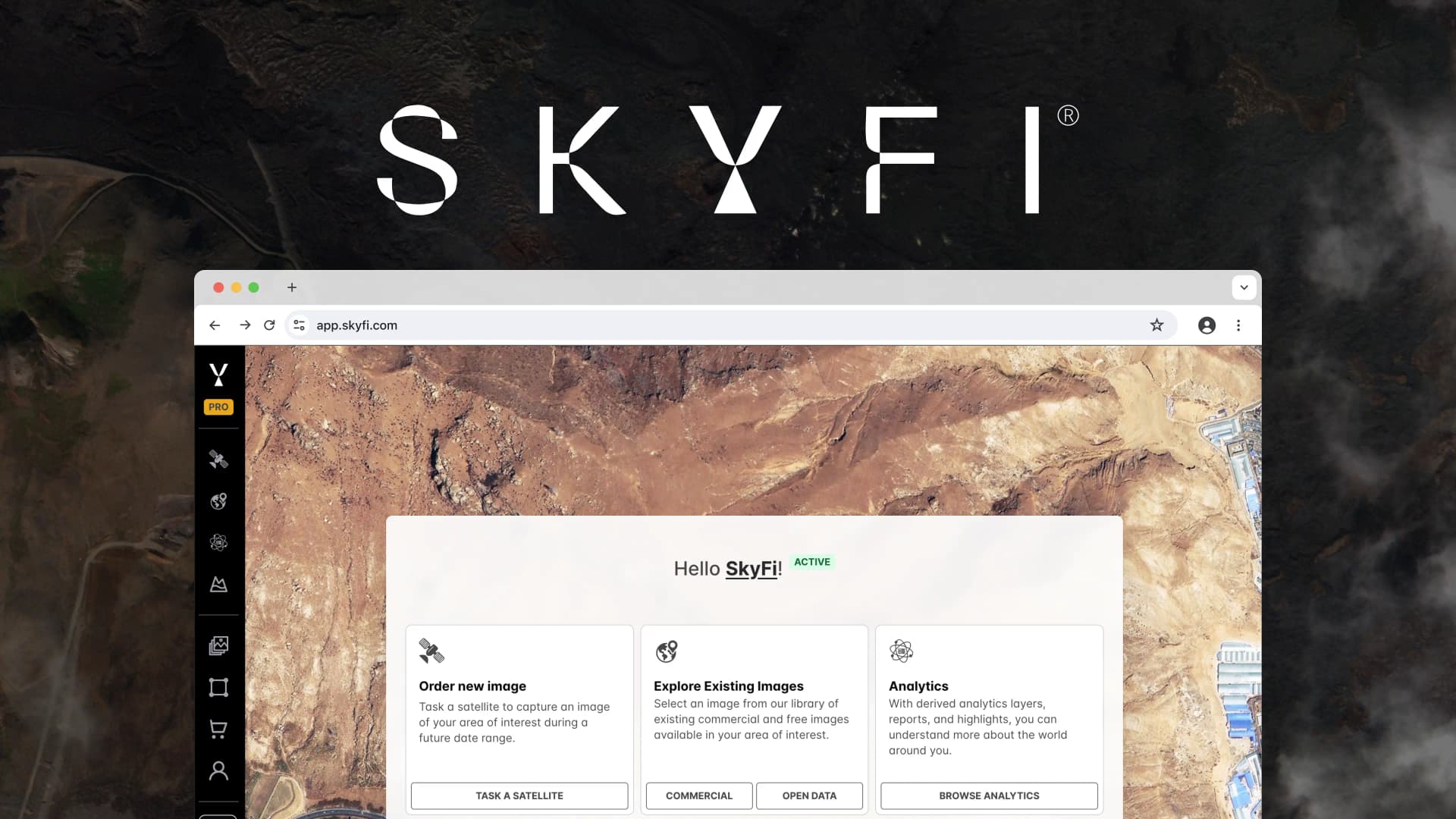
SkyFi Open Data
SkyFi brings free satellite data from several leading providers into one platform, with no specialized software or subscription required.
Rather than working across separate agency portals, each with its own login and file format, users can search a location and access the free imagery available there.
The Open Data catalog includes five sources: the two free ESA missions, Sentinel-1 (SAR radar, which images through cloud cover and at night) and Sentinel-2 (10-meter multispectral), alongside free commercial samples from Satellogic (high-resolution optical).
Sourcing Sentinel imagery through SkyFi rather than from ESA directly has a practical advantage: it arrives as a pre-processed, view-ready image alongside the raw files and full metadata.
Individuals or teams without a GIS analyst can open the processed image immediately and add it to a briefing or report.
GIS teams that need the source data receive the raw scene and metadata for further analysis. Cloud delivery to AWS, Google Cloud, or Azure is also available for teams operating at scale.
For developers, the SkyFi API is available for free too, allowing imagery to be pulled directly into existing workflows.
Open Data also serves as the entry point to high-resolution: browse at no cost, identify the coordinates and dates you need, and if free imagery lacks sufficient detail, order a high-resolution image of the same location without changing platforms.
See what SkyFi Open Data covers for a location relevant to your work.
Best for: anyone who needs free imagery from multiple sources in one platform, with a direct path to high-resolution when free imagery is no longer sufficient.
Copernicus and the Sentinel missions (ESA)
The European Space Agency's Copernicus program is the reference standard for free satellite imagery, and most other free tools, including parts of SkyFi Open Data, draw on it.
The two missions most relevant to commercial users are Sentinel-2, which delivers 10-meter optical imagery, including the near-infrared bands used for vegetation and water indices, and Sentinel-1, a radar (SAR) mission that images regardless of cloud cover or darkness.
Coverage is global and refreshes every few days, which makes Sentinel data a mainstay of free monitoring: crop conditions across a season, flood extent after a storm, or deforestation over months.
The raw data is available to download through the Copernicus Data Space Ecosystem at no cost.
The trade-off is that the data is distributed in formats built for remote-sensing specialists. Producing a usable, corrected image from a downloaded Sentinel product typically requires several processing steps and the appropriate software.
This is one reason to source the same imagery through SkyFi, where it is delivered view-ready with the raw files included.
Best for: regular monitoring of large areas where 10-meter resolution is sufficient and you or your tools can manage processing.
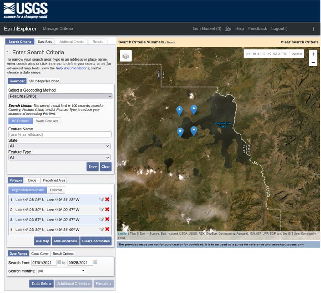
USGS EarthExplorer and Landsat
The U.S. Geological Survey's EarthExplorer provides access to the Landsat archive, whose principal strength is historical depth. The program has imaged Earth continuously since the 1970s, making it the right source for tracking how a coastline, forest, glacier, or city has changed over decades.
Resolution is approximately 15 to 30 meters depending on the band, coarser than Sentinel-2 but sufficient for long-term change detection.
EarthExplorer also catalogs aerial photography and additional datasets, all available to download at no cost. The interface is dated, but the data is authoritative and the archive is extensive for time-series analysis.
Best for: historical analysis, long-term change detection, and any work requiring imagery that extends back decades.
NASA Worldview and Earthdata
NASA's Worldview provides a near-daily, full-globe view drawn largely from the MODIS and VIIRS instruments.
Resolution is coarse, typically 250 meters to 1 kilometer, so it is not suited to examining a single building or field. Its strength is broad coverage updated daily: wildfire smoke, dust storms, algal blooms, snow cover, and storm systems.
Earthdata, the wider portal, provides access to NASA's full catalog of free earth-observation datasets for research-grade work.
Best for: daily, large-area environmental monitoring where timeliness matters more than fine detail.
NOAA
The National Oceanic and Atmospheric Administration distributes free imagery and data focused on weather, climate, atmosphere, and oceans, including feeds from the GOES weather satellites.
For questions about storms, sea-surface temperature, atmospheric conditions, or environmental change rather than the appearance of a specific site, NOAA's open data is the right starting point.
Best for: weather, ocean, and atmospheric monitoring.
Google Earth
Google Earth is the most widely recognized free satellite tool, and it is useful for orientation: understanding a location, measuring approximate distances, and general reference. However, it is a viewer and not a data source.
It is built from a mosaic of imagery captured on different dates and stitched together. The underlying raw data cannot be downloaded, the capture date is unknown and cannot be selected, and the current view of any given location may be months or years old.
It answers how a place generally appears, not how it appears at present.
Best for: general reference and orientation, not analysis or current imagery. A note on direct downloads: a number of commercial imagery vendors advertise free samples, but these are usually limited promotional crops selected by the vendor, not free access to image a location of your choosing.
For genuinely open, downloadable data, the government and inter-governmental sources above (Copernicus, USGS, NASA, NOAA) provide a reliable foundation, and platforms such as SkyFi Open Data make that data easier to use.
How businesses use free satellite imagery
Free imagery supports real work across industries, particularly for monitoring trends and screening large areas before committing to higher-cost data. The following examples illustrate where it provides value:
Agriculture. Sentinel-2's near-infrared bands support vegetation indices such as NDVI, allowing growers and agronomists to track crop health, irrigation stress, and field variability across a season at no cost. Free imagery is often enough to identify where an issue exists, though confirming its nature frequently requires higher resolution.
Insurance and risk. Adjusters and underwriters use free imagery to assess broad-area damage following storms, wildfires, and floods, and to evaluate property surroundings and exposure before issuing a claim or policy.
Energy and infrastructure. Operators monitor right-of-way encroachment, construction progress, and site conditions across pipelines, transmission lines, and remote facilities that are costly to visit in person.
Defense, government, and intelligence. Free SAR and optical imagery support situational awareness and change monitoring across wide areas, with the option to commission high-resolution tasking when a specific site requires closer examination.
Maritime and logistics. Sentinel-1 radar detects vessels and tracks activity at ports and in coastal waters regardless of cloud cover, supporting supply-chain and maritime-domain awareness.
Urban planning and environment. Planners and researchers use free imagery to map land-use change, monitor green space, and track development over time.
The common pattern is that free imagery is well suited to detection and monitoring across large areas, and to determining where closer examination is warranted.
That closer examination is typically where free resolution reaches its limit, as the next section explains. For more on how organizations select imagery, see what to look for in a satellite imagery provider.
How individuals use free satellite imagery
The applications are not limited to enterprise use. Individuals use free satellite imagery to check on a property or parcel of land, follow nearby construction, satisfy curiosity about a location, support a school or university project, or document environmental change in their community.
For most of these purposes, a free source such as the SkyFi map or Sentinel imagery answers the question, and it is free to begin without a commitment.
The limitation appears when someone needs a current, detailed image of one specific location, which free imagery often cannot provide on demand.
Why free satellite imagery often falls short
Free imagery is valuable, but it carries inherent limits determined by how it is collected and distributed. Understanding these limits in advance prevents wasted effort.
Resolution
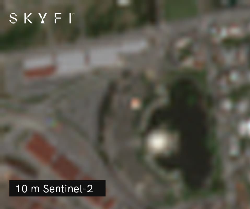
This is often the most significant limitation of free satellite imagery. Sentinel-2, one of the highest-resolution sources of free optical satellite imagery, captures selected bands at 10 meters per pixel, meaning each pixel represents a 10-by-10-meter area on the ground.
This is sufficient for identifying fields, large buildings, major roads, and broad land-cover changes, but not for reliably counting vehicles, examining rooftop features, assessing equipment condition, or distinguishing individual trees.
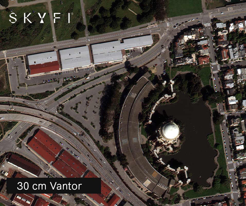
Commercial imagery can reach resolutions of 30 centimeters or finer, more than 30 times finer in ground sampling distance. In practice, that can mean the difference between confirming that a structure is present and distinguishing its shape, rooftop features, nearby vehicles, equipment, and overall site layout.
For a fuller explanation, see what counts as high-resolution satellite imagery.
Limited control over location and timing
Free satellite missions follow fixed orbital and acquisition schedules, capturing imagery when the satellite passes over an area rather than on demand. This means you are limited to the images available for your location and cannot direct the satellite to capture a specific site at a particular time.
The regular cadence supports broad, ongoing monitoring, but it may not provide a recent, cloud-free image when you need to see how a site looks right now.
Freshness and cloud cover
Current satellite imagery is a frequent search, but free archives are not live. Over a single location, the next pass may be days away, and cloud cover on optical passes extends that wait further.
SAR imagery such as Sentinel-1 images through clouds and smoke, but it produces a different type of image that requires expertise to interpret and process. No free optical source shows a location as it appears real-time or live.
Processing requirements
As noted, raw free data frequently arrives in technical formats that require correction and processing before use.
For a team without a GIS specialist, this is a genuine barrier, and it is among the clearest reasons to obtain the same imagery in a view-ready form from a platform.
Implications for businesses
Where a decision depends on detail, such as verifying an asset's condition, counting or measuring objects, or confirming what changed at a specific site on a specific date, free 10-meter imagery is not enough.
Since free satellites cannot be tasked, a clear, recent image of the required location cannot be relied upon when needed. That uncertainty carries its own cost.
Implications for individuals
For personal use, the limitation is largely one of expectation: zooming in for a detailed, current view of a specific location often returns a low-resolution and potentially outdated image.
Free imagery is well suited to context and general reference, but less so to delivering a detailed, on-demand view of a single location.
SkyFi: high-resolution imagery without enterprise pricing
When free imagery cannot answer the question, the conventional alternative has been difficult to access. Legacy commercial providers were built for governments and large enterprises, which typically meant high minimum spends, bulk-tasking contracts, annual commitments, and sales cycles measured in weeks.
For a single high-resolution image, or for a small team that needs detail only occasionally, that model is a poor fit. The one-off prices that were available could also be high and difficult to predict.
Where most paid solutions fall short
Bulk minimums and contracts. Many providers will not sell a single image, requiring a minimum order or a subscription regardless of the volume needed.
Limited pricing transparency. One-off image prices can be difficult to locate and to predict, with quotes that vary by sales conversation.
Procurement friction. Lengthy onboarding and sales processes stand between the buyer and the image required.
What SkyFi does differently
SkyFi was built to make high-resolution satellite imagery accessible beyond buyers with procurement departments. The model is straightforward:
Transparent pricing with no bulk minimums. The cost of an image is shown before purchase, and a single high-resolution image can be ordered as a one-off, with no contract and no minimum spend. Current rates are listed on the SkyFi pricing page.
Multiple resolutions in one platform. From free open data at 10 meters to very high-resolution commercial imagery, the resolution can be matched to the task and the budget, and sources can be combined.
Free to browse, straightforward to target. Open Data and the map are free to use; identify the coordinates and dates required and order high-resolution imagery of the same location in a few steps. No GIS expertise is necessary.
View-ready and raw together. Every image is delivered pre-processed and corrected for immediate use, with the raw files and metadata included for GIS tools or cloud storage.
A developer API. Imagery can be pulled into existing products and workflows through the SkyFi API, available on the Pro plan.
The result is a single platform on which to begin at no cost and scale up only as needed, covering the range from a general view of a location to a 30-centimeter image of a specific site within a given week.
For an introduction to the platform, see an overview of what SkyFi is and how it works, along with a closer look at high-resolution satellite imagery and its applications.
Start with free, upgrade to high-resolution when required
Free satellite imagery is valuable. For monitoring large areas, tracking change over time, screening ahead of closer examination, or satisfying general curiosity, sources such as Copernicus, Landsat, NASA, NOAA, and SkyFi Open Data, which brings several of these together in one platform, provide considerable capability at no cost.
Free imagery does, however, have a ceiling: 10-meter resolution at best, no control over location and timing, and no live, on-demand view of a specific site.
Once a question depends on detail or precise timing, free imagery reaches its limit and high-resolution becomes necessary.
There is no longer a need to choose between free but limited imagery and detailed imagery that is expensive and contract-bound.
With SkyFi, you can access free open data, identify the location and date required, and, only when necessary, order high-resolution imagery of the same site at a transparent, one-off price. Begin at no cost, and upgrade when the requirement justifies it.
Access Satellite Imagery More Easily With Rowan
Rowan, SkyFi's AI navigator for geospatial and satellite data, makes that upgrade even more direct.
When you reach the limit of what free imagery can show you, describe what you actually need to see to Rowan and it will find the right commercial option, show you pricing upfront, and place your order, without requiring you to navigate the catalog or choose between providers yourself.