Satellite imagery drives decision-making across defense, agriculture, insurance, energy, and finance. It tracks wildfire progression, quantifies crop health across thousands of hectares, and surfaces supply chain disruptions before they reach the headlines. Yet for decades, the process of actually acquiring this data has remained disproportionately difficult.
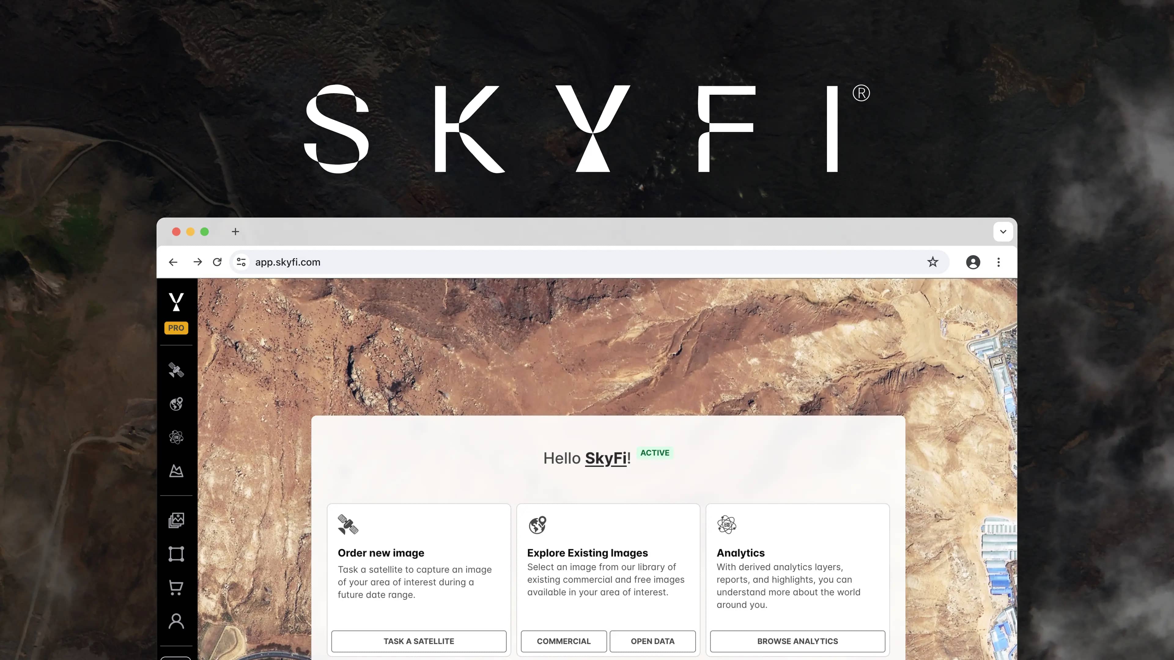
SkyFi is a self-service Earth intelligence platform that enables users to search, task, purchase, and analyze satellite imagery and geospatial analytics from more than 50 commercial providers through a single interface. Founded in 2021 and headquartered in Austin, Texas, the platform serves organizations worldwide, replacing weeks of procurement friction with an ordering process that takes minutes.
The Satellite Imagery Access Problem
The satellite imagery industry has long suffered from a fragmentation problem. Providers each operate their own ordering systems, pricing structures, licensing terms, and delivery pipelines. An organization that needs optical data from one provider and SAR data from another must manage two separate vendor relationships, two contracts, and two credential sets. For enterprise teams and government analysts who require multi-sensor coverage, this overhead adds weeks to every project.
Joe Morrison, VP of Commercial Product at satellite provider Umbra, described the traditional buying experience an puts it plainly:
“Have you ever tried to purchase a satellite image? It’s closer to a hostage negotiation than a sales transaction. There will be email introductions, phone calls, lists of demands, let-me-get-back-to-you-on-thats, appeals to lawyers, requests for paperwork, and ultimately…a ransom. Often, the captive is never released.” Joe Morrison · VP of Commercial Product
Free tools like Google Earth offered a preview of what satellite data could reveal, but with imagery that was often months or years out of date and locked at resolutions too coarse for professional applications. The gap between "free and outdated" and "current and high resolution" was significant, and crossing it required time, budget, and insider knowledge that most organizations did not have.
Our Story
SkyFi cofounder Bill Perkins encountered this problem through direct experience. Across ventures in energy production and maritime intelligence, he relied on remote sensing to answer operational questions: How many drilling crews are active at a given site? Which vessels have disabled their AIS transponders? The data existed, but acquiring it meant navigating an exhausting cycle of meetings, contracts, and licensing negotiations.
That frustration became a founding principle. In 2021, Perkins and CEO Luke Fischer launched SkyFi with a clear mission: democratize access to Earth observation data. In January 2026, the company raised a $12.7 million Series A co-led by Buoyant Ventures and IronGate Capital Advisors, and was selected for the NATO DIANA 2026 Defense Innovation Accelerator.
Platform Capabilities
SkyFi is a marketplace and aggregator, not a satellite operator. The platform unifies access to over 150 satellites across more than 50 provider partners, including Vantor (formerly Maxar), Planet Labs, ICEYE US, Umbra, Satellogic, and Near Space Labs, through one account, one contract, and transparent pricing. No subscriptions are required. There is no minimum spend and no long-term contract obligation for standard access.
Four core products are available on the platform.
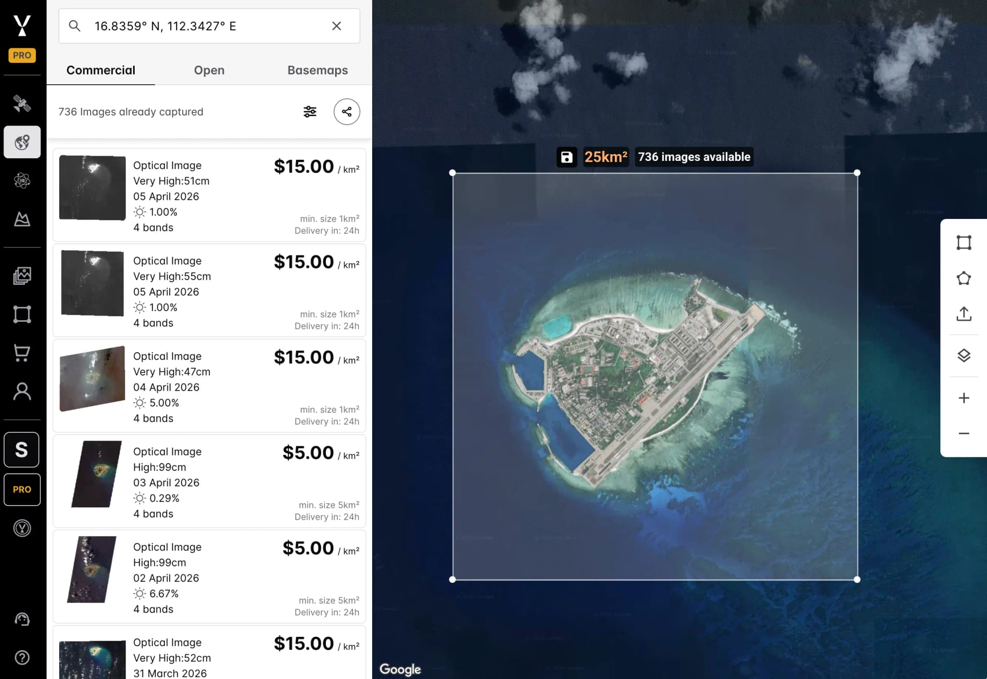
Archive Imagery Search and Ordering
SkyFi's global archive supports search by location, date, resolution, and sensor type. Users can preview scenes before purchasing and compare options from multiple satellite imagery providers in a single view. Resolution ranges from 10 meters for broad-area monitoring down to 7.5 centimeters for detailed site inspection. Basemaps provide persistent coverage for ongoing monitoring needs. Delivery formats include GeoTIFF, PNG, and associated metadata.
Satellite Tasking for New Captures
When archive imagery does not meet operational requirements, satellite tasking enables new captures for a specific area of interest (AOI). Users configure resolution, sensor type, cloud cover threshold, and acquisition window, and SkyFi routes the request across its provider network. Priority tasking, monitoring campaigns, and scheduled collections are all supported.
Multi-Sensor Data: Every Type of Satellite Imagery in One Platform
One of SkyFi's primary differentiators is consolidated multi-sensor access. Through a single interface, the platform provides:
Optical and multispectral imagery for urban monitoring, agricultural analysis, and infrastructure inspection.
Synthetic aperture radar (SAR) for all-weather, day-and-night imaging, essential for maritime monitoring, disaster response, and surface deformation detection.
Hyperspectral imagery capturing hundreds of spectral bands for mineral detection, vegetation analysis, and material classification.
Thermal imagery for fire detection, energy infrastructure monitoring, and industrial anomaly identification.
High resolution aerial imagery from aircraft-based sensors, delivering extremely fine spatial resolution for construction monitoring and urban mapping.
The platform also provides access to Sentinel-1 SAR and Sentinel-2 multispectral open data at no cost through its Open Data program.
Integrated Geospatial Analytics
SkyFi integrates analytics that extract insights directly from imagery, removing the need to export data into a separate GIS environment for initial analysis. Available capabilities include change detection, object detection (vehicles, ships, aircraft, buildings), land use classification, NDVI vegetation health, flood mapping, thermal anomaly detection, vessel detection, vehicle counting, forest carbon measurement, infrastructure resilience mapping, iron ore stockpile measurement, and custom GEOINT analysis projects.
3D Models and Elevation Products
Beyond two-dimensional imagery, SkyFi offers 3D modeling capabilities including digital surface models (DSM), digital terrain models (DTM), point clouds, building extraction, terrain classification, and 3D true ortho products.
Access Methods
SkyFi is available through four channels, each designed for different operational workflows.
The web application at app.skyfi.com provides a browser-based interface for searching imagery, tasking satellites, running analytics, and managing orders. The mobile app for iOS and Android supports satellite imagery ordering and area monitoring in the field. For teams building satellite data into existing systems, the SkyFi API enables programmatic access to archive search, tasking, analytics, and order management, with cloud delivery to AWS S3 and Google Cloud Storage. For defense and emergency response operators, the SkyFi ATAK Plugin integrates imagery ordering and analytics directly into the Android Team Awareness Kit (ATAK) environment, enabling satellite data access without leaving the tactical common operating picture.
Industries and Applications
SkyFi serves organizations across defense, agriculture, insurance, energy, finance, environmental monitoring, and mining.
Defense and intelligence teams leverage SkyFi for GEOINT workflows, with the ATAK Plugin integration supporting field operators and through SkyFi Sovereign Intelligence Platforms providing secure satellite tasking for government users. Agriculture professionals monitor crop health through NDVI analysis, track field conditions across growing seasons, and integrate high resolution satellite imagery into precision agriculture workflows.
Insurance companies use before-and-after imagery for claims validation, catastrophe response, and environmental risk assessment.
Energy and infrastructure operators monitor pipelines, assess renewable energy sites, and track construction progress through change detection analytics.
Financial services firms use satellite data as an alternative data source for commodity tracking, supply chain monitoring, and macroeconomic intelligence.
Environmental and mining organizations rely on SkyFi for deforestation tracking, carbon measurement, habitat monitoring, stockpile analysis, and regulatory compliance.
SkyFi Pro
SkyFi Pro is the enterprise tier of the platform, designed for teams that require advanced tasking parameters, bulk imagery ordering, higher API rate limits, team management, dedicated support, and service-level agreements. Individual Pro plans start at $20 per month. Enterprise Pro starts at $500 per month. SkyFi also builds white-label platforms for satellite operators to distribute data through SkyFi's infrastructure. Current white-label products include Vantor Connect, ICEYE US Direct, and Planet Select.
Frequently Asked Questions
What types of satellite imagery can I access through SkyFi?
SkyFi provides access to optical, multispectral, synthetic aperture radar (SAR), hyperspectral, thermal, and aerial imagery from over 50 commercial providers. Resolution ranges from 10 meters down to 7.5 centimeters depending on the sensor and provider. The platform also offers free Sentinel-1 and Sentinel-2 open data.
How is SkyFi different from Google Earth?
Google Earth provides free satellite imagery that is often months or years out of date at a fixed resolution. SkyFi provides access to current, high resolution satellite imagery from commercial providers, with satellite tasking for new captures, sensor type selection, and integrated analytics. The platform is built for professional and enterprise use cases that require timely, accurate, and actionable geospatial data.
Does SkyFi offer an API?
Yes. SkyFi offers an API for programmatic access to imagery search, satellite tasking, analytics execution, and order management. The API supports cloud delivery to AWS S3 and Google Cloud Storage, enabling integration with existing geospatial workflows and enterprise data pipelines.
Get Started
SkyFi accounts are free to create. Explore the global archive, preview imagery, and place an order at app.skyfi.com. For enterprise requirements, book a demo to see how SkyFi Pro supports large-scale operations.
Sources Medium, Joe Morrison: The Commercial Satellite Imagery Business Model Is Broken
Kat Tungol is the Product Marketing Manager at SkyFi, with a background in remote sensing and professional training as a licensed geologist. She works at the intersection of geospatial science and product marketing, translating complex Earth observation capabilities into clear, practical value for users.


