Satellite Imaging for the Financial Services Industry
SkyFi’s all-in-one satellite imagery platform provides hedge funds and other financial institutions with unmatched intelligence to detect market-moving events without latency.
SkyFi gives financial institutions a straightforward way to access satellite imagery as a dependable, high-value source of geospatial data for operations and analysis. As space-based technology advances, more firms, including banks, hedge funds and other global enterprises, are turning to satellite data for an information advantage. SkyFi enables on-demand access to imagery and analytics that speed organizations’ decision making.

40.7128º N
74.0060º W
On-demand satellite imagery and analytics for geospatial insights anywhere in the world.
Identify potential investment opportunities or risks unavailable to the public eye in near real-time.
Determine ground-truth to gain a competitive edge in the market without guessing.
On-Demand Geospatial Imagery & Analytics Data for Investors
Site Monitoring
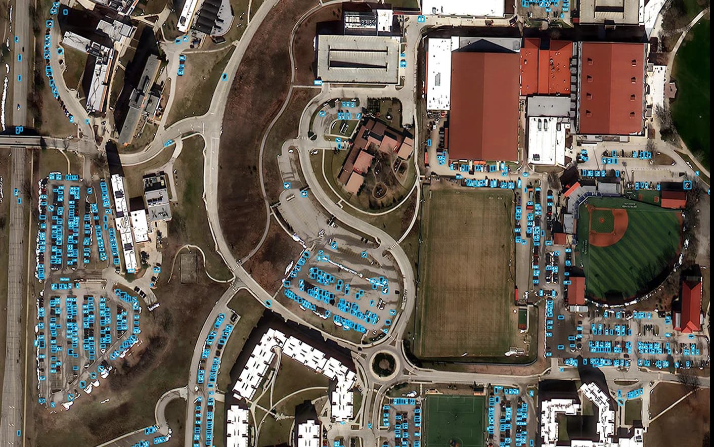
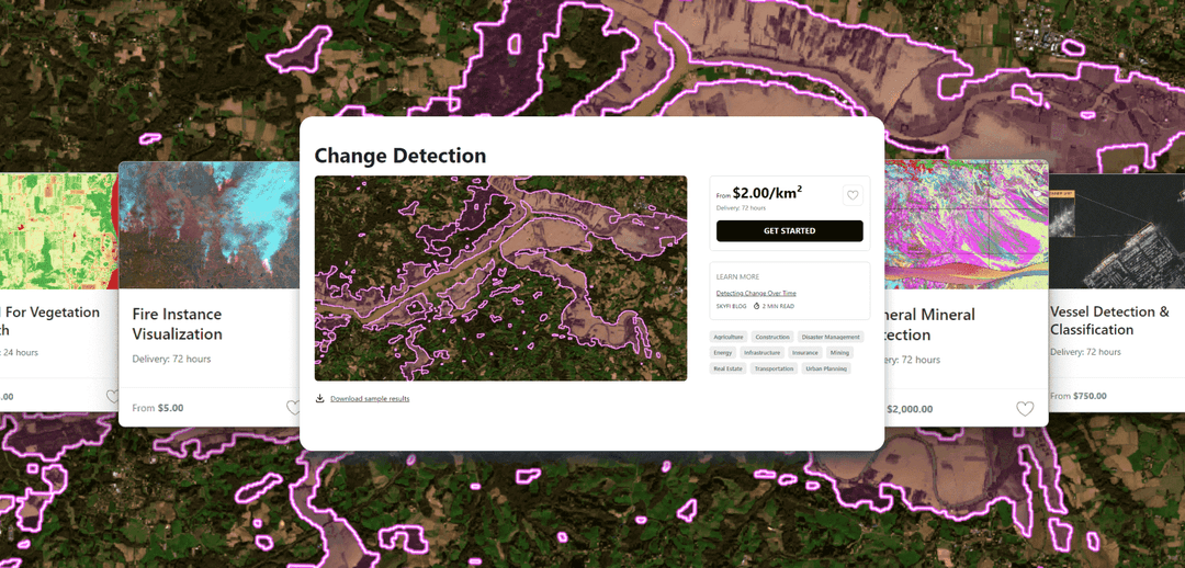
Use satellite imagery for site selection, to analyze foot or vehicle traffic, estimate market share, and conduct competitor analysis. Monitor sites for pattern analysis, change detection over time, soil moisture, or for construction and development projects.
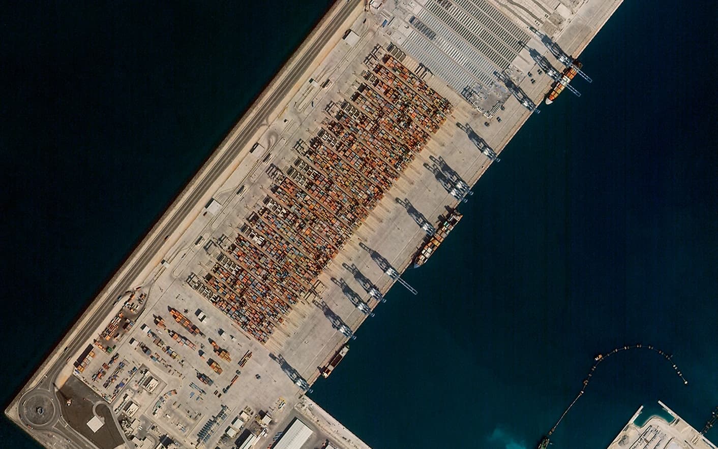
Supply Chain Tracking
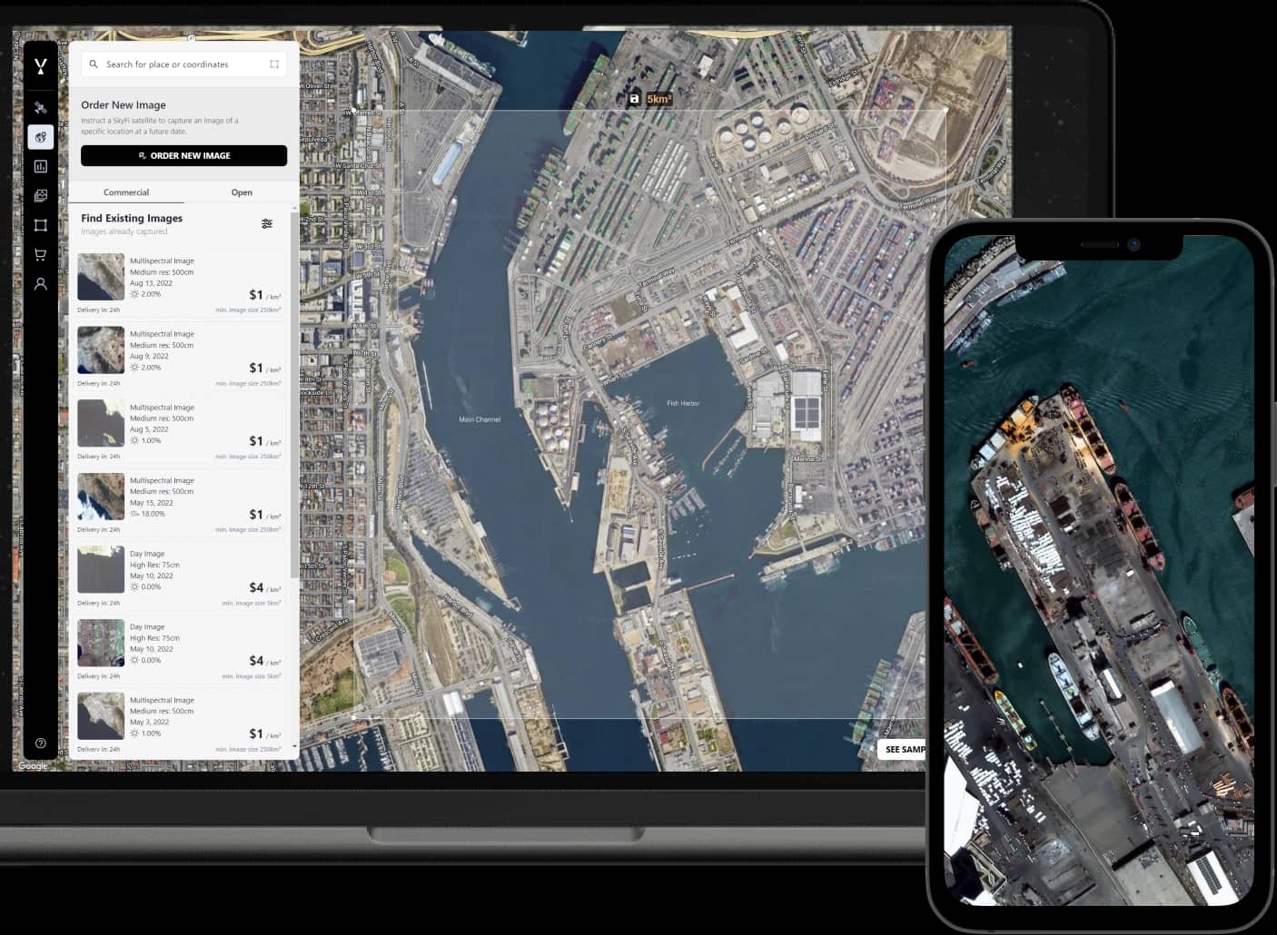
Access near real-time information about the global supply chain with satellite images of shipping containers and ports. Monitor relative changes in transportation activity by road, rail, and aircraft, and enhance port visibility with Maritime AIS Intelligence for vessel tracking and congestion analysis.
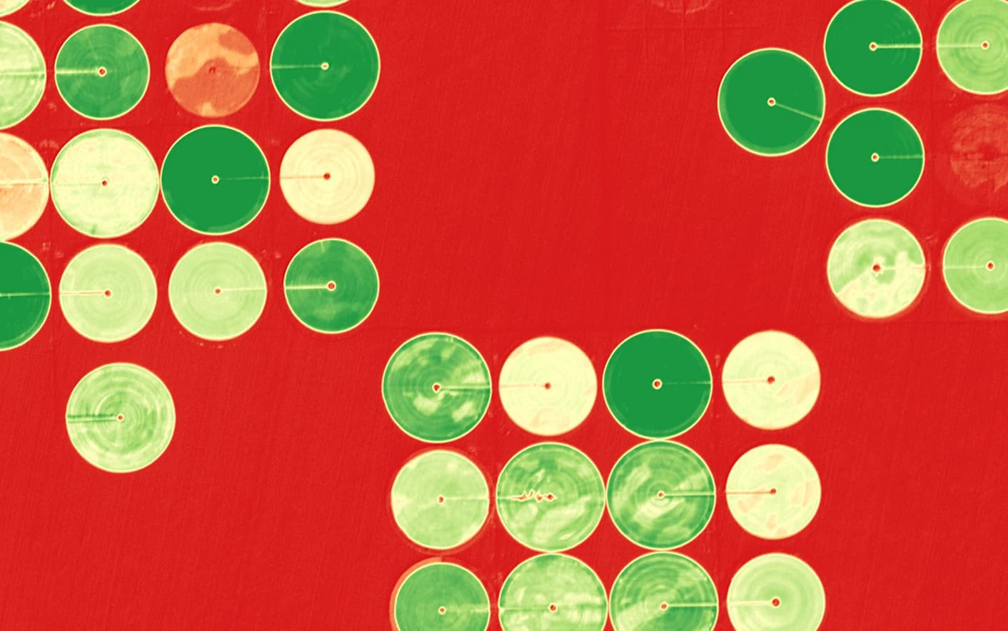
Global Commodity Monitoring
Observe commodity stockpiles by monitoring agricultural crop yields, livestock inventory, raw material extraction, and activity throughout mine and forestry operations.
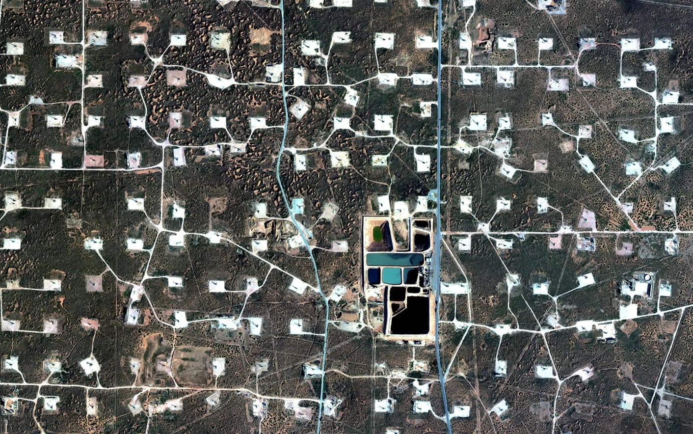
Asset Monitoring
Monitor large scale, physical assets to anticipate trade opportunities, risks, new developments, or damage to existing assets and infrastructure. Assess energy infrastructure, commercial real estate, mining operations and more at a frequency of your choosing.
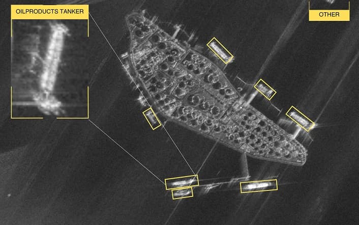
Geopolitical and Economic Indicators
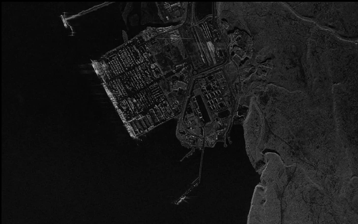
Monitor major global events, geopolitical conflicts, and macroeconomic activity on land and at sea with real-time optical imagery and SAR imagery in any condition day or night. SkyFi also provides mission-grade workflows for government and defense intelligence partners in the U.S. and allies abroad, helping agencies monitor strategic assets and high-priority regions around the world.
Geospatial Data for Finance: Case Studies
Problem
Finance teams need continuous visibility into regions affected by geopolitical tension, natural disasters, or policy shifts. Traditional satellite imagery sources are limited by cloud cover, low revisit rates, and fragmented vendor workflows, resulting in high costs and blind spots that weaken alternative-data models and slow risk assessment.
Solution
SkyFi’s earth intelligence platform delivers persistent, all-weather coverage through synthetic aperture radar (SAR), high-resolution optical imagery, and multi-provider satellite tasking. SAR provides uninterrupted visibility, while optical imagery offers detailed confirmation. Using SkyFi’s API-first architecture, enterprises automate AOI monitoring and integrate geospatial analytics directly into internal systems. This creates a continuous stream of intelligence to support faster market decisions.
Problem
Financial Institutions, Investment groups and macroeconomic research teams need objective, high-frequency indicators of supply-chain pressure and infrastructure activity. Public datasets provide delayed signals, and traditional Earth Observation (EO) providers cannot deliver the revisit rates or analytics required for real-time market intelligence.
Solution
SkyFi provides on-demand satellite imagery across SAR and optical sensors, combined with advanced geospatial data and analytics like vessel detection, vehicle counting, change detection, and Maritime AIS. This sensor-agnostic platform generates quantifiable activity indicators for ports, logistics hubs, and critical infrastructure. Through SkyFi’s API, enterprises automate refresh schedules, integrate outputs into forecasting models, and gain timely economic and supply-chain intelligence that informs investing, trading, commodities, macro, and risk strategies.
With access to a network of over 150 individual satellites and diversified product types, SkyFi is your solution for any and all satellite imagery needs.


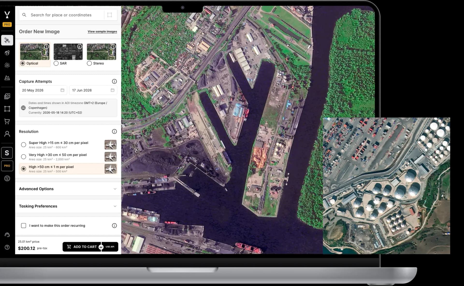
Satellite Imagery, Data, and Analytics. All in One Platform
Get new imagery IN UNDER 24 HOURS
| Single Archive Image | Single Tasking Image |
Starting at $ 15 *High-resolution optical image | Starting at $ 200 *High-resolution optical image |
Or Connect Directly To Our API and Integrate SkyFi’s Powerful Solutions Into Your Daily Workflow.
SEE PRICINGStart Exploring Now!
CREATE YOUR FREE ACCOUNTCreate your FREE account today.
Get immediate access to our user-friendly interface and start exploring anywhere on the planet with transparent pricing options upfront.
Order new images for a specific date and location, or access our extensive library of existing images.
About SkyFi
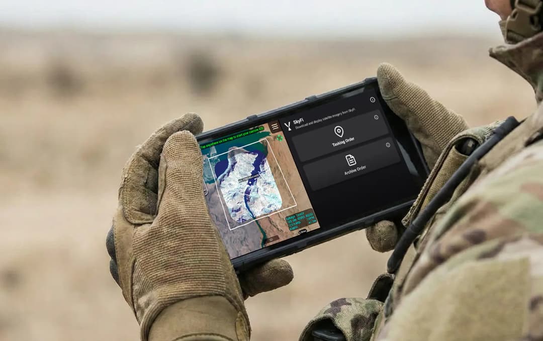
SkyFi is a self-service Earth Intelligence Platform that allows users to run built-in geospatial analytics, task satellites, and access archived imagery. The dual-use platform supports both civilian and defense use cases, with flexible ordering options, transparent pricing, and API access for large-scale workflows.
Customers can use SkyFi's web platform, mobile app, or developer APIs to manage Earth observation projects without needing contracts or in-house GIS teams.
More SkyFi Products
Analytics

Commercial Imagery

Open Data

Vantor

Vantor Connect

Maritime AIS Data

SkyFi Plugin for ATAK

ICEYE US Direct

Planet Select