Why is SkyFi the Best Satellite Imagery, Analytics, & API Provider
If you need to get satellite imagery, you already know the market is fragmented. Dozens of satellite operators sell data through separate portals, each with its own pricing model, licensing terms, ordering workflow, and delivery timeline. For analysts, developers, and procurement teams who need reliable access to commercial satellite imagery, this fragmentation creates friction at every stage from discovery to integration.
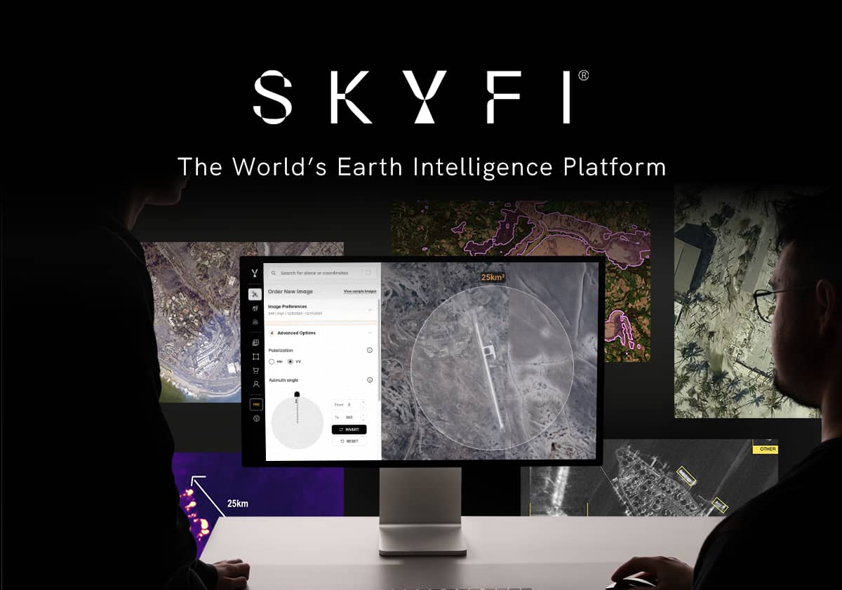
SkyFi addresses that problem directly. As a unified Earth intelligence platform, SkyFi lets users search, order, task, and analyze satellite data from multiple providers through a single interface without long-term or minimum commitments. This guide explains what SkyFi offers, how it compares to traditional procurement paths, and why the platform has become a serious option for anyone evaluating where to get satellite imagery in 2026.
What Is SkyFi and Who Uses It?
SkyFi is a geospatial data platform headquartered in Austin, Texas, founded in 2021 by Luke Fischer and Bill Perkins. The platform aggregates satellite imagery from leading commercial providers and packages it with geospatial analytics tools, API access, and flexible delivery options. Its user base spans:
Military, Defense and Intelligence (GEOINT workflows)
Government (Urban planning, disaster response)
Agriculture (crop health)
Financial Services (Asset monitoring, supply chain monitoring, etc)
Insurance (claims and catastrophe modeling)
Energy (pipeline and offshore monitoring)
Construction (site progress tracking)
Maritime operations (AIS vessel tracking).
What these users share is a need for multi-source satellite data without the complexity of managing individual provider relationships. With SkyFi, a single account gives you instant access to many of the best satellite imagery providers in the world, all from a single platform.
Why Get Satellite Imagery Through a Unified Platform
The traditional route to purchasing commercial satellite imagery involves contacting operators directly, negotiating AOI pricing, signing multi-year agreements, and managing separate delivery pipelines for each provider. A marketplace platform approach changes the economics and logistics in several ways.
Transparent, Transaction-Based Pricing
SkyFi publishes pricing for purchasing satellite imagery upfront and supports one-time purchases. No subscription commitments, no minimum annual spend. This matters for time-limited projects like a construction monitoring campaign, a post-disaster assessment, or a seasonal agriculture analysis, where a subscription or credits model creates waste.
Cross-Provider Access in One Workflow
Instead of maintaining accounts with multiple operators, SkyFi users search across providers simultaneously. The platform handles licensing, fulfillment, and delivery. As a result, this reduces procurement cycles from weeks to minutes for archive imagery.
Web and Mobile App Accessibility
SkyFi offers both a web platform and a mobile application, allowing field teams to order imagery and monitor areas of interest from anywhere. This is uncommon in a market where most providers still require desktop portals or sales-assisted transactions.
Processed Imagery You Can Actually Open
One of the most overlooked barriers to ordering satellite imagery is what happens after delivery. Satellite imagery providers typically deliver raw data in formats like GeoTIFF, NITF, or HDF5, which are specialized geospatial file types that require GIS software such as ArcGIS or QGIS to open, interpret, and visualize. For teams without a GIS specialist on staff, this means the imagery they purchased is effectively locked behind a technical wall.
SkyFi satellite imagery is processed before delivery and includes a ready-to-view PNG alongside the raw geospatial and metadata files. That means anyone, such as a student, a financial analyst, a project manager, or a field operator, can open and view the satellite image on any device without specialized software. The processed file breaks the expertise barrier and makes satellite data immediately useful to non-technical users, especially considering the high-resolution image quality of SkyFi's geospatial imagery.
SkyFi’s Core Satellite Imagery Capabilities
Multi-Sensor Access: Optical, SAR Imagery, Stereo, Thermal, and Aerial
SkyFi is not limited to a single sensor type. Users can access optical (natural color and multispectral), synthetic aperture radar (SAR), hyperspectral, thermal, and aerial imagery through the same platform. SAR imagery penetrates cloud cover and operates day or night, which is essential for maritime monitoring and disaster response. Optical imagery delivers the spectral detail needed for land use classification and vegetation health indexing. Having all sensor types in a single ordering interface eliminates separate vendor relationships for each imagery type.
Satellite Tasking and On-Demand Capture
Satellite tasking is the process of requesting a new image capture over a specific location within a defined time window. SkyFi supports priority tasking, multi-provider routing, monitoring campaigns, and scheduled collections. Users set their AOI, resolution requirements, sensor type, cloud cover threshold, and acquisition window directly through the platform. SkyFi then routes the request across its constellation network to find the earliest viable capture, which is critical for tracking construction milestones, monitoring crop stress, or capturing post-event damage before conditions change.
Archive Imagery Search
SkyFi’s archive spans multiple providers and sensor types, searchable by location, date range, resolution, and cloud cover. Users can preview scenes before purchasing and acquire historical satellite images for change detection baselines or trend analysis.
Open Earth Observation Data
SkyFi also provides access to open Earth observation datasets such as Sentinel-1 SAR and Sentinel-2 multispectral imagery. These government satellite programs offer global coverage and frequent revisit times, making them useful for environmental monitoring, agriculture, and disaster response. By integrating open data with commercial satellite imagery, SkyFi enables users to combine free global coverage with high-resolution commercial data in a single platform.
Geospatial Analytics: From Change Detection to Carbon Measurements
SkyFi goes well beyond satellite imagery. The platform offers a catalog of analytics products accessible at any scale. Core products include Change Detection, NDVI for Vegetation Health, NDWI for Standing Water, Land Use Classification, Vessel Detection & Classification, and Fire Instance Visualization.
Specialized earth observation analytics are also available:
Forest Carbon Measurements for ESG reporting and carbon credit verification
Infrastructure Resilience Mapping for structural vulnerability assessment
Iron Ore Stockpile Measurements for commodity intelligence
For requirements outside the standard catalog, SkyFi offers Custom GEOINT Projects, Custom Spectral Analysis, and Custom Annotated Datasets.
3D Products and Elevation Models
SkyFi’s 3D product suite transforms satellite imagery into elevation and terrain intelligence: Digital Surface Models, Digital Terrain Models, 3D Point Clouds, Building extraction, Vegetation mapping, Terrain Classification, and 3D True Ortho products. Bundled options like the Elevation Bundle and the 3D Bundle reduce per-kilometer cost for construction planning, urban modeling, and defense terrain assessment.
How SkyFi’s Commercial Satellite Imagery Partnerships Expand Access
Rather than operating its own satellites, SkyFi aggregates data from leading satellite operators that give users access to a broader range of resolutions, revisit rates, and sensor modalities than any single provider offers alone.
Vantor (Formerly Maxar) Integration
SkyFi’s integration with Vantor brings some of the highest-resolution commercial optical imagery on the market into the platform. In addition, their basemaps, 3D products and elevation models are also available on the platform and are used extensively by defense, intelligence, and infrastructure teams. Through SkyFi, users can search, task, and order Vantor imagery including 3D terrain models, without a separate enterprise contract.
Umbra: SAR Imagery at Scale
Umbra operates a constellation of SAR satellites capable of very high-resolution radar imaging. SkyFi’s partnership with Umbra makes SAR imagery accessible to users who need all-weather, day-and-night surveillance for covering maritime domain awareness, border monitoring, and surface deformation tracking.
Planet, Satellogic, ICEYE US, and Additional Providers
Beyond Vantor, SkyFi expands its optical imagery offering with providers such as Planet and Satellogic, alongside a growing network of additional satellite operators. Planet’s SkySat fleet delivers sub-meter resolution with multiple daily revisits, available through SkyFi for both tasking and archive access, while Satellogic’s high-revisit optical constellation enables frequent coverage for monitoring and change detection applications.
For SAR imagery, ICEYE SAR satellites can be tasked directly through SkyFi, with access to ICEYE’s extensive archive for historical radar data.
As the platform continues to grow, SkyFi is also onboarding next-generation sensors, including hyperspectral providers like Pixxel, ensuring users have access to the latest satellite constellations and imaging technologies as they come online.
ATAK Plugin for Defense and Emergency Response
SkyFi’s ATAK (Android Team Awareness Kit) plugin brings satellite imagery ordering directly into the tactical environment. Defense and emergency response teams can task satellites and receive imagery without leaving the common operating picture.
Maritime AIS Intelligence
SkyFi provides vessel tracking powered by Automatic Identification System (AIS) data from satellite, terrestrial, and ship-based sources. Use cases include vessel monitoring, dark ship detection, port congestion analysis, and supply chain visibility.
Developer Access: The SkyFi Satellite Imagery API
SkyFi’s Platform API gives development teams programmatic access to the same capabilities available in the web platform: archive search, imagery ordering, satellite tasking, analytics execution, webhook notifications, and automated area monitoring. Interactive documentation with code examples in Python and JavaScript is available at app.skyfi.com/platform-api/redoc.
Data is delivered as GeoTIFF, PNG, and metadata files directly to cloud storage destinations including AWS S3 and Google Cloud Storage. With access to 150+ satellites, four sensor types, resolutions from 10 meters to 30 centimeters, and delivery times under 24 hours, the SkyFi API allows programmable EO infrastructure for teams building geospatial applications, automated monitoring pipelines, or AI-powered workflows.
How to Evaluate the Best Platform to Order Satellite Images
When evaluating platforms that offer the best satellite imagery, consider these criteria:
Resolution and sensor diversity. Can you access sub-meter optical, SAR, stereo, aerial, hyperspectral, and thermal data from one account?
Pricing transparency. Is pricing published upfront, or does every purchase require a sales conversation?
Delivery format accessibility. Are deliverables available in formats anyone can open (like PNG), or do you need GIS software to view what you purchased?
Tasking flexibility. Can you task satellites on demand, or are you limited to archive-only access?
Analytics integration. Does the platform offer built-in analytics, or do you need separate GIS tools?
API and cloud delivery. Are APIs available with direct-to-bucket delivery, or is the platform browser-only?
SkyFi checks every box. Its multi-provider model delivers sensor diversity, transparent pricing, processed imagery anyone can view, flexible tasking, native analytics, and production-ready APIs with cloud delivery.
Frequently Asked Questions
What industries benefit most from satellite imagery?
Defense and intelligence, agriculture, insurance, energy, construction, environmental monitoring, maritime logistics, and financial intelligence all rely on satellite imagery for operational decision-making. SkyFi serves all of these industries through its multi-sensor platform.
Can you order satellite imagery without a subscription or long-term contract?
Yes. SkyFi supports one-time, per-transaction purchases with no subscription requirement. Users pay for the imagery they need, when they need it. SkyFi Pro and Enterprise is available for teams that require higher volume, but no long-term contract is needed for platform access.
What types of satellite sensors does SkyFi support?
SkyFi provides access to optical (multispectral and natural color), synthetic aperture radar (SAR), stereo, aerial, hyperspectral, thermal, and aerial imagery. This multi-sensor access is delivered through partnerships with providers including Vantor, Umbra, Planet, Satellogic, ICEYE US, Pixxel, and others.
How does satellite tasking work on the SkyFi platform?
Users define an area of interest, select resolution and sensor requirements, set a cloud cover threshold, and choose an acquisition window. SkyFi routes the request across its provider network and returns captured imagery upon completion. Priority tasking, scheduled collections, and monitoring campaigns are supported.
Does SkyFi offer an API for developers?
Yes. The SkyFi Platform API provides REST endpoints for archive search, imagery ordering, satellite tasking, and area monitoring. Data is delivered as GeoTIFF, PNG, and metadata files to AWS S3 or Google Cloud Storage. Documentation is available at app.skyfi.com/platform-api/redoc.
Sources:
Future Market Insights. (2025, May 26). Commercial Satellite Imaging Market Size & Forecast to 2035. https://www.futuremarketinsights.com/reports/commercial-satellite-imaging-market
NASA Earthdata. (2025, April 16). Synthetic Aperture Radar (SAR). https://www.earthdata.nasa.gov/learn/earth-observation-data-basics/sar
Mordor Intelligence. (2026). Commercial Satellite Imaging Market Size, Forecast Report & Share 2031. https://www.mordorintelligence.com/industry-reports/commercial-satellite-imaging-market
Warner, T. A., Nellis, M. D., & Foody, G. M. (Eds.). (2009). The SAGE Handbook of Remote Sensing. SAGE Publications. https://methods.sagepub.com/hnbk/edvol/the-sage-handbook-of-remote-sensing/chpt/7-optical-sensor-technology
Kat Tungol is the Product Marketing Manager at SkyFi, with a background in remote sensing and professional training as a licensed geologist. She works at the intersection of geospatial science and product marketing, translating complex Earth observation capabilities into clear, practical value for users.


