What Is Optical Satellite Imagery and How Is It Used Across Industries?
A hurricane makes landfall on a Thursday. By Friday afternoon, an insurer needs to know which insured properties in the storm path lost their roofs, and adjusters cannot safely reach the area for days. A single clear satellite image, captured the morning after the storm, answers the question before the first claim is filed.
That is the promise of optical satellite imagery. A portfolio manager counting cars in retail parking lots, a contractor verifying a milestone for a lender, and a defense analyst watching activity at a foreign port all need the same thing: a current, accurate picture of one specific place on Earth.
For most of the industry's history, that picture was hard to get. High-resolution optical satellite imagery sat behind enterprise contracts, minimum order sizes, and weeks of correspondence with sales teams. The files often arrived in formats that required GIS specialists to open. Teams that could not clear those hurdles worked from outdated images, low-resolution captures that missed the vehicles or damage that mattered, or no imagery at all.
SkyFi was built to remove those hurdles. The self-serve platform gives organizations of any size direct access to imagery from the world's leading satellite operators, with prices shown up front and delivery measured in hours. This guide covers how optical imagery works, how eight industries use it, and what sets SkyFi apart as an optical satellite imagery app.
What Is Optical Satellite Imagery?
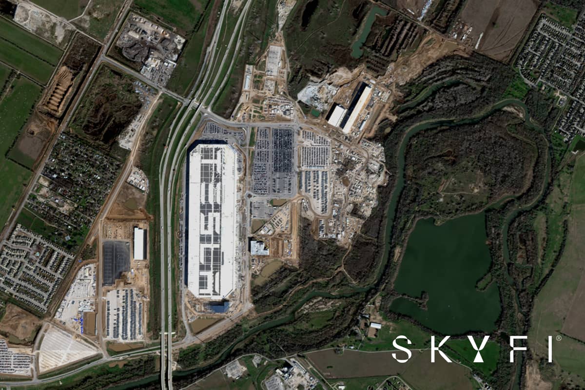
Optical satellite imagery is captured by sensors that record sunlight reflected off the Earth's surface. Those sensors detect the same visible wavelengths the human eye sees, and multispectral systems add near-infrared and other bands. The result is a natural-color image that reads like an aerial photograph. Roads, rooftops, vehicles, crops, and shorelines look the way a person expects them to look, which is why optical imagery is the most intuitive form of remote sensing to interpret.
Synthetic aperture radar (SAR) works differently. Optical sensors are passive and depend on the sun for light. SAR sensors are active: they send out microwave pulses and measure the signal that returns. SAR images are grayscale maps of structure and texture that take training to read. A natural-color optical image needs no training at all, which makes optical imagery remote sensing the easiest kind to share with executives, clients, and field teams.
The term is sometimes confused with optical satellite communication, a separate technology that uses laser links to move data between satellites and ground stations. Optical imagery is about seeing the surface, not transmitting data.
Optical Imagery Resolution on SkyFi
Resolution is the ground area a single pixel represents. At 25 cm, each pixel covers a 25 by 25 cm square, which is sharp enough to separate individual vehicles, rooftop equipment, and road markings. SkyFi brings optical imagery from several leading constellations into one catalog:
Source | Resolution | Best for |
SIIS SpaceEye-T | 25 cm | The finest native satellite resolution on SkyFi, with archive, tasking, and stereo capture |
Vantor WorldView constellation | 30 cm | Asset-level detail, infrastructure inspection, defense analysis |
BlackSky Gen-3 | 35 cm | Rapid, frequent tasking, including nighttime collection |
IMPRO GÖKTÜRK-1 | 50 cm | Very high-resolution optical and stereo tasking |
Planet SkySat | 50 cm | Daily revisit for frequent monitoring, with stereo available on request |
Satellogic (Mark IV and Mark V) | 70 cm native | Near-daily revisit and cost-effective high-resolution archive and tasking |
GEOSAT-2 | 75 cm | Regional mapping, agriculture, and land monitoring |
Sentinel-2 (open data) | 10 m | Free multispectral coverage for broad-area and vegetation analysis |
SkyFi also offers Vivid Mosaic basemaps, including a 15 cm HD product processed from 30 cm satellite imagery, for seamless context across large areas. Projects that need finer detail than any satellite provides can turn to aerial imagery from Vexcel at 7.5 cm. Teams starting on a small budget can begin with the free sources in SkyFi's open data satellite imagery guide.
The Limitation: Clouds and Darkness
Optical sensors need reflected sunlight, so clouds, smoke, and darkness usually block the view. BlackSky's nighttime collection is one exception, capturing lit infrastructure and activity after dark, but it cannot see through clouds. For persistently cloudy regions, round-the-clock monitoring, or disaster response that cannot wait for clear skies, SAR is the right complement because radar sees through clouds and works at night. Many teams use both, relying on SAR to guarantee a collection and on optical imagery to confirm what changed. SkyFi's SAR imagery 101 guide explains how the two fit together.
Optical Satellite Imagery Across Industries
High-resolution optical satellite imagery turns a distant site into a dated, verifiable record. Here is how organizations across SkyFi's core industries use it.
Defense and Military
Defense and intelligence teams use optical imagery to monitor airfields, ports, border regions, and force posture where ground access is limited or impossible. At 25 to 35 cm, analysts can identify aircraft types, count vehicles, and follow construction at a site of interest week by week.
Rapid tasking from SIIS, BlackSky, and Vantor supports time-sensitive requirements, BlackSky adds nighttime collection, and stereo captures from BlackSky and IMPRO feed the terrain models used in mission planning. Paired with SAR for all-weather coverage, optical imagery gives operators visual confirmation they can act on.
Construction and Real Estate
Developers, contractors, and investors use optical imagery to evaluate a parcel before acquisition and to document progress without repeated site visits. Archive imagery shows how a site and its surroundings have changed over years. Scheduled tasking builds a consistent visual timeline that lenders and stakeholders can check against the project schedule. See how SkyFi supports construction and real estate.
Energy
Oil and gas operators, utilities, and renewable developers manage assets spread across remote terrain. Optical imagery supports pipeline right-of-way monitoring, vegetation checks along transmission lines, solar and wind farm siting, and verification of activity at storage facilities. A clear capture lets a team spot a problem early and send field crews only where they are needed. Read more about SkyFi for energy.
Environment
Conservation groups, researchers, and sustainability teams track deforestation, coastal erosion, wetland loss, and wildfire scars with optical and multispectral imagery. Free Sentinel-2 data covers broad areas often enough for trend analysis, and very high-resolution captures confirm what is happening at a specific site. See how SkyFi supports environmental monitoring.
Financial Services
Investors and analysts treat optical satellite imagery as alternative data that registers activity before it appears in an earnings report. Parking lot occupancy, container counts at ports, crop conditions, and construction pace all work as leading indicators. With pay-as-you-go access to archives and new captures, a research team can test a thesis on a handful of locations before committing to a larger program.
Insurance
Insurers and reinsurers use optical imagery across the policy lifecycle. Before underwriting, imagery verifies roof condition, property footprint, and nearby hazards. After a hurricane, wildfire, or flood, pre- and post-event comparisons speed up damage assessment and claims triage and help flag fraud, often before adjusters can reach the area. See how SkyFi supports insurance.
Mining
Mining companies use optical imagery to target new deposits, monitor pits and stockpiles, watch tailings dams, and document environmental compliance. Stereo imagery and digital surface models let teams estimate volumes and measure elevation change across a site without sending out survey crews. Read more about SkyFi for mining.
Government
Federal, state, and local agencies use optical satellite imagery for urban planning, infrastructure inventories, disaster response, agricultural oversight, and coastal management. Self-serve ordering lets an agency respond to an emerging need the same day, and API integration supports recurring programs. See how SkyFi supports government agencies.
What Makes SkyFi the Leading Platform for Optical Satellite Imaging?
The best optical satellite imagery has little value if a team cannot find it, afford it, or get it in time to act. SkyFi was designed around those three problems.
One Catalog for the World’s Leading Providers
SkyFi users search and order optical imagery from Vantor, Planet, Satellogic, BlackSky, SIIS, GEOSAT, IMPRO, and others through a single self-serve interface, with no separate agreement for each operator. A user draws an area of interest, compares archive captures by date, resolution, and cloud cover, and orders the right one, or tasks a new collection from the same screen. The full list is on the SkyFi partners page.
Pay-As-You-Go Pricing
SkyFi has no contracts, subscriptions, or minimum spend. Pricing starts at $15, archive imagery typically arrives within hours, and tasked captures can be collected within 24 hours, depending on satellite availability and weather. Every price is visible before checkout on the SkyFi pricing page.
API Access for Automated Workflows
Enterprise teams can build optical imagery into their own systems with the SkyFi API. The REST API covers archive search, tasking, order management, analytics, and automated area monitoring, so recurring imagery needs can run without anyone placing orders by hand.
AIS Maritime Intelligence
An optical image shows the vessels in a harbor. AIS data shows what those vessels report about themselves. SkyFi's AIS product combines satellite, terrestrial, and ship-based AIS tracking with imagery, so analysts can spot a ship that has gone dark, measure port congestion, and build a complete maritime picture.
ATAK Plugin for Field Operations
The SkyFi ATAK plugin puts optical satellite imagery inside the Android Team Awareness Kit. Defense, public safety, and emergency response personnel get current imagery in the tool they already carry in the field.
Digital Surface Models and Analytics
SkyFi turns optical imagery into measurements. Digital surface models built from stereo captures map elevation across a site for volume calculations, line-of-sight analysis, and change detection. Vegetation health, building detection, and vehicle and vessel detection run directly on delivered imagery.
Put Optical Satellite Imagery to Work With SkyFi
The construction site across town and the port on the other side of the world can both be on screen within hours. SkyFi brings high-resolution optical satellite imagery from the world's leading providers into one platform, with clear pricing, fast delivery, and tools that fit the workflows teams already run.
Whether the need is one archive image or an automated monitoring program, getting started takes minutes. Create a free SkyFi account to search the archive for any location on Earth, or see how SkyFi serves your industry.