What is Sub-Meter Satellite Imaging? How GSD Impacts Sub-Meter Satellite Images
Every high-stakes decision made from above depends on the same thing: whether you can trust what you see. A stalled construction schedule, an insurance payout, a stockpile valuation, a vehicle movement near a border. Analysts across defense, energy, construction, insurance, mining, financial services, and government all act on the same raw material, and much of it is not sharp enough for the job.
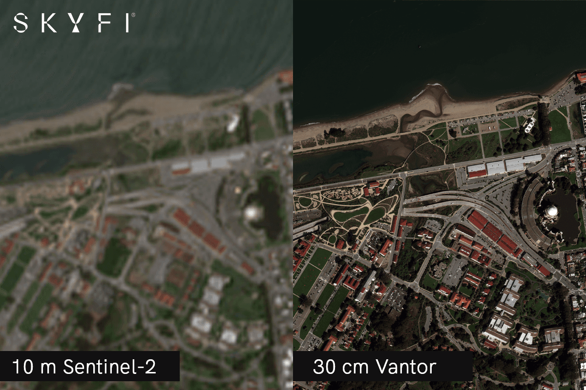
A great deal of the satellite imagery in circulation is too coarse for in-depth analysis. At 3, 5, or 10 meters per pixel, you cannot tell one vehicle from another, measure a stockpile, spot structural damage, or confirm whether a pipeline corridor has been encroached on. The image looks like intelligence but it isn't.
Pick the wrong resolution for a project and the costs compound: missed detail, wasted field visits, and decisions built on a picture that was never clear enough to trust. A blurry image not only fails to help, but it also points you the wrong way.
This is the problem sub-meter satellite imaging solves. Sub-meter imagery is the gold standard for ground-level clarity from orbit, and SkyFi has made it more accessible than ever: no contracts, no procurement cycles, and a multi-provider catalog you can search from a single interface, with imagery as sharp as 7.5 cm.
What Is Sub-Meter Satellite Imaging?
Sub-meter satellite imaging refers to any satellite image with a ground sampling distance (GSD) below one meter per pixel. Each pixel represents an area smaller than one square meter of ground.
That threshold is where the world becomes legible. Below one meter, objects that disappear in coarser imagery come into focus: individual vehicles, construction equipment, building features, road markings, and staging materials. Sub-meter imagery sits at the sharp end of the broader high-resolution satellite imagery category.
Why GSD Matters More Than Megapixels
Buyers often judge an image by its megapixel count or file size. For geospatial work, those numbers mean almost nothing on their own. What decides how much you can pull from an image is ground sampling distance: the real-world distance each pixel covers.
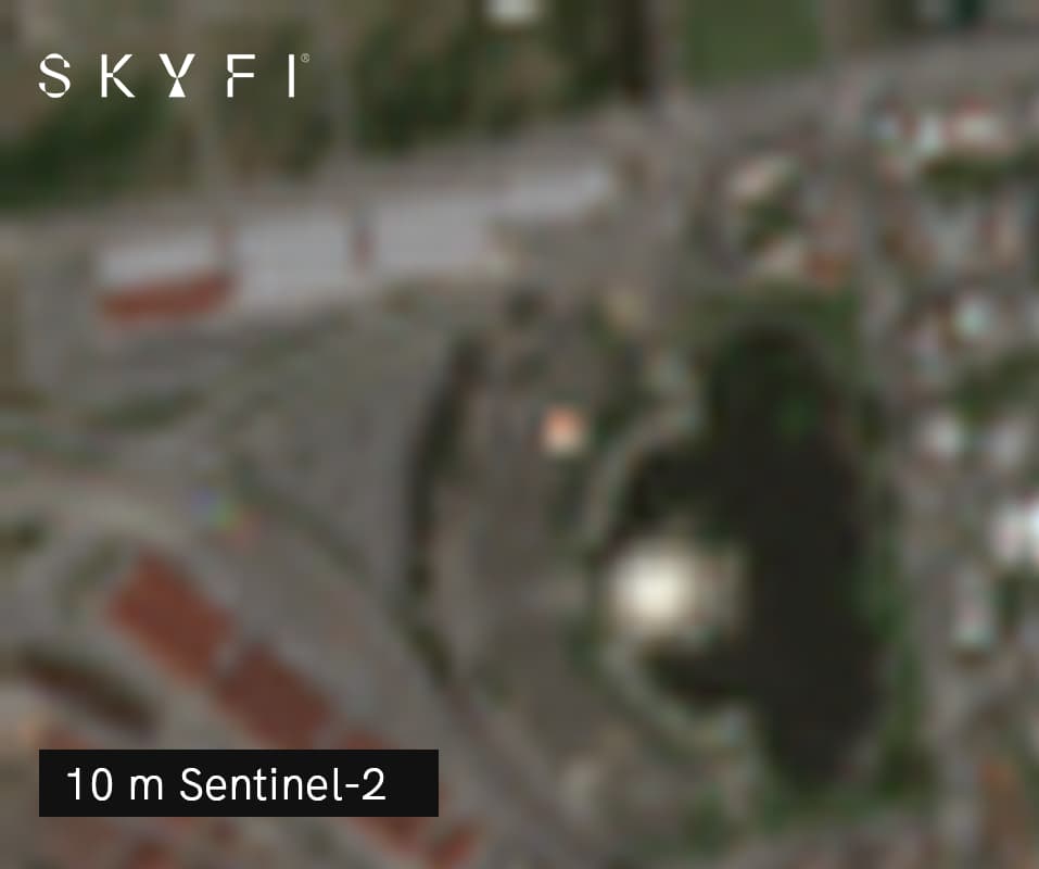
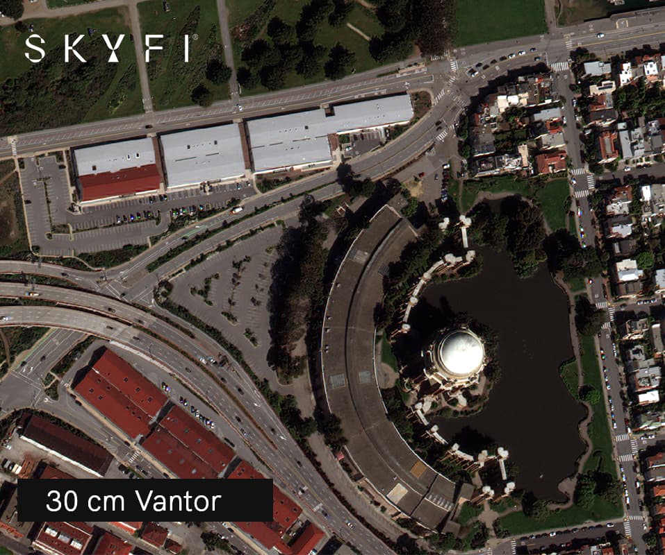
A Smaller GSD is sharper image with more to extract. A 30 cm image holds far more actionable detail than a 3 m image, whatever the file size. When you compare sub-meter resolution satellite imagery, GSD is the number that counts.
SkyFi gives you access to the full range of sub-meter tiers, each suited to different tasks:
7.5 cm (aerial)
The highest detail SkyFi offers, from Vexcel. Note that this is aerial imagery captured by aircraft, not satellites.
15 cm HD
Vantor’s proprietary HD technology, applied to native 30 cm satellite imagery to deliver enhanced visual detail.
25–30 cm
A leading tier for defense, intelligence, and precision site inspection. At this resolution, equipment types, vehicles, and fine structural details become distinguishable.
50 cm
A widely used commercial tier for applications such as construction monitoring, agricultural analysis, property mapping, and urban planning.
70 cm – 1 m
The entry point of sub-meter imaging. Well-suited to large-area monitoring, infrastructure mapping, and broad environmental assessment.
Sub-Meter Satellite Imagery Across Industries
The value of sub-meter imagery is clearest in the problems it solves for specific teams. Here is how it plays out across the industries SkyFi serves.
Defense and Government
Sub-meter imagery is a cornerstone of modern defense and government intelligence. At 30 cm resolution, analysts distinguish vehicle types, identify weapons systems and equipment, count aircraft on runways, monitor border movement, and track activity at installations in near real time.
SkyFi's ATAK Plugin puts that capability in the hands of field operators, letting frontline teams task satellites and receive imagery without leaving the tactical environment. For government agencies that cannot wait on traditional contracting timelines, SkyFi's self-serve model and under-24-hour delivery from new tasking is a real operational advantage.
Construction and Real Estate
Construction teams and real estate developers use sub-meter satellite imagery to monitor project progress remotely, verify site conditions, track equipment and material placement, and document change over time, all without sending personnel to the field.
At 50 cm resolution, individual buildings, parking areas, staging zones, and infrastructure are visible and measurable. Recurring tasking automates progress reporting on a weekly or monthly cadence, turning a manual site visit into a scheduled data feed.
Energy and Mining
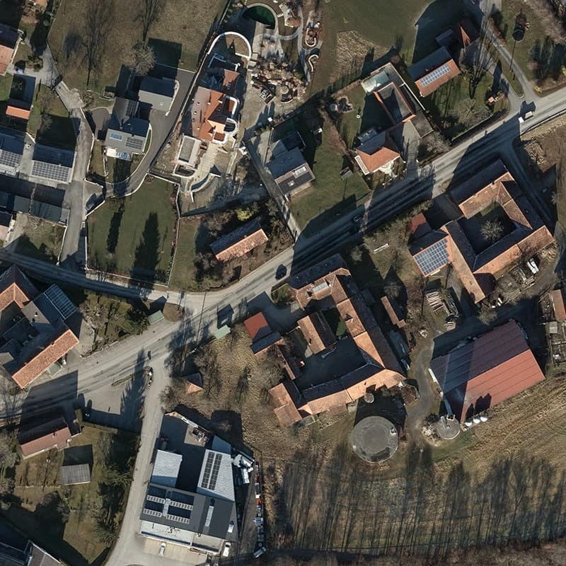
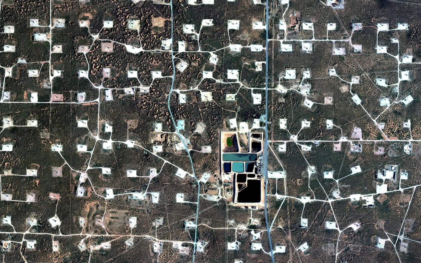
Energy infrastructure sprawls across vast geographies, which makes satellite-based inspection a practical necessity. Sub-meter imagery supports pipeline corridor monitoring, power line right-of-way inspection, solar and wind facility assessment, and detection of encroachment or damage that would take weeks to catch through ground survey. See how this works for energy operations.
In mining, SkyFi's sub-meter imagery supports stockpile volume estimation, open-pit monitoring, and tailings dam surveillance. Digital surface models derived from high-resolution stereo data deliver the elevation accuracy mining operations depend on. You can generate one directly with SkyFi's Digital Surface Model tool.
Insurance and Financial Services
Insurance companies use pre- and post-event sub-meter imagery to assess property damage after natural disasters, verify claims without sending adjusters into hazardous areas, and build property-level risk models from historical data. When a wildfire or hurricane makes a region unreachable, imagery becomes the safest, fastest way to see what happened.
Financial services firms treat sub-meter imagery as an alternative data source for investment research: counting cars in retail parking lots, tracking commodity stockpile levels at storage facilities, and monitoring construction activity to generate economic signals ahead of traditional reporting channels. It is ground truth, weeks before the earnings call.
Environment and Agriculture
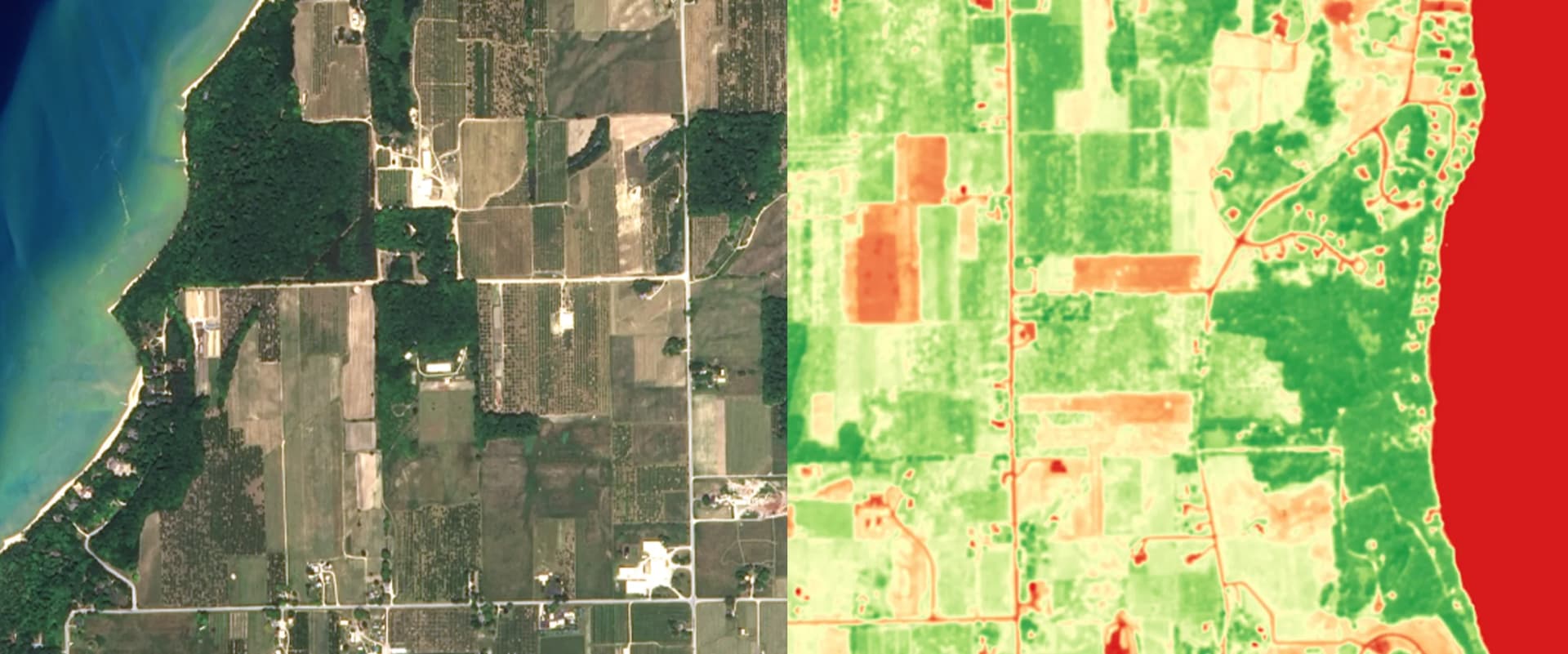
Sub-meter optical imagery enables vegetation health analysis, deforestation boundary mapping, and crop row-level assessment that coarser imagery cannot support. Monitoring an individual field instead of a whole region is the difference between an estimate and an answer.
Multispectral data at sub-meter resolution provides the granularity needed for NDVI analysis, irrigation assessment, and crop stress detection field by field. SkyFi supports both environmental monitoring and agriculture, and also provides SAR imagery that penetrates cloud cover for persistent monitoring where optical imagery is frequently blocked.
What Makes SkyFi the Leading Platform for Sub-Meter Satellite Imaging?
Access to sub-meter imagery once meant signing multi-year contracts with individual satellite operators. SkyFi collapses that process into a single self-service platform, then adds the tools that turn raw imagery into geospatial intelligence.
A Multi-Provider Sub-Meter Catalog Under One Roof
SkyFi aggregates sub-meter imagery from the world's leading providers through one interface. That includes Vantor (WorldView constellation, 15 cm HD and 30 cm), Planet SkySat (50 cm), Satellogic (70 cm – 1 m), Umbra (25 cm SAR), and ICEYE US (25 cm SAR).
Instead of juggling separate contracts and accounts, a user can compare resolution tiers, sensor types, collection dates, and pricing from multiple providers side by side. Browse the full roster on the partners page. That range of choice, without the procurement overhead, is what makes SkyFi one of the best sub-meter satellite imaging options available.
SAR for All-Weather Sub-Meter Coverage
Some monitoring cannot wait for a clear sky. For those cases, SkyFi provides synthetic aperture radar (SAR) imagery at resolutions as sharp as 25 cm from Umbra and ICEYE US.
SAR sensors emit their own radar signal and image straight through clouds, smoke, fog, rain, and darkness. That makes them essential for maritime monitoring, disaster response, and any operation in persistently cloudy or tropical regions. New to the technology? Our SAR imagery 101 guide explains how it works and when to choose it over optical.
Maritime AIS Data Paired With Satellite Imagery
SkyFi's unified AIS product merges satellite, terrestrial, and ship-based signal sources into a single vessel-tracking stream, backed by a historical archive reaching to 2018.
Paired with sub-meter optical or SAR imagery, AIS becomes far more powerful. Analysts identify vessels that have disabled their transponders (dark ships), correlate vessel movement against ground-truth imagery, and assemble a complete maritime intelligence picture in one place rather than stitching together disconnected sources.
API Access for Advanced Workflows
For organizations that need sub-meter data flowing directly into their own platforms, SkyFi's API provides programmatic access to imagery ordering, delivery, and analytics.
Teams automate recurring tasking, route imagery straight to cloud storage, and build custom geospatial workflows with no manual intervention. That is the step from buying images to building an imagery pipeline.
Transparent Pricing With No Contracts
The biggest shift SkyFi brings is commercial, not technical. The platform runs pay-as-you-go: no subscriptions, no minimum commitments, no procurement cycles. Archive sub-meter imagery starts at $25, and tasked captures, where a satellite is directed to image a specific location, arrive in under 24 hours. See current rates on the pricing page.
Weighing paid imagery against free sources first? Our guide to open-data satellite imagery covers what public programs offer at no cost, and where paid sub-meter tasking earns its price.
See What You've Been Missing
The organizations that make the sharpest decisions work from the sharpest imagery. Whether you are monitoring a construction site, valuing a mining stockpile, assessing storm damage, tracking vessels, or supporting a mission in the field, sub-meter satellite imaging gives you the ground-level clarity coarser data cannot.
SkyFi brings that clarity together with SAR, AIS, an ATAK plugin, and a full API, through one no-contract platform. Explore SkyFi's imagery and industry solutions and see what your agency or business can gain from a clearer view.
Frequently Asked Questions
What is sub-meter satellite imaging and how does it differ from standard high-resolution imagery?
Sub-meter satellite imaging is any satellite imagery with a ground sampling distance below one meter per pixel. It is a subset of high-resolution imagery, but the tier where the highest-value analysis happens. All sub-meter imagery is high-resolution; not all high-resolution imagery is sub-meter. Below one meter, you can distinguish individual vehicles, equipment, and building features that coarser imagery blurs together.
What resolution tiers are considered sub-meter, and what can you see at each one?
Sub-meter tiers run from about 1 m down to 15 cm HD, with Vexcel aerial imagery reaching 7.5 cm. At 70 cm – 1 m you map infrastructure and monitor large areas. At 50 cm, individual buildings, staging zones, and vehicles are measurable. At 25–30 cm you identify equipment types and fine detail for defense and inspection.
What industries benefit most from sub-meter satellite imagery?
Defense and government, construction and real estate, energy, mining, insurance, financial services, environmental monitoring, and agriculture all rely on sub-meter imagery, for tasks ranging from progress monitoring and stockpile estimation to damage assessment and intelligence.
How does SkyFi's sub-meter imaging support defense and government operations?
At 30 cm, analysts identify vehicles and equipment, count aircraft, and monitor installations and border activity. SkyFi's ATAK plugin lets field operators task satellites without leaving the tactical environment, and self-serve tasking delivers new imagery in under 24 hours, bypassing traditional contracting timelines.
Can sub-meter imagery be used for environmental monitoring and agriculture?
Yes. Sub-meter optical and multispectral imagery supports NDVI analysis, deforestation mapping, irrigation assessment, and field-level crop stress detection. SkyFi also offers SAR imagery that sees through cloud cover for persistent monitoring where optical imagery is frequently blocked.
What is the difference between sub-meter optical and sub-meter SAR imagery?
Optical imagery captures reflected sunlight, producing natural-looking images but requiring clear skies and daylight. SAR emits its own radar signal and images through clouds, smoke, fog, rain, and darkness. SkyFi offers SAR as sharp as 25 cm, ideal for maritime monitoring, disaster response, and cloudy regions.
Who are SkyFi's sub-meter imagery providers and partners?
SkyFi aggregates imagery from Vantor (WorldView, 15 cm HD and 30 cm), Planet SkySat (50 cm), Satellogic (70 cm – 1 m), Umbra (25 cm SAR), ICEYE US (25 cm SAR), and many more. All of the world's leading satellite providers are now accessible through a single interface.
Does SkyFi offer a sub-meter satellite imaging app?
Yes. SkyFi is a self-service web and mobile platform, and its ATAK plugin brings satellite tasking and imagery directly into the tactical environment for field operators. The SkyFi API also lets teams integrate sub-meter imagery into their own applications.
How do I order sub-meter satellite imagery through SkyFi?
Search SkyFi's archive of existing captures and order one immediately, or task a satellite to image a specific location. Archive imagery is delivered right away, while tasked captures arrive in under 24 hours. Enterprise teams can automate ordering through the API.
How much does sub-meter satellite imagery cost?
Archive sub-meter imagery on SkyFi starts at $15, with no subscriptions or contracts. Tasked captures are priced by provider, resolution, and area of interest, and arrive in under 24 hours. Free options exist too: public programs like Landsat and Sentinel offer imagery at no cost, though at coarser resolution. See the pricing page for current rates.
Mikkel Rasmussen is a Senior Remote Sensing Specialist at SkyFi, where he develops image processing methods, derived-data prototypes, and geospatial workflows that support scalable Earth observation products. With more than a decade of experience working across commercial and open-source satellite imagery, he collaborates closely with engineering, product, and UX teams to ensure efficient, operationally sound geospatial platforms.